<< Text Pages >> Craiglockart Hill Vitrified Fort - Hillfort in Scotland in Midlothian
Submitted by Anonymous on Sunday, 10 February 2019 Page Views: 1721
Iron Age and Later PrehistorySite Name: Craiglockart Hill Vitrified FortCountry: Scotland County: Midlothian Type: Hillfort
Nearest Town: Edinburgh
Map Ref: NT22827006
Latitude: 55.917412N Longitude: 3.236439W
Condition:
| 5 | Perfect |
| 4 | Almost Perfect |
| 3 | Reasonable but with some damage |
| 2 | Ruined but still recognisable as an ancient site |
| 1 | Pretty much destroyed, possibly visible as crop marks |
| 0 | No data. |
| -1 | Completely destroyed |
| 5 | Superb |
| 4 | Good |
| 3 | Ordinary |
| 2 | Not Good |
| 1 | Awful |
| 0 | No data. |
| 5 | Can be driven to, probably with disabled access |
| 4 | Short walk on a footpath |
| 3 | Requiring a bit more of a walk |
| 2 | A long walk |
| 1 | In the middle of nowhere, a nightmare to find |
| 0 | No data. |
| 5 | co-ordinates taken by GPS or official recorded co-ordinates |
| 4 | co-ordinates scaled from a detailed map |
| 3 | co-ordinates scaled from a bad map |
| 2 | co-ordinates of the nearest village |
| 1 | co-ordinates of the nearest town |
| 0 | no data |
Internal Links:
External Links:
I have visited· I would like to visit
schwagmyre has visited here
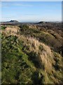
A small, D-shaped, stone-walled fort, measuring 27.0 by 18.0 metres overall, occupies the summit of Wester Craiglockhart Hill. A wide, rock-cut ditch,about 20.0 metres SW of the summit gave additional protection. A comparatively large number of sherds of coarse pottery were found in 1970 when a small-scale excavation was carried out to assist in planning the site.
The wall of the fort was sectioned in 1971,about 6.0 metres NNW of the OS triangulation station, and was found to be only 2.5 metres thick. Although only the lowest course of the inner face survived in situ, the outer facing stones stood to a height of 0.7 metres.
The interior had been seriously disturbed by the construction of a ditched and banked emplacement of recent military origin, but it was established that the original ground level was covered by a confused layer of large blocks of stone and rubble representing the dislocated upper portion of the fort wall, thoroughly mingled with domestic refuse including pot-sherds. Immediately above this layer, were patches of paving and a hearth.
This suggested that the first phase of occupation ended in wholesale destruction, but that only a short period of abandonment occurred before the secondary settlement.
It is not certain when these events took place,but the presence of two fragments of Roman glass as well as a tiny flake of Samian ware and a round bead, apparently of Antrim bauxite, would indicate that the site was probably occupied in the late 1st or the 2nd century AD.
Items from among midden material on this site,which are in the NMAS,having been donated in 1916 and 1918, comprise a bronze armlet, a segment of a jet armlet, a bronze finger ring, and a worked flake of chert. (Acc Nos: HR 671-HR 674).
Ritchie dates the bronze armlet to the 2nd century BC but this is clearly a misprint, his context indicating that the 2nd century AD is intended.
Proc Soc Antiq Scot 1917; 1918; G S Maxwell 1970; 1971; J N G Ritchie and A Ritchie 1972.
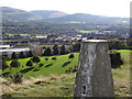
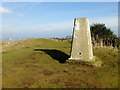
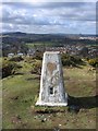
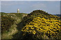
No recognisable feature of this fort remains. All of the topsoil has been removed immediately west of the summit while further west a modern gun emplacement overlays the site. There is a rock cut ditch 30.0m west of the summit effectively cutting off approach from that side and 10.0m NNW of the summit is a grass-covered scatter of stones that may be the remains of walling. To the N and S of this site are steep rocky cliffs showing no sign of any artificial work.
Taken from Canmore ID 52658.
You may be viewing yesterday's version of this page. To see the most up to date information please register for a free account.
Do not use the above information on other web sites or publications without permission of the contributor.
Nearby Images from Geograph Britain and Ireland:
©2014(licence)
©2015(licence)
©2019(licence)
©2009(licence)
©2009(licence)
The above images may not be of the site on this page, they are loaded from Geograph.
Please Submit an Image of this site or go out and take one for us!
Click here to see more info for this site
Nearby sites
Key: Red: member's photo, Blue: 3rd party photo, Yellow: other image, Green: no photo - please go there and take one, Grey: site destroyed
Download sites to:
KML (Google Earth)
GPX (GPS waypoints)
CSV (Garmin/Navman)
CSV (Excel)
To unlock full downloads you need to sign up as a Contributory Member. Otherwise downloads are limited to 50 sites.
Turn off the page maps and other distractions
Nearby sites listing. In the following links * = Image available
1.8km ENE 71° Hanging Stanes (Braid Road)* Marker Stone (NT24517061)
1.9km ESE 116° Buck Stane* Standing Stone (Menhir) (NT24506922)
2.0km SE 128° 1, West Camus Road* Modern Stone Circle etc (NT2441068763)
2.2km SE 139° Caiy Stane* Standing Stone (Menhir) (NT2424368357)
2.3km NE 47° The Bore Stone* Marker Stone (NT2450871568)
2.4km SE 136° Fairmiliehead (Edinburgh) Cairn (NT24466828)
3.1km ESE 124° Galachlaw Cairn* Cairn (NT25366831)
3.6km N 0° Succoth Place Double Cist Burial Cist (NT22897362)
3.9km ENE 63° Penny Well (Edinburgh)* Holy Well or Sacred Spring (NT26367177)
3.9km SSE 166° Caerketton Hill* Cairn (NT23706621)
4.0km NE 36° The Portsburgh Stone* Natural Stone / Erratic / Other Natural Feature (NT25287327)
4.1km NW 306° Physic Well (Corstorphine)* Holy Well or Sacred Spring (NT19597252)
4.1km NW 307° Lady Well* Holy Well or Sacred Spring (NT196726)
4.1km NE 36° Grassmarket modern menhir* Standing Stone (Menhir) (NT25337333)
4.2km NNE 31° St Margaret's Well (Edinburgh Castle)* Holy Well or Sacred Spring (NT2508273613)
4.2km SSE 155° Hillend (Loanhead)* Hillfort (NT24526620)
4.2km NE 35° Stone of Scone* Marker Stone (NT253735)
4.3km NE 47° Edinburgh Runestone* Carving (NT2598972937)
4.3km NNE 20° St George's Well (Edinburgh)* Holy Well or Sacred Spring (NT2440174070)
4.3km NE 41° National Museum of Scotland (Pictish Stones)* Museum (NT2572173302)
4.4km NE 41° National Museum of Scotland* Museum (NT2574873290)
4.4km NE 42° National Museum of Scotland (Early Christian Stones)* Ancient Cross (NT2583273324)
4.5km NNE 20° St Bernard's Well* Holy Well or Sacred Spring (NT2445174247)
4.7km E 81° Cat Stane (Inch)* Standing Stone (Menhir) (NT27457068)
4.8km NE 54° Slidey Stane (Holyrood Park)* Natural Stone / Erratic / Other Natural Feature (NT2676672765)
View more nearby sites and additional images


 We would like to know more about this location. Please feel free to add a brief description and any relevant information in your own language.
 Wir möchten mehr über diese Stätte erfahren. Bitte zögern Sie nicht, eine kurze Beschreibung und relevante Informationen in Deutsch hinzuzufügen.
 Nous aimerions en savoir encore un peu sur les lieux. S'il vous plaît n'hesitez pas à ajouter une courte description et tous les renseignements pertinents dans votre propre langue.
 Quisieramos informarnos un poco más de las lugares. No dude en añadir una breve descripción y otros datos relevantes en su propio idioma.