<< Our Photo Pages >> St John's Cross (Canongate) - Ancient Cross in Scotland in Midlothian
Submitted by Anne T on Wednesday, 09 October 2019 Page Views: 1827
Early Medieval (Dark Age)Site Name: St John's Cross (Canongate)Country: Scotland County: Midlothian Type: Ancient Cross
Nearest Town: Edinburgh
Map Ref: NT2628873733
Latitude: 55.950951N Longitude: 3.18197W
Condition:
| 5 | Perfect |
| 4 | Almost Perfect |
| 3 | Reasonable but with some damage |
| 2 | Ruined but still recognisable as an ancient site |
| 1 | Pretty much destroyed, possibly visible as crop marks |
| 0 | No data. |
| -1 | Completely destroyed |
| 5 | Superb |
| 4 | Good |
| 3 | Ordinary |
| 2 | Not Good |
| 1 | Awful |
| 0 | No data. |
| 5 | Can be driven to, probably with disabled access |
| 4 | Short walk on a footpath |
| 3 | Requiring a bit more of a walk |
| 2 | A long walk |
| 1 | In the middle of nowhere, a nightmare to find |
| 0 | No data. |
| 5 | co-ordinates taken by GPS or official recorded co-ordinates |
| 4 | co-ordinates scaled from a detailed map |
| 3 | co-ordinates scaled from a bad map |
| 2 | co-ordinates of the nearest village |
| 1 | co-ordinates of the nearest town |
| 0 | no data |
Internal Links:
External Links:
I have visited· I would like to visit
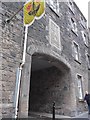
Anne T visited on 1st Oct 2019 - their rating: Cond: 2 Amb: 3 Access: 4 St John's Cross, Edinburgh (site of): The site of this cross was one of the clues (no. 6) on the 'Treasure Trail' map for the Old Town Trail. The markings for this cross were very faint indeed. I only recognised the spot by the circle of bricks in the road, as I’d seen similar features before. There is a plaque on the wall nearby.
From the funny, small brass plates in the road and pavement just to the west, at the junction of High Street and Canongate (W-E) and Jeffrey Street-Saint Mary's Street to the east, the cross would have been located just outside the old city walls.
Whilst I've been to Edinburgh on a number of occasions, I have never walked down Canongate before, and it was a great spot for discovering 'old things and old sites'.
 (PID:203746)")
We came across the site of this old cross as part of a 'Treasure Trail' for Edinburgh Old Town. It is recorded as Canmore ID 52301.
Standing just outside the old city walls at Netherbow (the position of the walls now marked now by some brass plates in the pavement and road, just to the west), this cross "marked a point on the western boundary of Canongate parish. It was removed long ago, a circle of stones intersected by a cross, on the pavement marking its site".
The sign on the wall just to the south of the spot marked on the road reads:
"St John’s Cross.
The Cross on the roadway marks the site of the original standing cross of St John which was on the boundary between Edinburgh and the borough of Canongate. The ancient order of St John is thought to have owned land and property next to the cross during the middle ages.
The cross was set in place during 1987 by the venerable order of St John of Jerusalem to mark the fortieth anniversary of the re-establishment of the order in Scotland".
To see a photograph of the spot with better painted markings, see Canmore Digital Image 1348377.
According to the Best of Edinburgh website, the original cross is sited at Canongate Kirk (see nearby sites below), although other sources talk of three separate crosses on Canongate - the St John's Cross, the Canongate Mercat Cross and the Girth Cross.
You may be viewing yesterday's version of this page. To see the most up to date information please register for a free account.
 (PID:203748)")
 (PID:203747)")
Do not use the above information on other web sites or publications without permission of the contributor.
Nearby Images from Geograph Britain and Ireland:
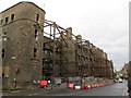
©2015(licence)
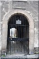
©2011(licence)
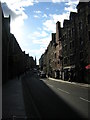
©2012(licence)
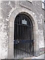
©2014(licence)
©2014(licence)
The above images may not be of the site on this page, they are loaded from Geograph.
Please Submit an Image of this site or go out and take one for us!
Click here to see more info for this site
Nearby sites
Key: Red: member's photo, Blue: 3rd party photo, Yellow: other image, Green: no photo - please go there and take one, Grey: site destroyed
Download sites to:
KML (Google Earth)
GPX (GPS waypoints)
CSV (Garmin/Navman)
CSV (Excel)
To unlock full downloads you need to sign up as a Contributory Member. Otherwise downloads are limited to 50 sites.
Turn off the page maps and other distractions
Nearby sites listing. In the following links * = Image available
200m ENE 66° Canongate Mercat Cross* Ancient Cross (NT2647273812)
483m ENE 68° Girth Cross (Canongate)* Ancient Cross (NT2673973910)
611m SW 227° National Museum of Scotland (Early Christian Stones)* Ancient Cross (NT2583273324)
697m SW 230° National Museum of Scotland* Museum (NT2574873290)
711m SW 232° National Museum of Scotland (Pictish Stones)* Museum (NT2572173302)
843m E 90° St Margaret's Well (Edinburgh)* Holy Well or Sacred Spring (NT2713373712)
849m SSW 200° Edinburgh Runestone* Carving (NT2598972937)
853m ESE 123° Salisbury Crags* Promontory Fort / Cliff Castle (NT27007326)
1.0km WSW 256° Stone of Scone* Marker Stone (NT253735)
1.0km WSW 246° Grassmarket modern menhir* Standing Stone (Menhir) (NT25337333)
1.1km SSE 153° Slidey Stane (Holyrood Park)* Natural Stone / Erratic / Other Natural Feature (NT2676672765)
1.1km WSW 244° The Portsburgh Stone* Natural Stone / Erratic / Other Natural Feature (NT25287327)
1.2km W 263° St Margaret's Well (Edinburgh Castle)* Holy Well or Sacred Spring (NT2508273613)
1.2km E 93° St Anthony's Well (Edinburgh)* Holy Well or Sacred Spring (NT27527364)
1.6km ESE 123° Arthur's Seat* Hillfort (NT27647282)
1.7km SE 136° Samson's Ribs* Promontory Fort / Cliff Castle (NT27457250)
1.9km WNW 285° St Bernard's Well* Holy Well or Sacred Spring (NT2445174247)
1.9km W 279° St George's Well (Edinburgh)* Holy Well or Sacred Spring (NT2440174070)
2.0km ESE 106° Dunsapie Crag* Hillfort (NT28177316)
2.0km S 177° Penny Well (Edinburgh)* Holy Well or Sacred Spring (NT26367177)
2.1km ESE 106° Holyrood Park Stone (Edinburgh) Natural Stone / Erratic / Other Natural Feature (NT28267313)
2.2km ENE 69° St Triduana's Wellhouse* Holy Well or Sacred Spring (NT2833274468)
2.2km ESE 117° Delf Well* Holy Well or Sacred Spring (NT282727)
2.8km SW 218° The Bore Stone* Marker Stone (NT2450871568)
3.3km SSE 158° Cat Stane (Inch)* Standing Stone (Menhir) (NT27457068)
View more nearby sites and additional images


 We would like to know more about this location. Please feel free to add a brief description and any relevant information in your own language.
 Wir möchten mehr über diese Stätte erfahren. Bitte zögern Sie nicht, eine kurze Beschreibung und relevante Informationen in Deutsch hinzuzufügen.
 Nous aimerions en savoir encore un peu sur les lieux. S'il vous plaît n'hesitez pas à ajouter une courte description et tous les renseignements pertinents dans votre propre langue.
 Quisieramos informarnos un poco más de las lugares. No dude en añadir una breve descripción y otros datos relevantes en su propio idioma.