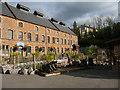
<< Our Photo Pages >> Wookey Hole Caves Museum - Museum in England in Somerset
Submitted by vicky on Thursday, 05 February 2004 Page Views: 7659
MuseumsSite Name: Wookey Hole Caves MuseumCountry: England County: Somerset Type: Museum
Nearest Town: Wells
Map Ref: ST531477 Landranger Map Number: 182
Latitude: 51.226553N Longitude: 2.673023W
Condition:
| 5 | Perfect |
| 4 | Almost Perfect |
| 3 | Reasonable but with some damage |
| 2 | Ruined but still recognisable as an ancient site |
| 1 | Pretty much destroyed, possibly visible as crop marks |
| 0 | No data. |
| -1 | Completely destroyed |
| 5 | Superb |
| 4 | Good |
| 3 | Ordinary |
| 2 | Not Good |
| 1 | Awful |
| 0 | No data. |
| 5 | Can be driven to, probably with disabled access |
| 4 | Short walk on a footpath |
| 3 | Requiring a bit more of a walk |
| 2 | A long walk |
| 1 | In the middle of nowhere, a nightmare to find |
| 0 | No data. |
| 5 | co-ordinates taken by GPS or official recorded co-ordinates |
| 4 | co-ordinates scaled from a detailed map |
| 3 | co-ordinates scaled from a bad map |
| 2 | co-ordinates of the nearest village |
| 1 | co-ordinates of the nearest town |
| 0 | no data |
Be the first person to rate this site - see the 'Contribute!' box in the right hand menu.
Internal Links:
External Links:
I have visited· I would like to visit
JimChampion cazzyjane hevveh have visited here
")
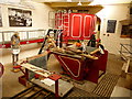
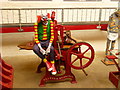
Finds from Wookey Hole Caves
Address: Wookey Hole, BA5 1BB
Phone: 01749 672243
Opening Hours: Open 7 days a week except 17-25 December inclusive, April-Oct 10am to 5pm, Nov-March10.30am -4.30pm
Admission: Charge
Visit their web site
You may be viewing yesterday's version of this page. To see the most up to date information please register for a free account.
")
Do not use the above information on other web sites or publications without permission of the contributor.
Nearby Images from Geograph Britain and Ireland:
©2012(licence)
©2012(licence)
©2012(licence)
©2012(licence)
©2012(licence)
The above images may not be of the site on this page, they are loaded from Geograph.
Please Submit an Image of this site or go out and take one for us!
Click here to see more info for this site
Nearby sites
Key: Red: member's photo, Blue: 3rd party photo, Yellow: other image, Green: no photo - please go there and take one, Grey: site destroyed
Download sites to:
KML (Google Earth)
GPX (GPS waypoints)
CSV (Garmin/Navman)
CSV (Excel)
To unlock full downloads you need to sign up as a Contributory Member. Otherwise downloads are limited to 50 sites.
Turn off the page maps and other distractions
Nearby sites listing. In the following links * = Image available
286m NNE 29° Badger Hole (Somerset) Cave or Rock Shelter (ST53244795)
323m NNE 16° Wookey Hole Caves* Cave or Rock Shelter (ST53194801)
1.7km NW 309° Deerleap Stones* Standing Stones (ST51804876)
2.7km SE 132° Wells and Mendip Museum* Museum (ST551459)
2.7km SE 131° Wells Cathedral* Early Christian Sculptured Stone (ST5514645865)
2.8km SE 131° St Andrew's Well (Wells)* Holy Well or Sacred Spring (ST5522745824)
3.0km SE 135° Glastonbury Tor milestone at Wells* Modern Stone Circle etc (ST552456)
3.3km ENE 72° Pen Hill Longbarrow* Long Barrow (ST563487)
3.4km NNE 24° Fair Lady Well* Holy Well or Sacred Spring (ST54515079)
3.5km NW 319° Westbury-Sub-Mendip Cave or Rock Shelter (ST50855036)
3.5km NE 53° Drove Cottage Henge* Henge (ST559498)
3.6km NNW 332° Priddy long barrow* Long Barrow (ST5141550915)
3.7km NE 49° Hunter's Lodge Inn Barrow* Round Barrow(s) (ST559501)
3.7km N 352° Priddy Church Barrows* Barrow Cemetery (ST526514)
3.9km NNE 12° Priddy Nine Barrows* Barrow Cemetery (ST53925149)
4.2km ESE 119° King's Castle (Wells) Ancient Village or Settlement (ST568456)
4.3km NNW 338° Townsend Farm Barrow Cemetery* Barrow Cemetery (ST5152851658)
4.4km N 10° Ashen Hill Barrows* Barrow Cemetery (ST53905205)
4.5km NNW 331° Bristol Plain Farm Barrow Cemetery* Barrow Cemetery (ST5097951665)
4.7km S 182° Harters Hill* Ancient Trackway (ST529430)
4.9km N 9° Priddy Circles S* Henge (ST53945255)
5.1km NNE 16° Castle Farm Long Barrow* Long Barrow (ST54525255)
5.2km N 10° Priddy Circles C* Henge (ST54015279)
5.2km N 9° Priddy Circles* Henge (ST54005280)
5.2km NW 311° Westbury Camp* Hillfort (ST49205112)
View more nearby sites and additional images


 We would like to know more about this location. Please feel free to add a brief description and any relevant information in your own language.
 Wir möchten mehr über diese Stätte erfahren. Bitte zögern Sie nicht, eine kurze Beschreibung und relevante Informationen in Deutsch hinzuzufügen.
 Nous aimerions en savoir encore un peu sur les lieux. S'il vous plaît n'hesitez pas à ajouter une courte description et tous les renseignements pertinents dans votre propre langue.
 Quisieramos informarnos un poco más de las lugares. No dude en añadir una breve descripción y otros datos relevantes en su propio idioma.