Featured: Hare and Tabor T Shirts for discerning antiquarians

Hare and Tabor T Shirts for discerning antiquarians

The Illustrated Encyclopedia of Native American Indian Mounds

The Illustrated Encyclopedia of Native American Indian Mounds

Who's Online

There are currently, 210 guests and 0 members online.

You are a guest. To join in, please register for free by clicking here

Sponsors

<< Our Photo Pages >> Priddy Circles - Henge in England in Somerset

Submitted by JJ on Friday, 17 June 2011  Page Views: 32264

Site WatchSite Name: Priddy Circles Alternative Name: Priddy Henges; The Castles; The Rings
Country: England County: Somerset Type: Henge
Nearest Town: Wells  Nearest Village: Priddy
Map Ref: ST54005280  Landranger Map Number: 182
Latitude: 51.272482N  Longitude: 2.660792W
Condition:
5Perfect
4Almost Perfect
3Reasonable but with some damage
2Ruined but still recognisable as an ancient site
1Pretty much destroyed, possibly visible as crop marks
0No data.
-1Completely destroyed
2 Ambience:
5Superb
4Good
3Ordinary
2Not Good
1Awful
0No data.
2 Access:
5Can be driven to, probably with disabled access
4Short walk on a footpath
3Requiring a bit more of a walk
2A long walk
1In the middle of nowhere, a nightmare to find
0No data.
1 Accuracy:
5co-ordinates taken by GPS or official recorded co-ordinates
4co-ordinates scaled from a detailed map
3co-ordinates scaled from a bad map
2co-ordinates of the nearest village
1co-ordinates of the nearest town
0no data
5

Internal Links:
External Links:

I have visited· I would like to visit

Tik visited on 19th Jan 2011 - their rating: Cond: 2 Amb: 4 Access: 1 Absolutely beautiful at sunset, can still tell bank and ditch features but clearly it has been worn down and eroded- gaps in the circles could be interpreted as entrances but contributing factors are weathering over time and animal grazing...

Andy B Mose have visited here
Priddy Circles
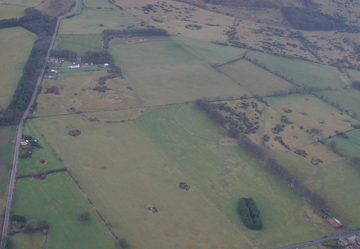
Priddy Circles submitted by JJ : Aerial Photo by JJ Evendon and Pete Glastonbury (Vote or comment on this photo)
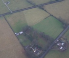
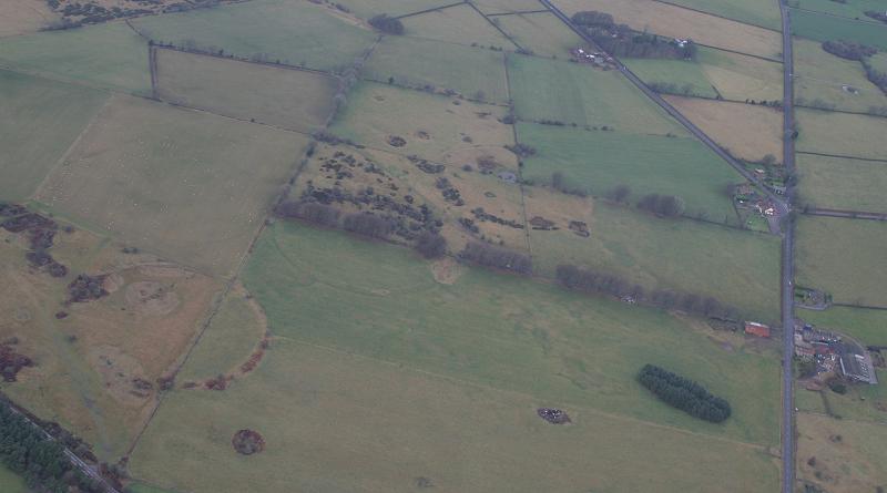
Priddy Circles are an arrangement of four circular earthwork enclosures near Priddy. The circles are described as 'probable Neolithic ritual or ceremonial monuments similar to a henge'. The circles, each nearly 200m across, are best seen from the air.

The total arrangement is spread over roughly 1.2km. The B3135 cuts through the circles and follows the course of the Roman road which runs between Charterhouse and Old Sarum.

Excavations carried out between 1956 and 1959 by members of the University of Bristol Spelaeological Society showed that the banks had stone cores with post and stake holes on either side. Geophysical surveys in 1995 and a magnetometer survey in 2006 explored the make up of the circles.

They are probably Neolithic ritual or ceremonial monuments similar to a henge. The external rather than internal ditches makes them unique in Britain.

Although no dating evidence has been found, they appear to be contemporary with Stonehenge. The circles are the most important surviving Neolithic sites in Somerset.

The Northern Antiquarian (TNA) also features a page for this site - see their entry for Priddy Henges, Priddy, Somerset, which includes a plan of the henges, an aerial photograph and an old drawing of the central henge.

They are also recorded as Pastscape Monument No. 197579.

Note: Fears one of Priddy circles has been obliterated, see latest comment
You may be viewing yesterday's version of this page. To see the most up to date information please register for a free account.

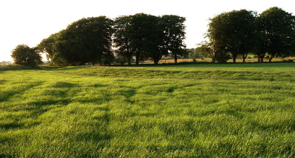
Priddy Circles
Priddy Circles submitted by JJ : Aerial Photo by JJ Evendon and Pete Glastonbury (7 comments - Vote or comment on this photo)

Priddy Circles S
Priddy Circles S submitted by TheCaptain : Here, I have borrowed JJ's picture, and marked in the area which I reckon has recently been bulldozed flat. Criminal. (2 comments - Vote or comment on this photo)

Priddy Circles C
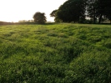
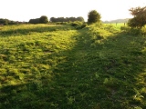
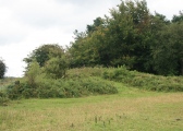
Priddy Circles C submitted by Bladup : Priddy Circles C, The bank on the Western side looking North West. (Vote or comment on this photo)

Priddy Circles N
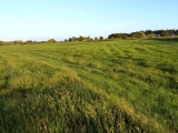
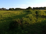
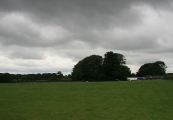
Priddy Circles N submitted by theCaptain : Priddy Northern circle, June 2011. Here we see the whole of the circle, looking north from the field containing the central circle. (Vote or comment on this photo)

Priddy Circles N
Priddy Circles N submitted by theCaptain : Priddy Northern circle, June 2011. Here we see the whole of the circle, looking northwest from the field containing the central circle.

Priddy Circles N
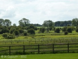
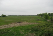
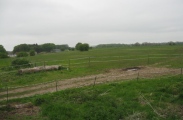
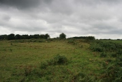
Priddy Circles N submitted by theCaptain : Priddy Northern circle, June 2011. Seen here looking west from the B3134, it is quite difficult to make the circle out, but it is mostly to be seen. Look over the three foreground fences, then you see lumps and bumps of the eastern arc. The next wall and fence cut the circle pretty much in half, and the western arc is quite clear beyond that as it is where all the dark bushes are growing.

Priddy Circles Unfinished N
Priddy Circles Unfinished N submitted by JJ : Priddy Circles Unfinished North henge. Aerial Photo by JJ Evendon and Pete Glastonbury

Priddy Circles C
Priddy Circles C submitted by Bladup : The Southern part of Priddy Circles C looking East.

Priddy Circles C
Priddy Circles C submitted by Bladup : The bank at Priddy Circles C.

Priddy Circles C
Priddy Circles C submitted by Bladup : Looking over the bank of Priddy Circles C towards the Southern henge [on the right].

Priddy Circles S
Priddy Circles S submitted by Bladup : Priddy Circles S, The bank at the Northern Part of the circle looking West.

Priddy Circles S
Priddy Circles S submitted by Bladup : Priddy Circles S, The Eastern side looking South East.

Priddy Circles S
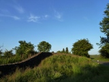
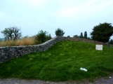
Priddy Circles S submitted by Bladup : The barrow by the road just to the South of the henge, Idiots built the wall.

Priddy Circles S
Priddy Circles S submitted by Bladup : Priddy Circles S, Northern Part of the circle looking West.

Priddy Circles S
Priddy Circles S submitted by theCaptain : October 2013, and nothing at all has been done to repair the bulldozed Priddy southern circle, but the barrow in the corner of the field has had a gert big wall built over the top of it. (1 comment)

Priddy Circles S
Priddy Circles S submitted by AngieLake : Looking over the wall to right of gate; a building site to east of this field and man making drystone wall to my right. (2 comments)

Priddy Circles S
Priddy Circles S submitted by AngieLake : Looking across the field where Priddy S is situated, from the gate or nearby wall to its left. A building site to the east of here, and someone making a drystone wall to my right.

Priddy Circles
Priddy Circles submitted by postman : This barrow is right next to the road and between the road and the southern henge.

Priddy Circles Unfinished N
Priddy Circles Unfinished N submitted by postman : The unfinished henge at Priddy, under darkening skies.

Priddy Circles C
Priddy Circles C submitted by postman : The cenral henge as seen from the edge of the southern henge.

Priddy Circles S
Priddy Circles S submitted by postman : Just weeks before the wanton carnage visited upon this, one of the rarest of England's jewels.

Priddy Circles N
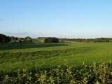
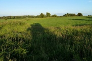
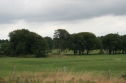
Priddy Circles N submitted by theCaptain : Priddy Northern circle, June 2011. Here we see the southern arc, made clear by the bushes, seen here looking north from the field containing the central circle.

Priddy Circles N
Priddy Circles N submitted by theCaptain : Priddy Northern circle, June 2011. Seen here looking north from the field containing the central circle. Here we see the southeastern arc, particularly notable as it passes through the fence beyond the cows.

Priddy Circles N
Priddy Circles N submitted by theCaptain : Priddy Northern circle, June 2011. Seen here looking south from the B3134 to the north of the Castle of Comfort. Again, it is quite difficult to make the circle out, and it takes an eye of faith to follow it in this picture, but it is mostly here to be seen. Bear in mind, that the conjunction of the two near field boundaries, pretty much in the centre of the picture, is approxima...

These are just the first 25 photos of Priddy Circles. If you log in with a free user account you will be able to see our entire collection.

Do not use the above information on other web sites or publications without permission of the contributor.
Click here to see more info for this site

Nearby sites

Click here to view sites on an interactive OS map

Key: Red: member's photo, Blue: 3rd party photo, Yellow: other image, Green: no photo - please go there and take one, Grey: site destroyed

Download sites to:
KML (Google Earth)
GPX (GPS waypoints)
CSV (Garmin/Navman)
CSV (Excel)

To unlock full downloads you need to sign up as a Contributory Member. Otherwise downloads are limited to 50 sites.


Turn off the page maps and other distractions

Nearby sites listing. In the following links * = Image available
 14m SE 135° Priddy Circles C* Henge (ST54015279)
 238m NNE 22° Priddy Circles N* Henge (ST54095302)
 257m SSW 193° Priddy Circles S* Henge (ST53945255)
 576m ESE 115° Castle Farm Long Barrow* Long Barrow (ST54525255)
 756m S 187° Ashen Hill Barrows* Barrow Cemetery (ST53905205)
 779m NNE 15° Priddy Circles Unfinished N* Henge (ST54215355)
 1.3km S 183° Priddy Nine Barrows* Barrow Cemetery (ST53925149)
 1.4km NNW 349° Pool Farm Cist* Rock Art (ST53745415)
 2.0km SW 224° Priddy Church Barrows* Barrow Cemetery (ST526514)
 2.1km SSE 165° Fair Lady Well* Holy Well or Sacred Spring (ST54515079)
 2.1km NNW 334° Wright's Piece barrows (N)* Barrow Cemetery (ST531547)
 2.1km NW 322° Wright's Piece barrows (S)* Barrow Cemetery (ST527545)
 2.7km WSW 245° Townsend Farm Barrow Cemetery* Barrow Cemetery (ST5152851658)
 3.0km NW 324° Whites Town Farm Tumulus* Round Barrow(s) (ST5223355265)
 3.1km W 264° Cheddar Head Stone Circle (ST509525)
 3.2km SW 233° Priddy long barrow* Long Barrow (ST5141550915)
 3.2km WSW 249° Bristol Plain Farm Barrow Cemetery* Barrow Cemetery (ST5097951665)
 3.3km SE 144° Hunter's Lodge Inn Barrow* Round Barrow(s) (ST559501)
 3.5km NNW 340° Fernhill Farm* Modern Stone Circle etc (ST52865606)
 3.5km SSE 147° Drove Cottage Henge* Henge (ST559498)
 4.0km SW 232° Westbury-Sub-Mendip Cave or Rock Shelter (ST50855036)
 4.4km NW 312° Nordrach Tumulus* Round Barrow(s) (ST5078755765)
 4.5km N 356° Barrow Well (Compton Martin) Holy Well or Sacred Spring (ST537573)
 4.6km SSW 208° Deerleap Stones* Standing Stones (ST51804876)
 4.6km NW 308° Charterhouse settlement* Misc. Earthwork (ST504557)
View more nearby sites and additional images

<< El Castillejo dolmen

Bown Hill Bowl Barrow >>

Please add your thoughts on this site

Understanding the Neolithic

Understanding the Neolithic

Sponsors

Auto-Translation (Google)

Translate from English into:

"Priddy Circles" | Login/Create an Account | 29 News and Comments
  
Go back to top of page    Comments are owned by the poster. We aren't responsible for their content.
Re: Priddy Circles by Anne T on Wednesday, 03 January 2018
(User Info | Send a Message)
Just been updating this really interesting page with TNA and Pastscape links. The 'This is Somerset' link: Fears-circle-obliterated/story-12782536 [Source: This is Somerset] no longer works, and I haven't been able to find an alternative. Can anyone help trace this story, please, so I can update the link?
[ Reply to This ]

Re: Priddy Circles by Andy B on Tuesday, 11 July 2017
(User Info | Send a Message)
The Northern Antiquarian writes: Although cited in all modern archaeology texts as a series of four henge monuments, a recent article by J. Lewis & D. Mullin (2011) inform us that these “are not henges but belong to a tradition of enclosure that predates them and had a different function.”

More at
https://megalithix.wordpress.com/2012/04/07/priddy-henges/

Ref: Lewis, J. & Mullin, D., “New Excavations at Priddy Circle 1, Mendip Hills, Somerset,” in Proceedings of the University of Bristol Speleological Society, volume 25, 2011.
[ Reply to This ]
    New Excavations at Priddy Circle 1, Lewis,J., and Mullin,D., 2011 by Andy B on Tuesday, 11 July 2017
    (User Info | Send a Message)
    Lewis,J., and Mullin,D., 2011. New Excavations at Priddy Circle 1, Mendip Hills, Somerset. UBSS Proceedings, 25(2)

    In August 2008, small-scale research excavations were carried out at Priddy Circle 1, one of four related circular earthwork enclosures located on the Mendip Hills in Somerset. The date and function of the Priddy Circles has been much debated, largely due to the morphology of the monuments: they have external ditches and internal banks which seem to have been revetted by wooden posts.

    Although E. K. Tratman, who was involved in excavating a number of trenches across Priddy Circle 1, suggested that the monuments were related to henges and thus of Neolithic date, the lack of artefacts and radiocarbon dates, together with the unusual layout and construction, has led to much speculation. The reopening of one of the earlier excavation trench across the bank and ditch of Circle 1 showed that his interpretation of the constructional sequence was erroneous, with greater complexity revealed in the bank/ditch/posthole sequence, suggesting that the monument's construction went through more than one phase.

    So far, three radiocarbon determinations have been returned and these suggest a Later Neolithic date for the monument but it is argued that the monuments are not henges but belong to a tradition of enclosure that predates them and had a different function. A palaeo-environmental study was able to successfully retrieve and analyse pollen from several different contexts and all confirm Dimbleby's original assertion (1967) that the Circles were constructed in an open grassland environment.

    Full PDF.
    http://www.ubss.org.uk/resources/proceedings/vol25/UBSS_Proc_25_2_133-163.pdf

    Source UBSS
    [ Reply to This ]

Re: Priddy by Anonymous on Thursday, 18 July 2013
MY WEEKS FAMILIES LIVED AND DIED IN PRIDDY 1726 THRU1805 AND LATER WOULD LIKE TO FIND THE HOUSE/HOMESTEAD OF JOHN WEEKS SR AND JR

F
DONNA BEVLY
ON FACEBOOK
KALVGV65@AOL.COM
THANKS SO MUCH
[ Reply to This ]

Re: Priddy South has indeed been bulldozed. by angieweekender on Thursday, 23 June 2011
(User Info | Send a Message)
Who will enforce the law on this?
[ Reply to This ]
    Re: Priddy South has indeed been bulldozed. by Andy B on Thursday, 23 June 2011
    (User Info | Send a Message)
    Well, the police and crown prosecution service but English Heritage have a role as well. My sources tell me EH don't have a terribly good reputation for making prosecutions stick.
    [ Reply to This ]
    Re: Priddy South has indeed been bulldozed. by 4clydesdale7 on Friday, 24 June 2011
    (User Info | Send a Message)
    Any member of the public may complain to the Police - whether the Police do anything is another matter - to their line of thinking it is not a high priority - anyone thought of complaining to an MP?
    [ Reply to This ]

Priddy South has indeed been bulldozed. by TheCaptain on Sunday, 19 June 2011
(User Info | Send a Message)
I can indeed confirm that the field containing much of the southern, and perhaps most well preserved of the three main Priddy Circles has indeed been bulldozed and flattened. There are also piles of old building rubble about, which have no doubt been used to fill in the ditches, and much new fencing erected around this field.

Trying to look on the bright side, it would seem that only about a third of the circle has been destroyed.
[ Reply to This ]
    Re: Priddy South has indeed been bulldozed. by Anonymous on Tuesday, 21 June 2011
    Absolutely disgraceful. Pressure now needs putting on the police & EH to confirm someone will be prosecuted for this and be forced to pay for any restorative work that may be possible.
    [ Reply to This ]

Re: Rumours circulating in Priddy by SteveT on Saturday, 18 June 2011
(User Info | Send a Message)
Ther are 4 circles visible; 3 in a row to the south, a gap, then a 4th northerly one. The LiDAR survey of 2006 shows the northernmost circle is complete but has almost lost its SW sector.
With careful study of the LiDAR image, plus the eye of great faith, I think there is another "missing" 5th circle in the gap between the circles just south of the pub "The Castle of Comfort". It is slightly smaller (141m diameter compared to the 167m of the circle to the south of it). Like the other circles,it is not absolutely in line. It is bisected by the Roman road that goes from Charterhouse to Old Sarum.
There is an element of doubt about this "missing" circle, but I think it is there!
[ Reply to This ]

Rumours circulating in Priddy by Andy B on Friday, 17 June 2011
(User Info | Send a Message)
Priddy Circles Damaged!

Rumours are circulating in Priddy that the new landowner at Harptree Lodge (formerly the HQ of the Mendip Hunt) has been levelling land to the east of the house and has bulldozed one of the Bronze Age Priddy Circles, using the material to fill in nearby depressions.

http://community.activityseeker.com/pg/forum/topic/326/damage-to-priddy-circles/
[ Reply to This ]

Fears one of Priddy circles has been obliterated by Andy B on Friday, 17 June 2011
(User Info | Send a Message)
Archeologists are assessing damage to a 4,000-year-old prehistoric site on the Mendip Hills.

English Heritage experts have been investigating claims that one of the four Priddy Circles, which are Scheduled Ancient Monuments, has been obliterated.

The Ancient Monuments and Archaeological Areas Act 1979 makes it a criminal offence to destroy or damage a scheduled monument including agriculture, forestry, flooding and tipping.

Land near the circles appears to have been recently re-seeded and tree saplings have been planted close by.

Anyone who damages an ancient monument can be fined.

English Heritage has refused to be drawn on the extent of the alleged damage at this stage.

An English Heritage spokesman would only say: "We are currently investigating reports of damage to the Priddy Circles – a series of four large Neolithic henge monuments in Somerset."

All other interested groups, including Somerset County Council and the Area of Outstanding Natural Beauty, have directed inquiries to English Heritage.

Priddy Circles are an arrangement of four circular earthwork enclosures near Priddy.

The circles are described as 'probable Neolithic ritual or ceremonial monuments similar to a henge'.

The circles, each nearly 200m across, are best seen from the air.

The damaged circle was the most clearly defined of the four.

More at This is Somerset
http://www.thisissomerset.co.uk/Fears-circle-obliterated/story-12782536-detail/story.html
[ Reply to This ]
    Re: Fears one of Priddy circles has been obliterated by Andy B on Friday, 17 June 2011
    (User Info | Send a Message)
    Looking at the comments on this page, someone warned of potential problems three years ago. Photos or reports from anyone who lives locally as to what is going on would be much appreciated.
    [ Reply to This ]

Re: Street View by Anonymous on Monday, 12 July 2010
This might sound a bit obvious but if you google map priddy. pan north east a few hundred yards across the old bristol road then switch to sattelite they're as plain as day. fantastic to see
[ Reply to This ]

Re: Street View by MacMcLaren on Tuesday, 06 July 2010
(User Info | Send a Message)
In February 1999 I met with Mr. Ashton Sparkes, then the landowner. He was (& hopefully still is) a charming man who invited me in and talked with pride about the henges. I explained that a Duke of Edinburgh's Award Team wanted to include the henges as the aim of their Silver Expedition. He willingly granted his permission for them to enter his land.

When we visited in June 2009, unfortunately Mr. Sparkes was in hospital having taken a fall. I met his Daughter, Sharon Sparkes, who was equally friendly and helpful. I will not publish her phone number here but will happily put her in touch with any interestd parties.

This is a truly magical site and well worth a visit. Don't be put off by other posts saying there's not much to see. What do they expect?

A henge is a bank and ditch formation. The ditches were easily discovered due to their being filled with snow in February. Unfortunately I didn't manage to get a picture of the wife "discovering" the first one!

In the summer, the middle circle was magnificent and easily traced, especially with people positioned around it.


[ Reply to This ]

Street View by coldrum on Wednesday, 24 March 2010
(User Info | Send a Message)

View Larger Map
[ Reply to This ]

Re: Joan- thresjn1@tiscali.co.uk by Anonymous on Wednesday, 09 April 2008
Is preserving the site at risk with Mendip Farmers Hunt moving to Underbarrow Farm in Priddy as can be seen at the campaign website http://www.priddy-canine.org.uk
[ Reply to This ]

Re: Joan- thresjn1@tiscali.co.uk by Anonymous on Thursday, 18 October 2007
Can anyone give us information about the minories - old pictures etc., We would very much like to see what these lead mines looked like in Victorian times. (or whenever they were in operation) Are there any books on the subject?Any information will be greatly appreciated.
[ Reply to This ]
    Re: Joan- thresjn1@tiscali.co.uk by SteveT on Saturday, 18 June 2011
    (User Info | Send a Message)
    Check out the Festival of Archaeology. The CHERT group is giving a talk and walk from Charterhouse on Tuesday 19th 10 am, repeated Sunday 24th 2.30pm.
    [ Reply to This ]

Re: Priddy Circles by AngieLake on Saturday, 02 September 2006
(User Info | Send a Message)
See also Priddy N site page for recent news of proposed high-tech aerial surveys, possibly starting in mid-September 2006.
The Western Daily Press printed a small laser image of "Priddy stone circles" in their issue of 18th August 2006, under this article titled: "New light to shine on history."
[ Reply to This ]

Re: Priddy Circles by Anonymous on Tuesday, 18 April 2006
I am a Priddy and hope to get over there and see the circles and later stonehenge after visiting Priddy village.
[ Reply to This ]

Re: Priddy Circles by MarionBenham on Sunday, 07 March 2004
(User Info | Send a Message)
I've discovered from researching in local books that the banks of these circles have large stones visible in places- possibly they were stone circles before they were banked up.The nearest source for the type of stone used is at least a mile away from the site.The banks were made with two concentric rings of posts lined with stakes and hurdles, filled with drystone walling and heaped over with earth.
[ Reply to This ]

Priddy Damn Good by Anonymous on Thursday, 11 December 2003
Whilst looking at a recent aerial photograph of the 'Priddy' henges it could be argued that the three henge’s (there is a fourth further away) are aligned closely resembling the 3 stars in Orion’s Belt or the Pyramids of Giza. Look at the picture carefully. What do you think?

Whilst one can make assumptions about many things, is this yet another discovery that points towards our ancestors having more understanding of the cosmos in the belief that the seeds of mankind came from the stars.

Maybe the henges were the 'satellite dishes’ of the ancient world - a receptor and communicator for enlightenment on a cosmic scale – we’ll never know unless we’ve been there and freed our minds.

JJ
[ Reply to This ]

Re: Priddy Circles by MarionBenham on Sunday, 07 December 2003
(User Info | Send a Message)
Not easy to find unless you are working from a map! There are no signposts or car parks, I found the easiest place to get to them is through the gate on the B3135 West of the Miners Arms, you can park in the gateway (not far from the crossroads on the right), at least there are no signs to tell you not to. The circles are on private land though the owners must be resigned to people wanting to see them as there is a sign on the gate asking people not to open it and let the horses out.
I didn't get too close as the area did have a very private feel to it which put me off.
[ Reply to This ]
    Re: Priddy Circles by Anonymous on Sunday, 07 December 2003
    Well done! I tried and failed last month. The whole area is confusing and Dyer's directions, which are usually clear, were hopeless. Also tried and failed to find the Pool Farn cist.
    [ Reply to This ]

Your Name: Anonymous [ Register Now ]
Subject:


Add your comment or contribution to this page. Spam or offensive posts are deleted immediately, don't even bother

<<< What is five plus one as a number? (Please type the answer to this question in the little box on the left)
You can also embed videos and other things. For Youtube please copy and paste the 'embed code'.
For Google Street View please include Street View in the text.
Create a web link like this: <a href="https://www.megalithic.co.uk">This is a link</a>  

Allowed HTML is:
<p> <b> <i> <a> <img> <em> <br> <strong> <blockquote> <tt> <li> <ol> <ul> <object> <param> <embed> <iframe>

We would like to know more about this location. Please feel free to add a brief description and any relevant information in your own language.
Wir möchten mehr über diese Stätte erfahren. Bitte zögern Sie nicht, eine kurze Beschreibung und relevante Informationen in Deutsch hinzuzufügen.
Nous aimerions en savoir encore un peu sur les lieux. S'il vous plaît n'hesitez pas à ajouter une courte description et tous les renseignements pertinents dans votre propre langue.
Quisieramos informarnos un poco más de las lugares. No dude en añadir una breve descripción y otros datos relevantes en su propio idioma.