<< Our Photo Pages >> Malham settlements and field systems - Ancient Village or Settlement in England in Yorkshire (North)
Submitted by MarionBenham on Sunday, 05 December 2004 Page Views: 11662
Multi-periodSite Name: Malham settlements and field systems Alternative Name: Gordale field systemCountry: England
NOTE: This site is 0.71 km away from the location you searched for.
County: Yorkshire (North) Type: Ancient Village or Settlement
Nearest Town: Skipton Nearest Village: Malham
Map Ref: SD905635
Latitude: 54.067349N Longitude: 2.146651W
Condition:
| 5 | Perfect |
| 4 | Almost Perfect |
| 3 | Reasonable but with some damage |
| 2 | Ruined but still recognisable as an ancient site |
| 1 | Pretty much destroyed, possibly visible as crop marks |
| 0 | No data. |
| -1 | Completely destroyed |
| 5 | Superb |
| 4 | Good |
| 3 | Ordinary |
| 2 | Not Good |
| 1 | Awful |
| 0 | No data. |
| 5 | Can be driven to, probably with disabled access |
| 4 | Short walk on a footpath |
| 3 | Requiring a bit more of a walk |
| 2 | A long walk |
| 1 | In the middle of nowhere, a nightmare to find |
| 0 | No data. |
| 5 | co-ordinates taken by GPS or official recorded co-ordinates |
| 4 | co-ordinates scaled from a detailed map |
| 3 | co-ordinates scaled from a bad map |
| 2 | co-ordinates of the nearest village |
| 1 | co-ordinates of the nearest town |
| 0 | no data |
Internal Links:
External Links:
")
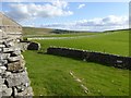
The land around here shows evidence of man's presence since Mesolithic times. Hut circles, field sytems, settlements, enclosures and tumuli can be found north of the village on the higher ground. There is also an Eighth Century Anglo-Saxon settlement.
You may be viewing yesterday's version of this page. To see the most up to date information please register for a free account.
")
Do not use the above information on other web sites or publications without permission of the contributor.
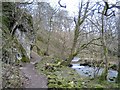
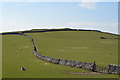
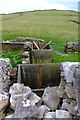
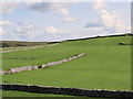
Nearby Images from Geograph Britain and Ireland:
©2005(licence)
©2015(licence)
©2007(licence)
©2018(licence)
©2016(licence)
The above images may not be of the site on this page, they are loaded from Geograph.
Please Submit an Image of this site or go out and take one for us!
Click here to see more info for this site
Nearby sites
Key: Red: member's photo, Blue: 3rd party photo, Yellow: other image, Green: no photo - please go there and take one, Grey: site destroyed
Download sites to:
KML (Google Earth)
GPX (GPS waypoints)
CSV (Garmin/Navman)
CSV (Excel)
To unlock full downloads you need to sign up as a Contributory Member. Otherwise downloads are limited to 50 sites.
Turn off the page maps and other distractions
Nearby sites listing. In the following links * = Image available
1.6km NW 314° Ing Scar* Ancient Village or Settlement (SD8931964626)
1.8km NW 320° Comb Scar* Ancient Village or Settlement (SD89366485)
1.9km WNW 292° Jorden Scar* Ancient Village or Settlement (SD88776419)
1.9km N 6° Seaty Hill (Malham Moor) Cairn (SD9069265390)
1.9km NNW 338° Torlery Edge (Malham Moor) Ancient Village or Settlement (SD8978465292)
2.4km WNW 293° Ewe Moor* Ring Cairn (SD88326445)
4.1km W 267° Rye Loaf Hill (Settle) Cairn (SD8641963309)
4.8km ENE 68° Druid's Altar (Yorkshire)* Stone Circle (SD94946527)
5.0km ENE 70° Hammond Close Stone (Threshfield) Standing Stones (SD9516165209)
5.1km ENE 74° Hammond Close (Threshfield)* Ancient Village or Settlement (SD95386492)
5.3km ENE 66° Lantern Holes (Bordley)* Ancient Village or Settlement (SD95336566)
6.0km E 79° Heights Cave* Cave or Rock Shelter (SD96446460)
6.0km N 7° Dewbottoms (Arncliffe) Ancient Village or Settlement (SD912695)
6.1km S 180° Lower Colgarth Hill Tumulus* Round Barrow(s) (SD9048157360)
6.4km NE 45° Kilnsey* Stone Circle (SD951680)
6.7km W 280° Attermire Scar (Settle)* Rock Art (SD83836464)
6.8km WNW 283° Victoria Cave* Cave or Rock Shelter (SD838650)
6.9km WNW 283° Albert Cave Cave or Rock Shelter (SD83796508)
7.0km SSE 158° St Helen's Well (Eshton)* Holy Well or Sacred Spring (SD9309656992)
7.1km NE 40° Douky Bottom Ring (Arncliffe) Ancient Village or Settlement (SD9512668887)
7.1km NE 41° Dowkerbottom Cave* Cave or Rock Shelter (SD95176889)
7.2km ENE 75° Chapel House Wood* Ancient Village or Settlement (SD9750165316)
7.3km NE 40° Douky Bottom Settlement (Arncliffe) Ancient Village or Settlement (SD9520369067)
7.5km ENE 78° Brazen Gate* Round Cairn (SD9785964995)
7.8km E 84° Little Wood* Ancient Village or Settlement (SD98266429)
View more nearby sites and additional images


 We would like to know more about this location. Please feel free to add a brief description and any relevant information in your own language.
 Wir möchten mehr über diese Stätte erfahren. Bitte zögern Sie nicht, eine kurze Beschreibung und relevante Informationen in Deutsch hinzuzufügen.
 Nous aimerions en savoir encore un peu sur les lieux. S'il vous plaît n'hesitez pas à ajouter une courte description et tous les renseignements pertinents dans votre propre langue.
 Quisieramos informarnos un poco más de las lugares. No dude en añadir una breve descripción y otros datos relevantes en su propio idioma.