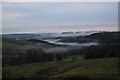
<< Our Photo Pages >> Allgreave - Standing Stone (Menhir) in England in Cheshire
Submitted by astronomer on Monday, 30 August 2004 Page Views: 10490
Neolithic and Bronze AgeSite Name: AllgreaveCountry: England
NOTE: This site is 0.811 km away from the location you searched for.
County: Cheshire Type: Standing Stone (Menhir)
Nearest Town: Macclesfield Nearest Village: Wincle
Map Ref: SJ969665
Latitude: 53.195573N Longitude: 2.047858W
Condition:
| 5 | Perfect |
| 4 | Almost Perfect |
| 3 | Reasonable but with some damage |
| 2 | Ruined but still recognisable as an ancient site |
| 1 | Pretty much destroyed, possibly visible as crop marks |
| 0 | No data. |
| -1 | Completely destroyed |
| 5 | Superb |
| 4 | Good |
| 3 | Ordinary |
| 2 | Not Good |
| 1 | Awful |
| 0 | No data. |
| 5 | Can be driven to, probably with disabled access |
| 4 | Short walk on a footpath |
| 3 | Requiring a bit more of a walk |
| 2 | A long walk |
| 1 | In the middle of nowhere, a nightmare to find |
| 0 | No data. |
| 5 | co-ordinates taken by GPS or official recorded co-ordinates |
| 4 | co-ordinates scaled from a detailed map |
| 3 | co-ordinates scaled from a bad map |
| 2 | co-ordinates of the nearest village |
| 1 | co-ordinates of the nearest town |
| 0 | no data |
Internal Links:
External Links:
")
This stone is alleged to have been found partially buried during pipe-laying on land belonging to Burnt House Farm.
It was re-erected close to where it was discovered.The stone shows clear signs of ancient weathering and bears a superficial resemblance to the great standing stones at Bridestones burial chamber 7.5km to the SW. There are other standing stones in the area and the Allgreave stone is only 1600m SE of Bullstones and the Longgutter stone circle.
You may be viewing yesterday's version of this page. To see the most up to date information please register for a free account.
")
")
")
Do not use the above information on other web sites or publications without permission of the contributor.
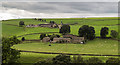
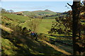
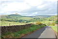
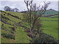
Nearby Images from Geograph Britain and Ireland:
©2016(licence)
©2012(licence)
©2013(licence)
©2006(licence)
©2020(licence)
The above images may not be of the site on this page, they are loaded from Geograph.
Please Submit an Image of this site or go out and take one for us!
Click here to see more info for this site
Nearby sites
Key: Red: member's photo, Blue: 3rd party photo, Yellow: other image, Green: no photo - please go there and take one, Grey: site destroyed
Download sites to:
KML (Google Earth)
GPX (GPS waypoints)
CSV (Garmin/Navman)
CSV (Excel)
To unlock full downloads you need to sign up as a Contributory Member. Otherwise downloads are limited to 50 sites.
Turn off the page maps and other distractions
Nearby sites listing. In the following links * = Image available
1.0km SSW 209° Bartomley Farm* Long Barrow (SJ964656)
1.7km WNW 303° Longgutter* Round Barrow(s) (SJ955674)
1.7km NW 310° Bullstones* Stone Circle (SJ9556867627)
1.9km WNW 298° Clulow Cross* Round Barrow(s) (SJ952674)
1.9km NW 326° Cessbank Common* Round Barrow(s) (SJ958681)
2.0km ESE 117° Lud's Church* Natural Stone / Erratic / Other Natural Feature (SJ987656)
2.9km W 264° Bosley Minn 4 & 5* Standing Stones (SJ940662)
2.9km W 260° Bosley Minn 2 & 3* Standing Stones (SJ940660)
3.0km NNW 335° The Plague Stone* Ancient Cross (SJ9561269221)
3.1km WSW 258° Bosley Minn 1* Standing Stone (Menhir) (SJ93886585)
3.2km E 92° Roaches Stone carving* Carving (SK00076637)
3.9km SSW 201° Heaton Low* Round Barrow(s) (SJ955629)
4.1km SE 129° The Roaches Barrow Round Barrow(s) (SK001639)
4.3km SE 133° Sainter's Dolmen* Rock Outcrop (SK00106357)
4.9km N 10° Macclesfield Forest Ancient Cross (SJ97767136)
5.1km E 84° Flash Chambered Tomb (SK0267)
5.1km SSW 213° St Helen's Well (Rushton Spencer)* Holy Well or Sacred Spring (SJ94076222)
5.3km S 180° Gun Hill Standing Stone* Standing Stone (Menhir) (SJ969612)
5.3km NNW 340° High Low* Round Barrow(s) (SJ951715)
5.3km NNW 345° Higher Ridgegate* Standing Stone (Menhir) (SJ9550671636)
5.4km N 2° Toot Hill Warilow* Round Barrow(s) (SJ971719)
5.4km ESE 116° The Bald Stone* Natural Stone / Erratic / Other Natural Feature (SK018641)
5.5km N 2° Toot Hill* Ancient Village or Settlement (SJ971720)
5.5km N 6° Rains Low* Round Barrow(s) (SJ975720)
5.6km NNW 338° Langley Conical mound* Round Barrow(s) (SJ948717)
View more nearby sites and additional images


 We would like to know more about this location. Please feel free to add a brief description and any relevant information in your own language.
 Wir möchten mehr über diese Stätte erfahren. Bitte zögern Sie nicht, eine kurze Beschreibung und relevante Informationen in Deutsch hinzuzufügen.
 Nous aimerions en savoir encore un peu sur les lieux. S'il vous plaît n'hesitez pas à ajouter une courte description et tous les renseignements pertinents dans votre propre langue.
 Quisieramos informarnos un poco más de las lugares. No dude en añadir una breve descripción y otros datos relevantes en su propio idioma.