

<< Our Photo Pages >> Ulupō Heiau - Ancient Temple in United States in The West
Submitted by torwen on Monday, 15 July 2013 Page Views: 4891
Pre-ColumbianSite Name: Ulupō HeiauCountry: United States
NOTE: This site is 14.713 km away from the location you searched for.
Region: The West Type: Ancient Temple
Nearest Town: Kailua
Latitude: 21.385610N Longitude: 157.752938W
Condition:
| 5 | Perfect |
| 4 | Almost Perfect |
| 3 | Reasonable but with some damage |
| 2 | Ruined but still recognisable as an ancient site |
| 1 | Pretty much destroyed, possibly visible as crop marks |
| 0 | No data. |
| -1 | Completely destroyed |
| 5 | Superb |
| 4 | Good |
| 3 | Ordinary |
| 2 | Not Good |
| 1 | Awful |
| 0 | No data. |
| 5 | Can be driven to, probably with disabled access |
| 4 | Short walk on a footpath |
| 3 | Requiring a bit more of a walk |
| 2 | A long walk |
| 1 | In the middle of nowhere, a nightmare to find |
| 0 | No data. |
| 5 | co-ordinates taken by GPS or official recorded co-ordinates |
| 4 | co-ordinates scaled from a detailed map |
| 3 | co-ordinates scaled from a bad map |
| 2 | co-ordinates of the nearest village |
| 1 | co-ordinates of the nearest town |
| 0 | no data |
Internal Links:
External Links:
")
Since there has been no archaeological investigation or any scientific dating, the exact age is not known. Muriel Seto, Culture Chair of Hawaii's Thousand Friends and collector of oral histories says it goes back to around AD 900; its antiquity is also suggested by the mentioning of the menehune people (pre-Polynesian inhabitants of Hawai’i, often described as dwarfs) as responsible for the first stage of the heiau (SterlingSummer 1978, 233). A comparison with heiau on Maui, which have been radiocarbondated, points to a later date at around AD 1300 (Kolb 2006).
The Ulupō heiau began its life with the legendary menehune and later with high chiefs of Oahu, such as Kakuhihewa in the 15th century and Kuali’I in the 17th century. Ulupō had its peak of importance around 1750 when Kailua was the political seat of power for the district of Ko’olaupoko and the favoured residence of Oahu chiefs because of the fish pond (which is now the Kawai Nui Marsh) and the superb canoe landing point in the bay. After Oahu was conquered in the 1780s the heiau was abandoned. It was turned into a territorial park in 1954, restored in the early 1960s, and listed as State Monument on the National Register of Historic Places in 1972.
It probably started its life as a mapele heiau, but Kauli’i eventually turned it into a luakini heiau with an altar, an oracle tower (anu’u), thatched hale buildings and wooden images (ki’i). A nice comparison can be seen in the restored Hale O Lono heiau at Waimea Valley (built between AD 1470-1700).
The still very visible stone platform of the Ulupō heiau measures 42m x 54m and the outer walls are 9m high. In mass and volume of stones used in its construction it is even the largest heiau in Oahu. Some stones were brought over more than ten miles away, from Kualoa north of Kailua.
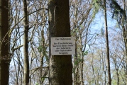
An important feature was the natural spring which was feeding the crops of taro, sweet potato, and sugar cane. Although Hawai'in religion is not officially practised anymore, one can still observe offerings laid down by worshippers, and there are regular ceremonies held at the heiau.
More at http://torwenb.wordpress.com/2013/07/15/the-ulupo-heiau-kaulua-hawaii/
You may be viewing yesterday's version of this page. To see the most up to date information please register for a free account.
")
")
Do not use the above information on other web sites or publications without permission of the contributor.
Nearby Images from Flickr


The above images may not be of the site on this page, but were taken nearby. They are loaded from Flickr so please click on them for image credits.
Click here to see more info for this site
Nearby sites
Click here to view sites on an interactive map of the areaKey: Red: member's photo, Blue: 3rd party photo, Yellow: other image, Green: no photo - please go there and take one, Grey: site destroyed
Download sites to:
KML (Google Earth)
GPX (GPS waypoints)
CSV (Garmin/Navman)
CSV (Excel)
To unlock full downloads you need to sign up as a Contributory Member. Otherwise downloads are limited to 50 sites.
Turn off the page maps and other distractions
Nearby sites listing. In the following links * = Image available
42.6km NW 312° Pu'u O Mahuka* Ancient Temple
43.6km NW 313° Pupukea Beach Rock Art
51.4km WNW 287° Kaneana Cave* Cave or Rock Shelter
52.3km WNW 288° Ukanipo Heiau Ancient Temple
189.2km ESE 110° Pi'ilanihale Heiau Ancient Temple
189.5km ESE 110° Kahanu Garden and Preserve* Natural Stone / Erratic / Other Natural Feature
235.2km SE 125° Lapakahi State Historical Park* Ancient Village or Settlement
254.2km SE 130° Waikoloa Petroglyph Field* Rock Art
266.7km SE 136° 'Ahu'ena Heiau* Ancient Temple
359.7km SE 130° Pu'u Loa Petroglyphs* Rock Art
754.3km WNW 290° Mokumanamana* Stone Row / Alignment
3688.4km N 351° Amaknak Bridge Ancient Village or Settlement
3784.3km NE 51° Van Damme State Park Shellmounds* Artificial Mound
3792.7km NE 54° East Bay Walls* Stone Row / Alignment
3805.7km NE 53° Bodega Head Shellmound* Artificial Mound
3806.6km NE 52° Duncans Landing Rockshelter* Cave or Rock Shelter
3806.9km NE 53° Bodega Harbor Shellmound* Artificial Mound
3822.0km NE 48° Indian Island Shellmounds* Artificial Mound
3829.8km NE 52° Cloverdale Stone Rock Art
3835.9km NE 55° Sand Hill Bluff Shellmound* Artificial Mound
3839.0km NE 53° Ring Mountain Carving
3845.9km NE 56° Monterey Indian Stone* Rock Art
3849.5km NE 55° Scotts Valley City Hall Artifact Display* Museum
3850.4km NE 52° Knight's valley stone Rock Art
3852.7km NE 54° Emeryville Shellmound* Artificial Mound
View more nearby sites and additional images


 We would like to know more about this location. Please feel free to add a brief description and any relevant information in your own language.
 Wir möchten mehr über diese Stätte erfahren. Bitte zögern Sie nicht, eine kurze Beschreibung und relevante Informationen in Deutsch hinzuzufügen.
 Nous aimerions en savoir encore un peu sur les lieux. S'il vous plaît n'hesitez pas à ajouter une courte description et tous les renseignements pertinents dans votre propre langue.
 Quisieramos informarnos un poco más de las lugares. No dude en añadir una breve descripción y otros datos relevantes en su propio idioma.