<< Text Pages >> Pi'ilanihale Heiau - Ancient Temple in United States in The West
Submitted by bat400 on Thursday, 09 November 2006 Page Views: 10075
Pre-ColumbianSite Name: Pi'ilanihale HeiauCountry: United States Region: The West Type: Ancient Temple
Nearest Town: Hana
Latitude: 20.803600N Longitude: 156.03975W
Condition:
| 5 | Perfect |
| 4 | Almost Perfect |
| 3 | Reasonable but with some damage |
| 2 | Ruined but still recognisable as an ancient site |
| 1 | Pretty much destroyed, possibly visible as crop marks |
| 0 | No data. |
| -1 | Completely destroyed |
| 5 | Superb |
| 4 | Good |
| 3 | Ordinary |
| 2 | Not Good |
| 1 | Awful |
| 0 | No data. |
| 5 | Can be driven to, probably with disabled access |
| 4 | Short walk on a footpath |
| 3 | Requiring a bit more of a walk |
| 2 | A long walk |
| 1 | In the middle of nowhere, a nightmare to find |
| 0 | No data. |
| 5 | co-ordinates taken by GPS or official recorded co-ordinates |
| 4 | co-ordinates scaled from a detailed map |
| 3 | co-ordinates scaled from a bad map |
| 2 | co-ordinates of the nearest village |
| 1 | co-ordinates of the nearest town |
| 0 | no data |
Be the first person to rate this site - see the 'Contribute!' box in the right hand menu.
Internal Links:
External Links:
Ancient Temple on Maui, Hawaii.
Among the Hawaiian heiau - sacred ceremonial centers - Pi'ilanihale is the largest.
On the Islands of Hawaii the temple sites are normally raised stone platforms. Buildings, walled enclosures, and statuary were then built or set into place on the platform. Pi'ilanihale's multilevel patform is larger than a football field.
Micheal Kolb (Northern Illinois University) has dated the initial building to 1200AD. He theorizes that the multiple building phases indicate a change in religious practices associated with the rise of a ruling system based on an elite nobility.
The site is located in a tropical garden and is a National Historic Landmark.
This Live Science article gives more detail. Similar information can be found in the October issue of American Archaeology magazine.
Also: Kahana Garden website.
You may be viewing yesterday's version of this page. To see the most up to date information please register for a free account.
Do not use the above information on other web sites or publications without permission of the contributor.
Nearby Images from Flickr

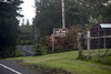
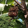
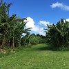
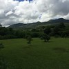

The above images may not be of the site on this page, but were taken nearby. They are loaded from Flickr so please click on them for image credits.
Click here to see more info for this site
Nearby sites
Click here to view sites on an interactive map of the areaKey: Red: member's photo, Blue: 3rd party photo, Yellow: other image, Green: no photo - please go there and take one, Grey: site destroyed
Download sites to:
KML (Google Earth)
GPX (GPS waypoints)
CSV (Garmin/Navman)
CSV (Excel)
To unlock full downloads you need to sign up as a Contributory Member. Otherwise downloads are limited to 50 sites.
Turn off the page maps and other distractions
Nearby sites listing. In the following links * = Image available
559m SSE 160° Kahanu Garden and Preserve* Natural Stone / Erratic / Other Natural Feature
71.4km SSE 168° Lapakahi State Historical Park* Ancient Village or Settlement
100.0km S 170° Waikoloa Petroglyph Field* Rock Art
129.6km S 178° 'Ahu'ena Heiau* Ancient Temple
189.2km WNW 290° Ulupō Heiau* Ancient Temple
193.4km SSE 150° Pu'u Loa Petroglyphs* Rock Art
229.1km WNW 294° Pu'u O Mahuka* Ancient Temple
229.9km WNW 295° Pupukea Beach Rock Art
240.5km WNW 290° Kaneana Cave* Cave or Rock Shelter
241.4km WNW 290° Ukanipo Heiau Ancient Temple
943.4km WNW 291° Mokumanamana* Stone Row / Alignment
3688.9km NE 53° East Bay Walls* Stone Row / Alignment
3690.4km NE 49° Van Damme State Park Shellmounds* Artificial Mound
3706.0km NE 51° Bodega Head Shellmound* Artificial Mound
3707.3km NE 51° Bodega Harbor Shellmound* Artificial Mound
3707.4km NE 51° Duncans Landing Rockshelter* Cave or Rock Shelter
3728.8km NE 54° Sand Hill Bluff Shellmound* Artificial Mound
3732.6km NE 50° Cloverdale Stone Rock Art
3735.3km SSE 151° Temehea Tohua* Ancient Village or Settlement
3735.5km SSE 151° Taetae Tupuna He'e Tai* Museum
3736.0km NE 46° Indian Island Shellmounds* Artificial Mound
3736.7km NE 52° Ring Mountain Carving
3736.9km NE 54° Monterey Indian Stone* Rock Art
3742.7km NE 54° Scotts Valley City Hall Artifact Display* Museum
3749.8km NE 52° Emeryville Shellmound* Artificial Mound
View more nearby sites and additional images


 We would like to know more about this location. Please feel free to add a brief description and any relevant information in your own language.
 Wir möchten mehr über diese Stätte erfahren. Bitte zögern Sie nicht, eine kurze Beschreibung und relevante Informationen in Deutsch hinzuzufügen.
 Nous aimerions en savoir encore un peu sur les lieux. S'il vous plaît n'hesitez pas à ajouter une courte description et tous les renseignements pertinents dans votre propre langue.
 Quisieramos informarnos un poco más de las lugares. No dude en añadir una breve descripción y otros datos relevantes en su propio idioma.