


<< Our Photo Pages >> Dragon Stone, Steeton - Rock Art in England in Yorkshire (West)
Submitted by brigantia on Friday, 12 November 2010 Page Views: 7071
Rock ArtSite Name: Dragon Stone, Steeton Alternative Name: Hollins Bank Farm CarvingCountry: England
NOTE: This site is 0.785 km away from the location you searched for.
County: Yorkshire (West) Type: Rock Art
Nearest Village: Steeton
Map Ref: SE0359043677
Latitude: 53.889264N Longitude: 1.946864W
Condition:
| 5 | Perfect |
| 4 | Almost Perfect |
| 3 | Reasonable but with some damage |
| 2 | Ruined but still recognisable as an ancient site |
| 1 | Pretty much destroyed, possibly visible as crop marks |
| 0 | No data. |
| -1 | Completely destroyed |
| 5 | Superb |
| 4 | Good |
| 3 | Ordinary |
| 2 | Not Good |
| 1 | Awful |
| 0 | No data. |
| 5 | Can be driven to, probably with disabled access |
| 4 | Short walk on a footpath |
| 3 | Requiring a bit more of a walk |
| 2 | A long walk |
| 1 | In the middle of nowhere, a nightmare to find |
| 0 | No data. |
| 5 | co-ordinates taken by GPS or official recorded co-ordinates |
| 4 | co-ordinates scaled from a detailed map |
| 3 | co-ordinates scaled from a bad map |
| 2 | co-ordinates of the nearest village |
| 1 | co-ordinates of the nearest town |
| 0 | no data |
Be the first person to rate this site - see the 'Contribute!' box in the right hand menu.
Internal Links:
External Links:
")
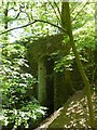
It’s a lovely flat stone, with curvaceous lines running across the middle and edges and into cup-markings. Although some of the cups give an impression of being natural, others have the authentic-looking ring to them, with at least one of them possessing a near-complete ring encircling it (as you can faintly see in the close-up photo here). There are at least 19 cup-markings on this stone, and four main ‘lines’ running roughly in north-south directions, with the cups interspersed between them. At the top (north) end of the rock, separated by a crack, the lines stop and we just have some cup-markings. The crack in the stone may have been functional here.
More details and photos at The Northern Antiquarian. The Journal of Antiquities also includes an entry for the Dragon Stone, Near Steeton, West Yorkshire which includes photographs, directions for finding this stone, and a list of reference sources for more information.
Also nearby is the Bowl Stone (see nearby sites below for the Portal's page for this stone).
You may be viewing yesterday's version of this page. To see the most up to date information please register for a free account.
")
Do not use the above information on other web sites or publications without permission of the contributor.
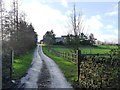
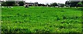
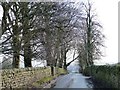
Nearby Images from Geograph Britain and Ireland:
©2012(licence)
©2022(licence)
©2012(licence)
©2019(licence)
©2012(licence)
The above images may not be of the site on this page, they are loaded from Geograph.
Please Submit an Image of this site or go out and take one for us!
Click here to see more info for this site
Nearby sites
Key: Red: member's photo, Blue: 3rd party photo, Yellow: other image, Green: no photo - please go there and take one, Grey: site destroyed
Download sites to:
KML (Google Earth)
GPX (GPS waypoints)
CSV (Garmin/Navman)
CSV (Excel)
To unlock full downloads you need to sign up as a Contributory Member. Otherwise downloads are limited to 50 sites.
Turn off the page maps and other distractions
Nearby sites listing. In the following links * = Image available
5m SE 143° Bowl Stone (Steeton) Rock Art (SE0359343673)
555m ENE 66° The Kirk (Steeton) Natural Stone / Erratic / Other Natural Feature (SE041439)
1.1km W 279° Currer Woods Stone (Steeton)* Rock Art (SE02514384)
1.8km NW 309° Nanny's Grave (Steeton) Cairn (SE022448)
2.1km NNE 19° Silsden round barrow Round Barrow(s) (SE0426345622)
2.1km SSE 152° Jennet's Well/Spring* Holy Well or Sacred Spring (SE04614180)
2.2km SW 234° Stinking Stone (Steeton) Standing Stone (Menhir) (SE0181442411)
2.2km E 83° High Carr 01* Rock Art (SE0578543930)
2.2km E 83° High Carr 02* Rock Art (SE0578543933)
2.2km E 83° High Carr 03* Rock Art (SE0578643935)
2.2km E 83° High Carr 04* Rock Art (SE0578843930)
2.2km E 83° High Carr 05* Rock Art (SE0579043935)
2.2km E 83° High Carr 06* Rock Art (SE0579243943)
2.2km E 83° High Carr Rock Art (SE0579343938)
2.2km SSE 148° Whin Knoll Well (Keighley) Holy Well or Sacred Spring (SE04794179)
2.4km E 82° Abacus Stone (Holden) Rock Art (SE060440)
2.5km ENE 78° High Carr 08 Rock Art (SE0600944190)
2.5km ENE 78° High Carr 07* Rock Art (SE0601044212)
2.5km SW 232° Sutton Stoop (Tarn Lane) Marker Stone (SE0161242146)
2.6km SE 127° Cliffe Castle Museum* Rock Art (SE057421)
2.7km S 188° Laycock Cross (Keighley)* Early Christian Sculptured Stone (SE032410)
2.7km ENE 73° Robin Hood's Stone (Riddlesden) Natural Stone / Erratic / Other Natural Feature (SE0622844470)
2.9km ESE 103° Elam Grange 01* Rock Art (SE0641543023)
3.0km ENE 73° Pinfold Hill 02* Rock Art (SE0641844564)
3.0km SW 228° Pole Stoop (Green Sykes) Marker Stone (SE0139641683)
View more nearby sites and additional images


 We would like to know more about this location. Please feel free to add a brief description and any relevant information in your own language.
 Wir möchten mehr über diese Stätte erfahren. Bitte zögern Sie nicht, eine kurze Beschreibung und relevante Informationen in Deutsch hinzuzufügen.
 Nous aimerions en savoir encore un peu sur les lieux. S'il vous plaît n'hesitez pas à ajouter une courte description et tous les renseignements pertinents dans votre propre langue.
 Quisieramos informarnos un poco más de las lugares. No dude en añadir una breve descripción y otros datos relevantes en su propio idioma.