


<< Our Photo Pages >> Castle Stead Ring - Misc. Earthwork in England in Yorkshire (West)
Submitted by DavidRaven on Wednesday, 22 December 2004 Page Views: 8372
Multi-periodSite Name: Castle Stead Ring Alternative Name: Castlestead Ring (Cullingworth); Blood Dykes (Cullingworth)Country: England
NOTE: This site is 1.79 km away from the location you searched for.
County: Yorkshire (West) Type: Misc. Earthwork
Nearest Town: Keighley Nearest Village: Cullingworth
Map Ref: SE05143627
Latitude: 53.822678N Longitude: 1.923402W
Condition:
| 5 | Perfect |
| 4 | Almost Perfect |
| 3 | Reasonable but with some damage |
| 2 | Ruined but still recognisable as an ancient site |
| 1 | Pretty much destroyed, possibly visible as crop marks |
| 0 | No data. |
| -1 | Completely destroyed |
| 5 | Superb |
| 4 | Good |
| 3 | Ordinary |
| 2 | Not Good |
| 1 | Awful |
| 0 | No data. |
| 5 | Can be driven to, probably with disabled access |
| 4 | Short walk on a footpath |
| 3 | Requiring a bit more of a walk |
| 2 | A long walk |
| 1 | In the middle of nowhere, a nightmare to find |
| 0 | No data. |
| 5 | co-ordinates taken by GPS or official recorded co-ordinates |
| 4 | co-ordinates scaled from a detailed map |
| 3 | co-ordinates scaled from a bad map |
| 2 | co-ordinates of the nearest village |
| 1 | co-ordinates of the nearest town |
| 0 | no data |
Internal Links:
External Links:
")
A semi-circular earthwork, thought to be a bronze-age enclosure. It appears to be the remaining half of a circle, split in two by the lane, and now also bisected by the adjacent dry-stone wall. The other half, in the next field, is sadly absent!
Approximately 150 feet in diameter (measured along the dry-stone wall), it was originally thought to cover one and three-quarter acres.
Update May 2017: The Northern Antiquarian (TNA) also features a page on this earthwork - see their entry for Castlestead Ring, Cullingworth, West Yorkshire, which gives directions on how to find this site ("dead easy this one!"), together with a photograph, a drawing of the site from 1898, an image of the 1852 map and a brief archaeology and history.
More information can be found on Pastscape Monument No. 47897, which adds: "the enclosure is visible on air photographs ..... the northern section is visible as an earthwork but part of the southern section is visible as a cropmark."
You may be viewing yesterday's version of this page. To see the most up to date information please register for a free account.
")
Do not use the above information on other web sites or publications without permission of the contributor.
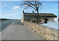
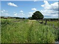
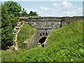
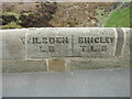
Nearby Images from Geograph Britain and Ireland:
©2018(licence)
©2023(licence)
©2023(licence)
©2019(licence)
©2017(licence)
The above images may not be of the site on this page, they are loaded from Geograph.
Please Submit an Image of this site or go out and take one for us!
Click here to see more info for this site
Nearby sites
Key: Red: member's photo, Blue: 3rd party photo, Yellow: other image, Green: no photo - please go there and take one, Grey: site destroyed
Download sites to:
KML (Google Earth)
GPX (GPS waypoints)
CSV (Garmin/Navman)
CSV (Excel)
To unlock full downloads you need to sign up as a Contributory Member. Otherwise downloads are limited to 50 sites.
Turn off the page maps and other distractions
Nearby sites listing. In the following links * = Image available
1.3km SSW 212° Armshaw Lowe Artificial Mound (SE04423513)
1.8km ESE 119° Castle Stead Misc. Earthwork (SE067354)
2.3km WSW 242° Oxenhope Cross (West Yorkshire) Ancient Cross (SE03103520)
2.5km NE 42° Catstones Ring* Misc. Earthwork (SE0680638145)
2.5km NE 47° Harden Moor Stone Row (Bingley) Stone Row / Alignment (SE0738)
2.7km NNE 22° Goff Well* Holy Well or Sacred Spring (SE0615038822)
3.4km NE 44° Harden Moor Ring Cairn* Ring Cairn (SE0749638675)
3.4km NE 45° Harden Moor Cairnfield* Cairn (SE0757838699)
3.9km N 355° Exley Head Cross* Ancient Cross (SE0481840146)
4.2km WNW 296° Hare Hill (Oakworth) Standing Stone (Menhir) (SE014381)
4.5km S 176° The Nab Round Cairn (SE0549831755)
4.6km NNW 328° True Well (Oakworth) Holy Well or Sacred Spring (SE02724017)
4.8km S 172° The Boggarts Grave Holy Well or Sacred Spring (SE058315)
4.8km N 11° Market Cross (Keighley) Ancient Cross (SE0604241002)
4.8km S 171° The Giants Tooth Modern Stone Circle etc (SE059315)
4.9km WSW 256° Haworth Moor Spa (Haworth) Holy Well or Sacred Spring (SE00413513)
4.9km ENE 71° Cottingley Woods* Rock Art (SE09803789)
4.9km E 96° Shaygate* Ancient Village or Settlement (SE10073576)
5.0km WSW 258° Wether Hill Brigstone Standing Stone (Menhir) (SE00203526)
5.1km NNW 338° Laycock Cross (Keighley)* Early Christian Sculptured Stone (SE032410)
5.2km NNE 15° Railway Station Cist (Keighley) Cist (SE06474127)
5.5km NE 48° Druid's Altar (Bingley) Natural Stone / Erratic / Other Natural Feature (SE09243994)
5.5km N 356° Whin Knoll Well (Keighley) Holy Well or Sacred Spring (SE04794179)
5.6km N 355° Jennet's Well/Spring* Holy Well or Sacred Spring (SE04614180)
5.6km NE 50° Druid's Well (Bingley)* Holy Well or Sacred Spring (SE094399)
View more nearby sites and additional images


 We would like to know more about this location. Please feel free to add a brief description and any relevant information in your own language.
 Wir möchten mehr über diese Stätte erfahren. Bitte zögern Sie nicht, eine kurze Beschreibung und relevante Informationen in Deutsch hinzuzufügen.
 Nous aimerions en savoir encore un peu sur les lieux. S'il vous plaît n'hesitez pas à ajouter une courte description et tous les renseignements pertinents dans votre propre langue.
 Quisieramos informarnos un poco más de las lugares. No dude en añadir una breve descripción y otros datos relevantes en su propio idioma.