<< Text Pages >> Hagg Woods (Thornbridge) - Cairn in England in Yorkshire (West)
Submitted by Anne T on Thursday, 02 November 2017 Page Views: 2605
Neolithic and Bronze AgeSite Name: Hagg Woods (Thornbridge)Country: England
NOTE: This site is 4.239 km away from the location you searched for.
County: Yorkshire (West) Type: Cairn
Nearest Town: Holmfirth Nearest Village: Thongsbridge
Map Ref: SE1493410443
Latitude: 53.590358N Longitude: 1.775861W
Condition:
| 5 | Perfect |
| 4 | Almost Perfect |
| 3 | Reasonable but with some damage |
| 2 | Ruined but still recognisable as an ancient site |
| 1 | Pretty much destroyed, possibly visible as crop marks |
| 0 | No data. |
| -1 | Completely destroyed |
| 5 | Superb |
| 4 | Good |
| 3 | Ordinary |
| 2 | Not Good |
| 1 | Awful |
| 0 | No data. |
| 5 | Can be driven to, probably with disabled access |
| 4 | Short walk on a footpath |
| 3 | Requiring a bit more of a walk |
| 2 | A long walk |
| 1 | In the middle of nowhere, a nightmare to find |
| 0 | No data. |
| 5 | co-ordinates taken by GPS or official recorded co-ordinates |
| 4 | co-ordinates scaled from a detailed map |
| 3 | co-ordinates scaled from a bad map |
| 2 | co-ordinates of the nearest village |
| 1 | co-ordinates of the nearest town |
| 0 | no data |
Be the first person to rate this site - see the 'Contribute!' box in the right hand menu.
Internal Links:
External Links:
Cairnfield in Yorkshire (West)
This cairnfield is recorded as Pastscape Monument No. 49197, an extract from which reads: "A cairnfield in Hagg Wood, Honley. It is situated at the end of a plateau. There are nine cairns, between 3 metres and 8 metres in diameter, and up to 0.6 metres high. Towrads the southern end of the cairnfield are two parallel rubble banks which run approximately south east-north west, from the scarp at the edge of the plateau to the west edge of the wood. The rubble banks are about 3 metres wide and up to 0.3 metres high. The cairnfield also includes two circular features which may be hut circles. The southern of these is a slight hollow with a level base about 12 metres in diameter. The northern one is largely obscured by holly trees, but is visible as a rubble bank where it is crossed by a path at the northern end of the cairnfield. Two of the cairns were excavated with finds consisting of two barbed and tanged arrowheads, flint fragments, waterworn stones, and charcoal."
This cairnfield is also scheduled - see Historic England List ID 1018555, which repeats the Pastscape information, adding that the site is "in Hagg Wood, Honley, 375m south east of Upper Hagg."
The Northern Antiquarian (TNA) also feature a page for this site - see their entry for Hagg Woods, Thongsbridge, Holmfirth, West Yorkshire, which gives directions for finding this site together with a brief archaeology & history. TNA say that these are "pretty difficult to locate even when the vegetation isn't covering them", but advise to be diligent! These were "last excavated in the early 1960s by Neil Lunn and other members of the Huddersfield & District Archaeology Society. Little by way of datable material was found, although one of them did “reveal features typical of some Bronze Age barrows.” Beneath this one they found “the remains of a hut or shelter with a succession of small hearths and a group of stone-packed postholes."
Note: Have you visited this site? Do you have any photographs or information to add?
You may be viewing yesterday's version of this page. To see the most up to date information please register for a free account.
Do not use the above information on other web sites or publications without permission of the contributor.
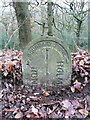
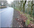
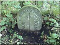
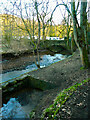
Nearby Images from Geograph Britain and Ireland:
©2014(licence)
©2014(licence)
©2019(licence)
©2021(licence)
©2021(licence)
The above images may not be of the site on this page, they are loaded from Geograph.
Please Submit an Image of this site or go out and take one for us!
Click here to see more info for this site
Nearby sites
Key: Red: member's photo, Blue: 3rd party photo, Yellow: other image, Green: no photo - please go there and take one, Grey: site destroyed
Download sites to:
KML (Google Earth)
GPX (GPS waypoints)
CSV (Garmin/Navman)
CSV (Excel)
To unlock full downloads you need to sign up as a Contributory Member. Otherwise downloads are limited to 50 sites.
Turn off the page maps and other distractions
Nearby sites listing. In the following links * = Image available
3.7km N 6° Castle Hill (West Yorkshire)* Hillfort (SE153141)
5.9km NNW 331° Crosland Moor Holy Well* Holy Well or Sacred Spring (SE121156)
6.2km W 267° Oldfield Hill (Meltham) Ancient Village or Settlement (SE0874510097)
7.7km W 263° Rocking Stone (Meltham Moor) Natural Stone / Erratic / Other Natural Feature (SE07280944)
8.7km WNW 294° Slaithwaite Cross Ancient Cross (SE0714)
9.2km SW 235° Black Hill Cairn (SE074051)
9.3km NW 309° Whole Stone (Golcar) Natural Stone / Erratic / Other Natural Feature (SE077163)
9.4km NW 309° Rocking Stone (Golcar) Natural Stone / Erratic / Other Natural Feature (SE076163)
9.8km W 276° Samuel Laycock's Monument (Marsden)* Carving (SE0512011485)
10.0km SW 236° Holgate Howe Barrow Round Barrow(s) (SE067048)
10.4km NW 324° St Helen's Well (Stainland) Holy Well or Sacred Spring (SE088188)
10.4km SW 235° Holgate Howe Cup & Ringmarks Rock Art (SE064044)
11.2km N 355° St Matthew (Rastrick)* Ancient Cross (SE1383121596)
11.6km W 268° Mount Rd stone* Marker Stone (SE033101)
11.7km W 270° Pule Hill (Marsden) Cairn (SE03231039)
11.9km SE 135° Cubley Cross* Ancient Cross (SE234020)
12.2km NW 306° Meg Dike Ancient Village or Settlement (SE04981749)
13.1km NW 307° Ringstone Edge* Stone Circle (SE0443518251)
13.4km NE 51° St Michael and All Angels (Thornhill)* Ancient Cross (SE25341885)
13.4km NNE 13° Lady Well (Hartshead) Holy Well or Sacred Spring (SE1788423487)
13.5km W 280° March Hill Mesolithic Camp Ancient Village or Settlement (SE0163612804)
13.5km NNE 21° Fairy Well (Roberttown)* Holy Well or Sacred Spring (SE19812308)
13.6km NNE 12° The Walton Cross* Ancient Cross (SE1761423792)
13.7km E 101° All Saints (Cawthorne)* Ancient Cross (SE28460793)
13.8km SE 143° St James's Well (Midhopestones)* Holy Well or Sacred Spring (SK234995)
View more nearby sites and additional images


 We would like to know more about this location. Please feel free to add a brief description and any relevant information in your own language.
 Wir möchten mehr über diese Stätte erfahren. Bitte zögern Sie nicht, eine kurze Beschreibung und relevante Informationen in Deutsch hinzuzufügen.
 Nous aimerions en savoir encore un peu sur les lieux. S'il vous plaît n'hesitez pas à ajouter une courte description et tous les renseignements pertinents dans votre propre langue.
 Quisieramos informarnos un poco más de las lugares. No dude en añadir una breve descripción y otros datos relevantes en su propio idioma.