<< Our Photo Pages >> Deb Well - Holy Well or Sacred Spring in England in Yorkshire (North)
Submitted by rogerkread on Sunday, 24 May 2020 Page Views: 662
Springs and Holy WellsSite Name: Deb WellCountry: England
NOTE: This site is 4.038 km away from the location you searched for.
County: Yorkshire (North) Type: Holy Well or Sacred Spring
Nearest Town: Harrogate Nearest Village: Ripley
Map Ref: SE266611
Latitude: 54.045188N Longitude: 1.595263W
Condition:
| 5 | Perfect |
| 4 | Almost Perfect |
| 3 | Reasonable but with some damage |
| 2 | Ruined but still recognisable as an ancient site |
| 1 | Pretty much destroyed, possibly visible as crop marks |
| 0 | No data. |
| -1 | Completely destroyed |
| 5 | Superb |
| 4 | Good |
| 3 | Ordinary |
| 2 | Not Good |
| 1 | Awful |
| 0 | No data. |
| 5 | Can be driven to, probably with disabled access |
| 4 | Short walk on a footpath |
| 3 | Requiring a bit more of a walk |
| 2 | A long walk |
| 1 | In the middle of nowhere, a nightmare to find |
| 0 | No data. |
| 5 | co-ordinates taken by GPS or official recorded co-ordinates |
| 4 | co-ordinates scaled from a detailed map |
| 3 | co-ordinates scaled from a bad map |
| 2 | co-ordinates of the nearest village |
| 1 | co-ordinates of the nearest town |
| 0 | no data |
Internal Links:
External Links:
")
You may be viewing yesterday's version of this page. To see the most up to date information please register for a free account.
")
Do not use the above information on other web sites or publications without permission of the contributor.
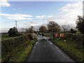
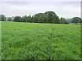
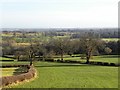
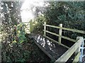
Nearby Images from Geograph Britain and Ireland:
©2009(licence)
©2012(licence)
©2017(licence)
©2009(licence)
©2014(licence)
The above images may not be of the site on this page, they are loaded from Geograph.
Please Submit an Image of this site or go out and take one for us!
Click here to see more info for this site
Nearby sites
Key: Red: member's photo, Blue: 3rd party photo, Yellow: other image, Green: no photo - please go there and take one, Grey: site destroyed
Download sites to:
KML (Google Earth)
GPX (GPS waypoints)
CSV (Garmin/Navman)
CSV (Excel)
To unlock full downloads you need to sign up as a Contributory Member. Otherwise downloads are limited to 50 sites.
Turn off the page maps and other distractions
Nearby sites listing. In the following links * = Image available
1.8km ESE 110° Weeping Cross* Ancient Cross (SE283605)
1.9km NW 314° Cowgate Manor Barn (Shaw Mills) Rock Art (SE2525562397)
2.8km NE 41° Cayton Gill carving* Modern Stone Circle etc (SE284632)
3.3km E 89° Yarmer Head (Nidd) Standing Stone (Menhir) (SE299612)
5.6km WNW 287° Hartwith Moor* Standing Stone (Menhir) (SE2123362737)
6.3km WNW 300° Graffa Plain (Hartwith) Cairn (SE211642)
6.8km NW 305° Brimham Rocks* Rock Outcrop (SE210649)
7.2km NNW 332° Wine Wife Well* Holy Well or Sacred Spring (SE23216742)
7.2km WNW 301° Brimham Rocks Rock Art Rock Art (SE2039764782)
7.2km WNW 304° Brimham Rocks Circle Stone Circle (SE20566507)
7.3km N 9° Robin Hood's Well ( Yorkshire)* Holy Well or Sacred Spring (SE2767868295)
8.0km W 274° Tadpole Stone (Eastwoods Rough)* Rock Art (SE1860161644)
8.0km W 279° Bryan's Wood 01 Rock Art (SE1866362280)
8.0km W 275° Morphing Stone (Dacre)* Rock Art (SE1855961795)
8.1km W 278° Eastwoods Farm 02 (Heyshaw) Rock Art (SE1857262168)
8.1km W 278° Eastwoods Farm 01 (Heyshaw) Rock Art (SE1855662240)
8.1km W 278° Fertility Stone (CR-638)* Rock Art (SE1855262228)
8.1km W 275° Eastwoods Rough 3 (Dacre) Rock Art (SE18506177)
8.1km W 277° Eastwoods Farm Cup (Heyshaw)* Rock Art (SE1852062010)
8.1km W 277° Eastwoods Cross Base (Summerbridge) Rock Art (SE1850662013)
8.2km SW 224° Long Stoop* Standing Stones (SE209552)
8.2km ENE 76° Devil's Stone (Copgrove)* Sculptured Stone (SE346632)
8.3km SW 218° Bank Slack* Misc. Earthwork (SE215545)
8.5km ENE 72° St Mungo's Well (Copgrove)* Holy Well or Sacred Spring (SE34706378)
8.8km W 262° Dacre Top* Ancient Village or Settlement (SE179599)
View more nearby sites and additional images


 We would like to know more about this location. Please feel free to add a brief description and any relevant information in your own language.
 Wir möchten mehr über diese Stätte erfahren. Bitte zögern Sie nicht, eine kurze Beschreibung und relevante Informationen in Deutsch hinzuzufügen.
 Nous aimerions en savoir encore un peu sur les lieux. S'il vous plaît n'hesitez pas à ajouter une courte description et tous les renseignements pertinents dans votre propre langue.
 Quisieramos informarnos un poco más de las lugares. No dude en añadir una breve descripción y otros datos relevantes en su propio idioma.