


<< Our Photo Pages >> Long Stoop - Standing Stones in England in Yorkshire (North)
Submitted by rogerkread on Monday, 13 May 2013 Page Views: 4416
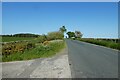
Neolithic and Bronze AgeSite Name: Long StoopCountry: England County: Yorkshire (North) Type: Standing Stones
Nearest Town: Harrogate Nearest Village: Kettlesing
Map Ref: SE209552
Latitude: 53.992423N Longitude: 1.682713W
Condition:
| 5 | Perfect |
| 4 | Almost Perfect |
| 3 | Reasonable but with some damage |
| 2 | Ruined but still recognisable as an ancient site |
| 1 | Pretty much destroyed, possibly visible as crop marks |
| 0 | No data. |
| -1 | Completely destroyed |
| 5 | Superb |
| 4 | Good |
| 3 | Ordinary |
| 2 | Not Good |
| 1 | Awful |
| 0 | No data. |
| 5 | Can be driven to, probably with disabled access |
| 4 | Short walk on a footpath |
| 3 | Requiring a bit more of a walk |
| 2 | A long walk |
| 1 | In the middle of nowhere, a nightmare to find |
| 0 | No data. |
| 5 | co-ordinates taken by GPS or official recorded co-ordinates |
| 4 | co-ordinates scaled from a detailed map |
| 3 | co-ordinates scaled from a bad map |
| 2 | co-ordinates of the nearest village |
| 1 | co-ordinates of the nearest town |
| 0 | no data |
Internal Links:
External Links:
")
Something of a mystery, little seems to be known about this stone which is named in Gothic script on Ordnance Survey maps. It lies at the corner of a wood just off a public footpath. As the photographs show one face possesses a deeply incised cross. A pair of 'long stoops' is shown at approximately this location on John Ogilby's 1675 map of the York to Lancaster road. However if this stoop is indeed one of those then it must have been moved as it lies about half a mile from the current A59 - as this is a Roman road just here it is almost certain to be in the same location as it was in the C17th! Probably a waymark of some sort and almost certainly not a Christianised menhir - but interesting and so perhaps worthy of inclusion on Megalithic.
You may be viewing yesterday's version of this page. To see the most up to date information please register for a free account.
")
")
Do not use the above information on other web sites or publications without permission of the contributor.
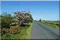
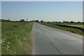
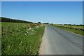
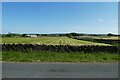
Nearby Images from Geograph Britain and Ireland:
©2023(licence)
©2016(licence)
©2023(licence)
©2023(licence)
©2023(licence)
The above images may not be of the site on this page, they are loaded from Geograph.
Please Submit an Image of this site or go out and take one for us!
Click here to see more info for this site
Nearby sites
Key: Red: member's photo, Blue: 3rd party photo, Yellow: other image, Green: no photo - please go there and take one, Grey: site destroyed
Download sites to:
KML (Google Earth)
GPX (GPS waypoints)
CSV (Garmin/Navman)
CSV (Excel)
To unlock full downloads you need to sign up as a Contributory Member. Otherwise downloads are limited to 50 sites.
Turn off the page maps and other distractions
Nearby sites listing. In the following links * = Image available
921m SE 140° Bank Slack* Misc. Earthwork (SE215545)
2.3km WSW 253° Busky Dike (Fewston) Natural Stone / Erratic / Other Natural Feature (SE187545)
3.7km SE 142° Little Almscliff* Rock Outcrop (SE232523)
4.6km SSW 204° Ellers Wood (619)* Rock Art (SE1903551025)
4.6km SSW 204° Ellers Wood (A)* Rock Art (SE1905651004)
4.6km SSW 204° Ellers Wood (618)* Rock Art (SE1901951014)
4.6km SSW 205° Ellers Wood (B)* Rock Art (SE190510)
4.6km SSW 205° Ellers Wood (614)* Rock Art (SE1895650990)
4.6km SSW 204° Ellers Wood (617)* Rock Art (SE1901250951)
4.6km SSW 204° Ellers Wood (616)* Rock Art (SE1900150953)
4.7km SSW 204° Ellers Wood (615)* Rock Art (SE1898750952)
4.8km SW 215° Snowden Carr (613) Rock Art (SE1814651242)
4.9km SW 216° Snowden Carr (605) Rock Art (SE1806651251)
4.9km SW 215° Snowden Carr (612) Rock Art (SE1812051201)
4.9km SW 217° Snowden Carr (594)* Rock Art (SE1790351266)
5.0km SW 216° Snowden Carr (600) Rock Art (SE1798751162)
5.0km SW 216° Tree of Life Stone* Rock Art (SE1797851163)
5.0km SW 216° Snowden Carr (597) Rock Art (SE1796551158)
5.0km SW 220° Snowden Crags Cairn Circle* Cairn (SE17705136)
5.0km SW 219° Snowden Carr (571) Rock Art (SE1777651293)
5.0km SW 219° Snowden Carr (570) Rock Art (SE1776651295)
5.0km SW 218° Snowdon Half Moon Stone* Rock Art (SE1780551254)
5.0km SW 216° Snowden Carr (603) Rock Art (SE1799351112)
5.0km SW 221° Snowden Crags Necropolis Barrow Cemetery (SE176514)
5.0km SW 218° Death's Head Carving (Askwith Moor)* Rock Art (SE1779551235)
View more nearby sites and additional images


 We would like to know more about this location. Please feel free to add a brief description and any relevant information in your own language.
 Wir möchten mehr über diese Stätte erfahren. Bitte zögern Sie nicht, eine kurze Beschreibung und relevante Informationen in Deutsch hinzuzufügen.
 Nous aimerions en savoir encore un peu sur les lieux. S'il vous plaît n'hesitez pas à ajouter une courte description et tous les renseignements pertinents dans votre propre langue.
 Quisieramos informarnos un poco más de las lugares. No dude en añadir una breve descripción y otros datos relevantes en su propio idioma.