<< Text Pages >> Combs Camp - Hillfort in England in Nottinghamshire
Submitted by coldrum on Monday, 18 October 2010 Page Views: 3623
Iron Age and Later PrehistorySite Name: Combs CampCountry: England County: Nottinghamshire Type: Hillfort
Map Ref: SK63145512
Latitude: 53.089568N Longitude: 1.058678W
Condition:
| 5 | Perfect |
| 4 | Almost Perfect |
| 3 | Reasonable but with some damage |
| 2 | Ruined but still recognisable as an ancient site |
| 1 | Pretty much destroyed, possibly visible as crop marks |
| 0 | No data. |
| -1 | Completely destroyed |
| 5 | Superb |
| 4 | Good |
| 3 | Ordinary |
| 2 | Not Good |
| 1 | Awful |
| 0 | No data. |
| 5 | Can be driven to, probably with disabled access |
| 4 | Short walk on a footpath |
| 3 | Requiring a bit more of a walk |
| 2 | A long walk |
| 1 | In the middle of nowhere, a nightmare to find |
| 0 | No data. |
| 5 | co-ordinates taken by GPS or official recorded co-ordinates |
| 4 | co-ordinates scaled from a detailed map |
| 3 | co-ordinates scaled from a bad map |
| 2 | co-ordinates of the nearest village |
| 1 | co-ordinates of the nearest town |
| 0 | no data |
Be the first person to rate this site - see the 'Contribute!' box in the right hand menu.
Internal Links:
External Links:
Hillfort in Nottinghamshire
"Earthwork remains of an Iron Age univallate hillfort. Supposed Roman brick and tile were found on the site. Bronze Age bronze socketted axes and a flint scraper and knife were also found during excavation. Aerial photographs taken in 2001 suggest two possibly earlier conjoined curvilinear enclosures, which may have been overlain by the hillfort, visible as cropmarks immediately to the west of the site."
Source: Pastscape
You may be viewing yesterday's version of this page. To see the most up to date information please register for a free account.
Do not use the above information on other web sites or publications without permission of the contributor.
Nearby Images from Geograph Britain and Ireland:
©2012(licence)
©2020(licence)
©2020(licence)
©2020(licence)
©2020(licence)
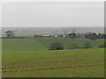
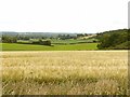
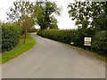
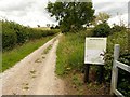
The above images may not be of the site on this page, they are loaded from Geograph.
Please Submit an Image of this site or go out and take one for us!
Click here to see more info for this site
Nearby sites
Key: Red: member's photo, Blue: 3rd party photo, Yellow: other image, Green: no photo - please go there and take one, Grey: site destroyed
Download sites to:
KML (Google Earth)
GPX (GPS waypoints)
CSV (Garmin/Navman)
CSV (Excel)
To unlock full downloads you need to sign up as a Contributory Member. Otherwise downloads are limited to 50 sites.
Turn off the page maps and other distractions
Nearby sites listing. In the following links * = Image available
1.2km SE 124° Hart's Well* Holy Well or Sacred Spring (SK6415254451)
2.0km S 170° Oldox Camp* Hillfort (SK635532)
4.6km W 279° Ashwell (Blidworth) Holy Well or Sacred Spring (SK586558)
5.5km W 280° The Druid Stone (Blidworth)* Natural Stone / Erratic / Other Natural Feature (SK577560)
5.7km ESE 110° St Catherine's Well (Westthorpe)* Holy Well or Sacred Spring (SK68565327)
6.4km SSW 195° King's Well (Calverton) Holy Well or Sacred Spring (SK615489)
6.6km WNW 286° Friar Tuck's Well* Holy Well or Sacred Spring (SK568569)
7.1km ESE 102° Southwell Minster* Early Christian Sculptured Stone (SK70165378)
7.5km SSW 209° Cockpit Hill Hillfort (SK59584850)
9.0km W 262° St Mary's Well (Newstead)* Holy Well or Sacred Spring (SK542537)
9.9km S 182° The Lambley Spring* Holy Well or Sacred Spring (SK629452)
10.5km S 180° Burton Lodge Fort Hillfort (SK63364461)
10.5km NW 309° The Lady Well (Mansfield) Holy Well or Sacred Spring (SK548616)
10.9km WSW 249° Linby Cross and Well* Ancient Cross (SK5351)
11.3km ESE 104° Rolleston Cross* Ancient Cross (SK7418052489)
11.3km ESE 104° Holy Trinity (Rolleston)* Ancient Cross (SK7418552503)
12.2km SW 225° Bull's Well Holy Well or Sacred Spring (SK546464)
13.6km NNW 347° Thynghowe* Artificial Mound (SK59936834)
13.9km SSW 198° St Ann's Well (Nottingham) Holy Well or Sacred Spring (SK58914191)
14.2km NW 321° Sookholme Bath* Holy Well or Sacred Spring (SK5466)
14.7km SSW 213° Holy Well (Basford) Holy Well or Sacred Spring (SK553427)
14.7km WSW 247° Robin Hood's Well (Beauvale)* Holy Well or Sacred Spring (SK49684915)
14.8km NE 39° The Duck's Mouth* Holy Well or Sacred Spring (SK724667)
14.9km SSE 155° Shelford and Newton Cursus Cursus (SK696417)
15.1km ESE 122° Willow Rundle Spring* Holy Well or Sacred Spring (SK7602047230)
View more nearby sites and additional images


 We would like to know more about this location. Please feel free to add a brief description and any relevant information in your own language.
 Wir möchten mehr über diese Stätte erfahren. Bitte zögern Sie nicht, eine kurze Beschreibung und relevante Informationen in Deutsch hinzuzufügen.
 Nous aimerions en savoir encore un peu sur les lieux. S'il vous plaît n'hesitez pas à ajouter une courte description et tous les renseignements pertinents dans votre propre langue.
 Quisieramos informarnos un poco más de las lugares. No dude en añadir una breve descripción y otros datos relevantes en su propio idioma.