 with our Megalithic Portal iPhone app")


<< Our Photo Pages >> La Barbehère dolmen - Burial Chamber or Dolmen in France in Aquitaine:Gironde (33)
Submitted by TheCaptain on Saturday, 16 April 2005 Page Views: 3527
Neolithic and Bronze AgeSite Name: La Barbehère dolmenCountry: France
NOTE: This site is 6.324 km away from the location you searched for.
Département: Aquitaine:Gironde (33) Type: Burial Chamber or Dolmen
Nearest Town: Pauillac Nearest Village: Saint-Germain-d'Esteuil
Latitude: 45.296620N Longitude: 0.8549W
Condition:
| 5 | Perfect |
| 4 | Almost Perfect |
| 3 | Reasonable but with some damage |
| 2 | Ruined but still recognisable as an ancient site |
| 1 | Pretty much destroyed, possibly visible as crop marks |
| 0 | No data. |
| -1 | Completely destroyed |
| 5 | Superb |
| 4 | Good |
| 3 | Ordinary |
| 2 | Not Good |
| 1 | Awful |
| 0 | No data. |
| 5 | Can be driven to, probably with disabled access |
| 4 | Short walk on a footpath |
| 3 | Requiring a bit more of a walk |
| 2 | A long walk |
| 1 | In the middle of nowhere, a nightmare to find |
| 0 | No data. |
| 5 | co-ordinates taken by GPS or official recorded co-ordinates |
| 4 | co-ordinates scaled from a detailed map |
| 3 | co-ordinates scaled from a bad map |
| 2 | co-ordinates of the nearest village |
| 1 | co-ordinates of the nearest town |
| 0 | no data |
Internal Links:
External Links:
I have visited· I would like to visit
johnstone visited on 10th Sep 2015 - their rating: Cond: 2 Amb: 3 Access: 4
")
Base Mérimée (Historic Monument)
You may be viewing yesterday's version of this page. To see the most up to date information please register for a free account.
")
")
")
")
Do not use the above information on other web sites or publications without permission of the contributor.
Nearby Images from Flickr
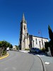


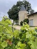

The above images may not be of the site on this page, but were taken nearby. They are loaded from Flickr so please click on them for image credits.
Click here to see more info for this site
Nearby sites
Click here to view sites on an interactive map of the areaKey: Red: member's photo, Blue: 3rd party photo, Yellow: other image, Green: no photo - please go there and take one, Grey: site destroyed
Download sites to:
KML (Google Earth)
GPX (GPS waypoints)
CSV (Garmin/Navman)
CSV (Excel)
To unlock full downloads you need to sign up as a Contributory Member. Otherwise downloads are limited to 50 sites.
Turn off the page maps and other distractions
Nearby sites listing. In the following links * = Image available
31.7km NE 43° Menhir de Bribaudon* Standing Stone (Menhir)
31.8km N 358° Dolmen du Moulin Rompu Burial Chamber or Dolmen
32.0km N 349° Beloire Dolmen* Burial Chamber or Dolmen
33.1km N 354° Tumulus de la Motte Ronde* Chambered Tomb
34.6km E 92° Dolmen de Montendre* Burial Chamber or Dolmen
35.2km NE 49° Menhirs de Ménac Standing Stones
39.6km E 82° La Pierre a Cerclet* Burial Chamber or Dolmen
39.7km SE 136° Grotte des Fées (Prignac-et-Marcamps) Cave or Rock Shelter
39.8km SE 136° Grotte de Pair-non-Pair* Cave or Rock Shelter
42.7km NE 50° Tumulus du Planti d'Audouin Round Barrow(s)
45.1km N 355° La Pierre Levée (Sablonceaux)* Burial Chamber or Dolmen
45.6km NNW 348° La Graube 2 Burial Chamber or Dolmen
46.6km NNE 19° Dolmen de la Pierre Qui Saute* Burial Chamber or Dolmen
46.8km SSE 159° Grotte de Majolan Cave or Rock Shelter
48.2km NE 55° La Pierre Percée (Sainte Lheurine)* Sculptured Stone
48.4km NE 56° Tumulus du Cruchaud* Long Barrow
49.2km ENE 78° Dolmen de Baignes Sainte Radegonde* Burial Chamber or Dolmen
50.0km E 94° Pierre Folle (Négrignac)* Burial Chamber or Dolmen
50.3km NNE 26° Terrier de la Fade Chambered Tomb
51.9km NNW 340° Beauregard menhir* Burial Chamber or Dolmen
52.9km NNE 19° Saintes Polissoir Polissoir
52.9km N 357° Dolmen dit le Terrier de Sainte-Catherine Chambered Tomb
53.2km NNE 20° Musée de Préhistoire (Saintes)* Museum
53.4km NE 55° Saint Fort Dolmen* Burial Chamber or Dolmen
53.5km E 98° La Pierre Folle (Montguyon)* Passage Grave
View more nearby sites and additional images


 We would like to know more about this location. Please feel free to add a brief description and any relevant information in your own language.
 Wir möchten mehr über diese Stätte erfahren. Bitte zögern Sie nicht, eine kurze Beschreibung und relevante Informationen in Deutsch hinzuzufügen.
 Nous aimerions en savoir encore un peu sur les lieux. S'il vous plaît n'hesitez pas à ajouter une courte description et tous les renseignements pertinents dans votre propre langue.
 Quisieramos informarnos un poco más de las lugares. No dude en añadir una breve descripción y otros datos relevantes en su propio idioma.