<< Our Photo Pages >> Tumulus de la Motte Ronde - Chambered Tomb in France in Poitou:Charente-Maritime (17)
Submitted by Rubis on Sunday, 23 January 2011 Page Views: 3432
Neolithic and Bronze AgeSite Name: Tumulus de la Motte Ronde Alternative Name: Tumulus du Bois de la ChasseCountry: France Département: Poitou:Charente-Maritime (17) Type: Chambered Tomb
Nearest Town: Royan Nearest Village: Semussac
Latitude: 45.593056N Longitude: 0.898333W
Condition:
| 5 | Perfect |
| 4 | Almost Perfect |
| 3 | Reasonable but with some damage |
| 2 | Ruined but still recognisable as an ancient site |
| 1 | Pretty much destroyed, possibly visible as crop marks |
| 0 | No data. |
| -1 | Completely destroyed |
| 5 | Superb |
| 4 | Good |
| 3 | Ordinary |
| 2 | Not Good |
| 1 | Awful |
| 0 | No data. |
| 5 | Can be driven to, probably with disabled access |
| 4 | Short walk on a footpath |
| 3 | Requiring a bit more of a walk |
| 2 | A long walk |
| 1 | In the middle of nowhere, a nightmare to find |
| 0 | No data. |
| 5 | co-ordinates taken by GPS or official recorded co-ordinates |
| 4 | co-ordinates scaled from a detailed map |
| 3 | co-ordinates scaled from a bad map |
| 2 | co-ordinates of the nearest village |
| 1 | co-ordinates of the nearest town |
| 0 | no data |
Internal Links:
External Links:
")
Near a campsite named "Bois de la Chasse" this circular mound is 30 meters long and 4 meters high. It had several stratums, first white (vegetable ground and charcoal), then black (clay and calcareous stones).
A the top there was a conical hole full of black ground and fragments of potteries.
During the World War II the German people used the tumulus as practise ground and as advance. They extended the hole.
In the fifties barbed wires and cases were still discovered.
The tumulus was also used as a house because of traces of hearthes in the Middle Ages.
Few things were discovered during two different excavations (in 1914 and in 1956) : bones, polished axes, a part of a spear in bronze and fragments of potteries.
You may be viewing yesterday's version of this page. To see the most up to date information please register for a free account.
")
")
")
Do not use the above information on other web sites or publications without permission of the contributor.
Nearby Images from Flickr


The above images may not be of the site on this page, but were taken nearby. They are loaded from Flickr so please click on them for image credits.
Click here to see more info for this site
Nearby sites
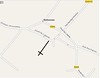
Click here to view sites on an interactive map of the areaKey: Red: member's photo, Blue: 3rd party photo, Yellow: other image, Green: no photo - please go there and take one, Grey: site destroyed
Download sites to:
KML (Google Earth)
GPX (GPS waypoints)
CSV (Garmin/Navman)
CSV (Excel)
To unlock full downloads you need to sign up as a Contributory Member. Otherwise downloads are limited to 50 sites.
Turn off the page maps and other distractions
Nearby sites listing. In the following links * = Image available
2.7km ESE 116° Dolmen du Moulin Rompu Burial Chamber or Dolmen
2.9km WSW 239° Beloire Dolmen* Burial Chamber or Dolmen
12.0km N 357° La Pierre Levée (Sablonceaux)* Burial Chamber or Dolmen
13.0km NNW 334° La Graube 2 Burial Chamber or Dolmen
19.9km N 2° Dolmen dit le Terrier de Sainte-Catherine Chambered Tomb
21.3km NW 318° Beauregard menhir* Burial Chamber or Dolmen
21.8km ENE 60° Dolmen de la Pierre Qui Saute* Burial Chamber or Dolmen
26.6km NE 50° Saintes Polissoir Polissoir
26.8km ESE 111° Menhir de Bribaudon* Standing Stone (Menhir)
27.1km NE 36° Terrier des Coutiers Chambered Tomb
27.5km NE 52° Musée de Préhistoire (Saintes)* Museum
28.4km ENE 65° Terrier de la Fade Chambered Tomb
29.5km N 7° Dolmen du Bois de la Grosse Pierre (Sainte-Radegonde) Burial Chamber or Dolmen
30.7km NE 35° Le Peu Chambered Tomb
31.3km ESE 108° Menhirs de Ménac Standing Stones
32.0km N 360° Buffletizion Dolmen* Burial Chamber or Dolmen
32.6km NNE 18° Dolmens de Civrac* Burial Chamber or Dolmen
33.1km N 7° Dolmen de la Pierre Levée (La Vallée)* Burial Chamber or Dolmen
33.1km S 174° La Barbehère dolmen* Burial Chamber or Dolmen
34.3km NNW 348° Soubise Dolmen 1* Burial Chamber or Dolmen
34.4km N 349° Soubise Dolmen 2* Burial Chamber or Dolmen
35.2km ENE 60° Paléosite* Museum
35.2km ENE 59° Abri de la Roche-a-Pierrot Cave or Rock Shelter
36.7km E 99° Tumulus du Planti d'Audouin Round Barrow(s)
37.9km NW 323° Dolmen d'Ors dit la Piare* Burial Chamber or Dolmen
View more nearby sites and additional images


 We would like to know more about this location. Please feel free to add a brief description and any relevant information in your own language.
 Wir möchten mehr über diese Stätte erfahren. Bitte zögern Sie nicht, eine kurze Beschreibung und relevante Informationen in Deutsch hinzuzufügen.
 Nous aimerions en savoir encore un peu sur les lieux. S'il vous plaît n'hesitez pas à ajouter une courte description et tous les renseignements pertinents dans votre propre langue.
 Quisieramos informarnos un poco más de las lugares. No dude en añadir una breve descripción y otros datos relevantes en su propio idioma.