<< Image Pages >> Etonbury Fort - Hillfort in England in Bedfordshire
Submitted by wardrop04 on Tuesday, 14 September 2021 Page Views: 911
Iron Age and Later PrehistorySite Name: Etonbury FortCountry: England County: Bedfordshire Type: Hillfort
Nearest Town: Arlesey
Map Ref: TL1929637984
Latitude: 52.027449N Longitude: 0.262606W
Condition:
| 5 | Perfect |
| 4 | Almost Perfect |
| 3 | Reasonable but with some damage |
| 2 | Ruined but still recognisable as an ancient site |
| 1 | Pretty much destroyed, possibly visible as crop marks |
| 0 | No data. |
| -1 | Completely destroyed |
| 5 | Superb |
| 4 | Good |
| 3 | Ordinary |
| 2 | Not Good |
| 1 | Awful |
| 0 | No data. |
| 5 | Can be driven to, probably with disabled access |
| 4 | Short walk on a footpath |
| 3 | Requiring a bit more of a walk |
| 2 | A long walk |
| 1 | In the middle of nowhere, a nightmare to find |
| 0 | No data. |
| 5 | co-ordinates taken by GPS or official recorded co-ordinates |
| 4 | co-ordinates scaled from a detailed map |
| 3 | co-ordinates scaled from a bad map |
| 2 | co-ordinates of the nearest village |
| 1 | co-ordinates of the nearest town |
| 0 | no data |
Internal Links:
External Links:
I have visited· I would like to visit
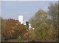
wardrop04 visited on 16th Sep 2021 - their rating: Cond: 2 Amb: 3 Access: 4 The site is hard to access as most is on private land some can be seen from the east footpath. The location of the supposed harbour is visible but not recognisable due to overgrowth.
")
You may be viewing yesterday's version of this page. To see the most up to date information please register for a free account.
Do not use the above information on other web sites or publications without permission of the contributor.
Nearby Images from Geograph Britain and Ireland:
©2012(licence)
©2012(licence)
©2012(licence)
©2012(licence)
©2012(licence)
The above images may not be of the site on this page, they are loaded from Geograph.
Please Submit an Image of this site or go out and take one for us!
Click here to see more info for this site
Nearby sites
Key: Red: member's photo, Blue: 3rd party photo, Yellow: other image, Green: no photo - please go there and take one, Grey: site destroyed
Download sites to:
KML (Google Earth)
GPX (GPS waypoints)
CSV (Garmin/Navman)
CSV (Excel)
To unlock full downloads you need to sign up as a Contributory Member. Otherwise downloads are limited to 50 sites.
Turn off the page maps and other distractions
Nearby sites listing. In the following links * = Image available
5.5km SE 136° Norton Henge Henge (TL232341)
5.6km S 172° Wilbury Hill* Hillfort (TL202325)
5.8km SE 129° Letchworth Cursus Cursus (TL239344)
6.6km E 85° Arbury Banks Barrow/hut circle Round Barrow(s) (TL2584638770)
6.9km E 85° Arbury Banks (Hertfordshire)* Hillfort (TL262387)
7.6km ENE 78° Ashwell Village Museum* Museum (TL2668539684)
7.8km ESE 117° Barrows under A505 Barrow Cemetery (TL264346)
7.9km ENE 78° Seven Springs (Ashwell)* Holy Well or Sacred Spring (TL270398)
8.5km ESE 105° Bygrave Barrows Barrow Cemetery (TL2759935981)
8.6km N 4° Biggleswade Cursus Cursus (TL197466)
8.7km N 2° Biggleswade Cursus Cursus (TL194467)
8.7km SE 135° Weston Hill Henge* Henge (TL256319)
8.8km S 188° North Herts Museum* Museum (TL18342926)
9.2km SW 222° Knocking Knoll* Long Barrow (TL133310)
9.2km E 92° Highley Hill Round Barrow(s) (TL2856637881)
9.5km E 93° Odsey Round Barrow(s) (TL2880337659)
9.6km ESE 112° Tree Barrow Round Barrow(s) (TL2831834612)
9.6km SW 220° Tingley Field Plantation Round Barrow* Round Barrow(s) (TL1324030475)
9.8km N 358° Sandy Lodge Promontory Fort / Cliff Castle (TL187478)
10.1km E 96° Deadman's Hill Barrow Cemetery (TL294371)
10.3km E 97° Galley Hill (Sandon) Misc. Earthwork (TL2961136893)
10.4km SSE 168° Priory Well (Hertfordshire)* Holy Well or Sacred Spring (TL217279)
10.5km SW 221° Deacon Hill* Hillfort (TL12602982)
10.7km E 91° Gallows Hill (Hertfordshire)* Round Barrow(s) (TL30023801)
11.1km N 355° Caesar's Camp (Bedfordshire)* Hillfort (TL180490)
View more nearby sites and additional images


 We would like to know more about this location. Please feel free to add a brief description and any relevant information in your own language.
 Wir möchten mehr über diese Stätte erfahren. Bitte zögern Sie nicht, eine kurze Beschreibung und relevante Informationen in Deutsch hinzuzufügen.
 Nous aimerions en savoir encore un peu sur les lieux. S'il vous plaît n'hesitez pas à ajouter une courte description et tous les renseignements pertinents dans votre propre langue.
 Quisieramos informarnos un poco más de las lugares. No dude en añadir una breve descripción y otros datos relevantes en su propio idioma.