<< Our Photo Pages >> Nordkjosbotn sacrificial site - Natural Stone / Erratic / Other Natural Feature in Norway in Troms
Submitted by kenntha88 on Saturday, 15 December 2007 Page Views: 7673
Natural PlacesSite Name: Nordkjosbotn sacrificial site Alternative Name: VollanCountry: Norway Fylke: Troms Type: Natural Stone / Erratic / Other Natural Feature
Nearest Town: Tromsø
Latitude: 69.221388N Longitude: 19.579182E
Condition:
| 5 | Perfect |
| 4 | Almost Perfect |
| 3 | Reasonable but with some damage |
| 2 | Ruined but still recognisable as an ancient site |
| 1 | Pretty much destroyed, possibly visible as crop marks |
| 0 | No data. |
| -1 | Completely destroyed |
| 5 | Superb |
| 4 | Good |
| 3 | Ordinary |
| 2 | Not Good |
| 1 | Awful |
| 0 | No data. |
| 5 | Can be driven to, probably with disabled access |
| 4 | Short walk on a footpath |
| 3 | Requiring a bit more of a walk |
| 2 | A long walk |
| 1 | In the middle of nowhere, a nightmare to find |
| 0 | No data. |
| 5 | co-ordinates taken by GPS or official recorded co-ordinates |
| 4 | co-ordinates scaled from a detailed map |
| 3 | co-ordinates scaled from a bad map |
| 2 | co-ordinates of the nearest village |
| 1 | co-ordinates of the nearest town |
| 0 | no data |
Internal Links:
External Links:
")
This site is an ancient sacrificial site for the Sami people, it consists of a really huge (about 20 metres tall) boulder, it is diamond-shaped and with one of the sharpest edges pointing up to the sky. It is about 0.5-1m tick, and looks like a enormous slab standing on one of the pointed edges. It standing about 10 metres north of the european road nmb6, and it is impossible not to notice this enormous landmark!
Sadly, the stone has been painted with layers and layers of grafitti, from local people and also tourists that has went past it over the years!
This place is a road-crossing between the main highway that continues north, and the highway going north-west to the town of Tromsø, and is easy to get to.
It was originally two of these enormous standing slabs, but the other one was removed when the main highway was buildt.
Despite the removing of the other stone and all the colourful grafitti, the site is still a impressing sight!
You may be viewing yesterday's version of this page. To see the most up to date information please register for a free account.
")
Do not use the above information on other web sites or publications without permission of the contributor.
Nearby Images from Flickr

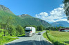

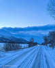
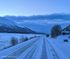
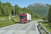
The above images may not be of the site on this page, but were taken nearby. They are loaded from Flickr so please click on them for image credits.
Click here to see more info for this site
Nearby sites
Click here to view sites on an interactive map of the areaKey: Red: member's photo, Blue: 3rd party photo, Yellow: other image, Green: no photo - please go there and take one, Grey: site destroyed
Download sites to:
KML (Google Earth)
GPX (GPS waypoints)
CSV (Garmin/Navman)
CSV (Excel)
To unlock full downloads you need to sign up as a Contributory Member. Otherwise downloads are limited to 50 sites.
Turn off the page maps and other distractions
Nearby sites listing. In the following links * = Image available
13.5km NW 316° Balsfjord rock carvings* Carving
27.3km W 271° Mårfjellskardet sacrificial site* Natural Stone / Erratic / Other Natural Feature
43.6km N 7° Skarmunken* Natural Stone / Erratic / Other Natural Feature
50.0km NW 320° Skavberget* Rock Art
52.8km NNW 331° University Museum, Tromso* Museum
58.3km NNW 328° Håkøya* Ancient Village or Settlement
63.2km WNW 303° Greipstad* Ancient Village or Settlement
68.0km WNW 303° Buvika* Barrow Cemetery
73.1km NW 307° Sandvik* Ancient Village or Settlement
73.4km NW 307° Brensholmen stone age settlement* Ancient Village or Settlement
74.0km NW 306° Brensholmen iron age settlement* Ancient Village or Settlement
75.6km NW 308° Sommarøy* Ancient Village or Settlement
83.6km WSW 243° Andasteinen* Natural Stone / Erratic / Other Natural Feature
83.9km SW 226° Lapphaugen sacrificial site* Natural Stone / Erratic / Other Natural Feature
86.2km WSW 237° Lavangen* Barrow Cemetery
89.0km SW 233° Spansdalen sacrificial site* Natural Stone / Erratic / Other Natural Feature
98.0km SW 230° Kvernmo Sacrificial Site* Natural Stone / Erratic / Other Natural Feature
101.1km W 277° Grunnfarnes Neolithic Settlement* Ancient Village or Settlement
101.1km W 276° Grunnfarnes Iron Age Settlement* Ancient Village or Settlement
102.2km W 259° Eidekjosen Settlement* Ancient Village or Settlement
108.6km WSW 245° Vik on Rolla* Carving
112.8km SW 228° Herjangen* Carving
122.1km SW 226° Narvik rock carving* Carving
122.3km WSW 254° Alvestad, Grytøya* Barrow Cemetery
122.6km WSW 245° Sørrollnes* Cairn
View more nearby sites and additional images


 We would like to know more about this location. Please feel free to add a brief description and any relevant information in your own language.
 Wir möchten mehr über diese Stätte erfahren. Bitte zögern Sie nicht, eine kurze Beschreibung und relevante Informationen in Deutsch hinzuzufügen.
 Nous aimerions en savoir encore un peu sur les lieux. S'il vous plaît n'hesitez pas à ajouter une courte description et tous les renseignements pertinents dans votre propre langue.
 Quisieramos informarnos un poco más de las lugares. No dude en añadir una breve descripción y otros datos relevantes en su propio idioma.