<< Our Photo Pages >> Moa Round Barrow - Round Barrow(s) in Norway in Nord-Trøndelag
Submitted by kenntha88 on Tuesday, 10 November 2009 Page Views: 2474
Neolithic and Bronze AgeSite Name: Moa Round Barrow Alternative Name: HarranCountry: Norway
NOTE: This site is 134.886 km away from the location you searched for.
Fylke: Nord-Trøndelag Type: Round Barrow(s)
Nearest Town: Trondheim Nearest Village: Grong
Latitude: 64.567125N Longitude: 12.485018E
Condition:
| 5 | Perfect |
| 4 | Almost Perfect |
| 3 | Reasonable but with some damage |
| 2 | Ruined but still recognisable as an ancient site |
| 1 | Pretty much destroyed, possibly visible as crop marks |
| 0 | No data. |
| -1 | Completely destroyed |
| 5 | Superb |
| 4 | Good |
| 3 | Ordinary |
| 2 | Not Good |
| 1 | Awful |
| 0 | No data. |
| 5 | Can be driven to, probably with disabled access |
| 4 | Short walk on a footpath |
| 3 | Requiring a bit more of a walk |
| 2 | A long walk |
| 1 | In the middle of nowhere, a nightmare to find |
| 0 | No data. |
| 5 | co-ordinates taken by GPS or official recorded co-ordinates |
| 4 | co-ordinates scaled from a detailed map |
| 3 | co-ordinates scaled from a bad map |
| 2 | co-ordinates of the nearest village |
| 1 | co-ordinates of the nearest town |
| 0 | no data |
Internal Links:
External Links:
")
The visible mound is about 8 metres across and about 1 metre in height. A path leads to the top of the ridge and a small sign mark is placed just beside the mound.
You may be viewing yesterday's version of this page. To see the most up to date information please register for a free account.
")
")
Do not use the above information on other web sites or publications without permission of the contributor.
Nearby Images from Flickr

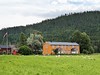
The above images may not be of the site on this page, but were taken nearby. They are loaded from Flickr so please click on them for image credits.
Click here to see more info for this site
Nearby sites
Click here to view sites on an interactive map of the areaKey: Red: member's photo, Blue: 3rd party photo, Yellow: other image, Green: no photo - please go there and take one, Grey: site destroyed
Download sites to:
KML (Google Earth)
GPX (GPS waypoints)
CSV (Garmin/Navman)
CSV (Excel)
To unlock full downloads you need to sign up as a Contributory Member. Otherwise downloads are limited to 50 sites.
Turn off the page maps and other distractions
Nearby sites listing. In the following links * = Image available
13.9km SW 216° Smihaugen* Round Barrow(s)
14.1km SW 218° Tinghaugen-Grong* Round Barrow(s)
14.3km SW 216° Sundspetringen* Round Barrow(s)
16.0km SW 219° Kvitem Round Mounds* Round Barrow(s)
16.3km SW 221° Sørisvegen* Round Barrow(s)
17.0km SSW 205° Persmoen* Standing Stone (Menhir)
17.1km SW 234° Rundhaugan* Barrow Cemetery
17.3km SW 226° Værem Settlement* Ancient Village or Settlement
18.2km SSW 203° Formofoss Standing Stones* Standing Stones
18.6km WSW 254° Brannhaugan* Barrow Cemetery
19.2km WSW 238° Øyem Round Barrow* Round Barrow(s)
19.3km SSW 198° Rognsmoen Settlement* Ancient Village or Settlement
19.6km SSW 195° Formomoen* Barrow Cemetery
21.5km SW 234° Skistad Cemetery* Barrow Cemetery
22.4km WSW 239° Storem Gravfelt* Barrow Cemetery
22.9km WSW 253° Fuglem* Round Barrow(s)
23.3km WSW 255° Lille Skogmo gravfelt* Round Barrow(s)
23.3km WSW 256° Bjornes* Round Barrow(s)
23.5km WSW 243° Bertnem Round Mounds* Round Barrow(s)
26.3km WSW 253° Ranem Burial Mounds* Barrow Cemetery
30.0km WSW 247° Gansmo Gravfelt* Barrow Cemetery
30.1km WSW 247° Ristad* Round Barrow(s)
33.6km S 180° Ryggvoll-Moholt* Barrow Cemetery
34.2km SSW 193° Roaldsteinen* Hillfort
35.4km S 183° Navlus gravfelt* Standing Stone (Menhir)
View more nearby sites and additional images


 We would like to know more about this location. Please feel free to add a brief description and any relevant information in your own language.
 Wir möchten mehr über diese Stätte erfahren. Bitte zögern Sie nicht, eine kurze Beschreibung und relevante Informationen in Deutsch hinzuzufügen.
 Nous aimerions en savoir encore un peu sur les lieux. S'il vous plaît n'hesitez pas à ajouter une courte description et tous les renseignements pertinents dans votre propre langue.
 Quisieramos informarnos un poco más de las lugares. No dude en añadir una breve descripción y otros datos relevantes en su propio idioma.