<< Our Photo Pages >> Einangssteinen - Standing Stone (Menhir) in Norway in Oppland
Submitted by kenntha88 on Tuesday, 02 November 2010 Page Views: 3119
Neolithic and Bronze AgeSite Name: Einangssteinen Alternative Name: GarbergsteinenCountry: Norway Fylke: Oppland Type: Standing Stone (Menhir)
Nearest Town: Fagernes Nearest Village: Slidre
Latitude: 61.085826N Longitude: 9.012437E
Condition:
| 5 | Perfect |
| 4 | Almost Perfect |
| 3 | Reasonable but with some damage |
| 2 | Ruined but still recognisable as an ancient site |
| 1 | Pretty much destroyed, possibly visible as crop marks |
| 0 | No data. |
| -1 | Completely destroyed |
| 5 | Superb |
| 4 | Good |
| 3 | Ordinary |
| 2 | Not Good |
| 1 | Awful |
| 0 | No data. |
| 5 | Can be driven to, probably with disabled access |
| 4 | Short walk on a footpath |
| 3 | Requiring a bit more of a walk |
| 2 | A long walk |
| 1 | In the middle of nowhere, a nightmare to find |
| 0 | No data. |
| 5 | co-ordinates taken by GPS or official recorded co-ordinates |
| 4 | co-ordinates scaled from a detailed map |
| 3 | co-ordinates scaled from a bad map |
| 2 | co-ordinates of the nearest village |
| 1 | co-ordinates of the nearest town |
| 0 | no data |
Internal Links:
External Links:
I have visited· I would like to visit
lichen visited on 22nd Jun 2017 - their rating: Cond: 4 Amb: 5 Access: 4

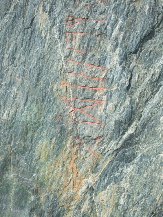
This runestone is the oldest runestone in North Europe that is still standing on its original place! The runic inscription is made in the older futhark runic alphabet. The stone and inscription has been dated to around 300AD. It is read from top to bottom.
The inscription of the stone has been translated to "I, Gudgjest carved these runes".
The runes were invented around year 0 and was in use up until the 1400s. It was in use in most of the northern Europe. In this early stage of the runic inscriptions, it was probably been in use only for symbolic or ritual purposes. Around year 700, the runes were changing into what we know today as younger or later futhark. Around 50 inscriptions are known in Norway from the old period.
It is placed in the south-east corner of the major burial cemetery of Einang. The stone has probably been a part of this extensive burial cemetery, but I have put them in two different sites on this site because I think the stone itself is so special it deserves to be put in its own site.
The stone stands on a large and flat burial cairn that does not elevate much from the surrounding terrain, and no stones are visible on the surface due to the growth of small plants and moss. The cairn under the stone has been excavated, but it was already plundered in ancient times, so nothing was found that could say anything about who was laid to rest in this cairn. Artifacts from other cairns and mounds in this large burial cemetery is however been found.
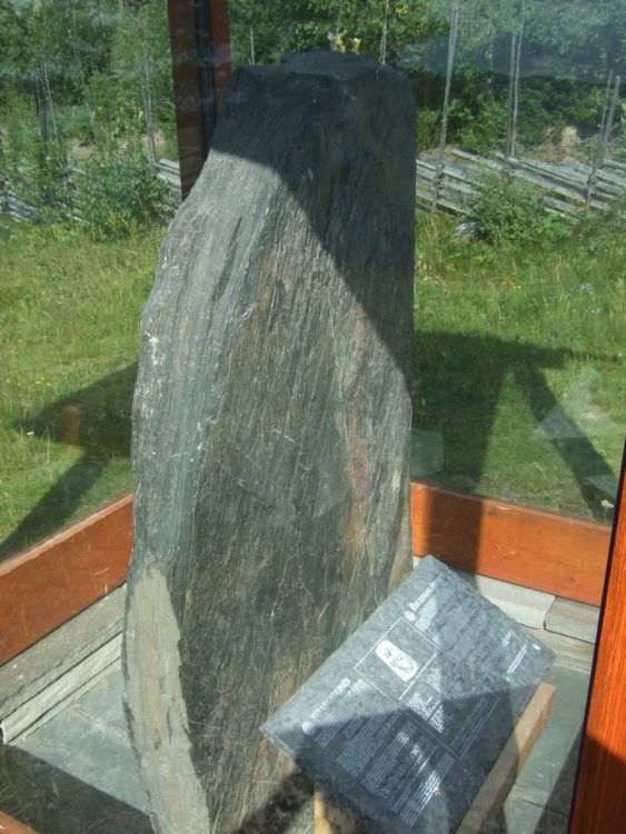
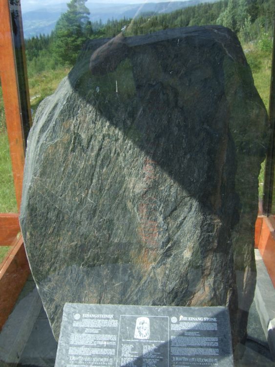
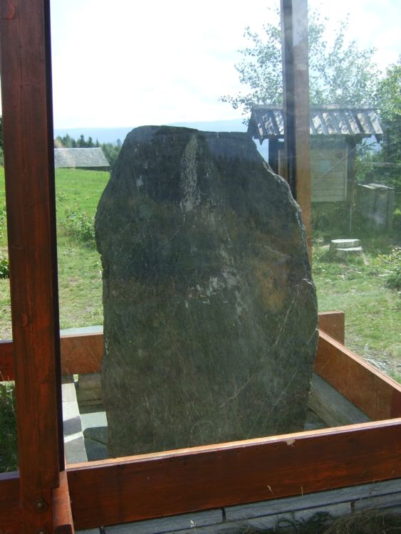
The stone itself measures about 1.5 metres in height, around 1 metre wide and about 20-30cm wide.
The stone has for several hundreds of years been standing in a tilting position with the runes on the lower side towards the ground. This has protected them against the elements and made them less eroded. In 1706, the stone was set upright and used as a border stone between the areas of Einang and Nesja.
A framework with glass walls has been built recently to protect the stone and the inscription. It obscures the "natural" look and view over the cemetery and the stone in context with each other, but it is however necessary to protect it from erosion.
You may be viewing yesterday's version of this page. To see the most up to date information please register for a free account.


Do not use the above information on other web sites or publications without permission of the contributor.
Click here to see more info for this site
Nearby sites
Click here to view sites on an interactive map of the areaKey: Red: member's photo, Blue: 3rd party photo, Yellow: other image, Green: no photo - please go there and take one, Grey: site destroyed
Download sites to:
KML (Google Earth)
GPX (GPS waypoints)
CSV (Garmin/Navman)
CSV (Excel)
To unlock full downloads you need to sign up as a Contributory Member. Otherwise downloads are limited to 50 sites.
Turn off the page maps and other distractions
Nearby sites listing. In the following links * = Image available
612m NNW 335° Garberg* Barrow Cemetery
1.5km WNW 285° Timbervegen* Round Barrow(s)
3.2km NW 308° Lysthaugen Vestre Slidre* Round Barrow(s)
3.5km NW 311° Nordre-Hausåker* Round Barrow(s)
4.6km SSE 155° Rønehaugen* Round Barrow(s)
9.1km NW 308° Kitilhaugen* Round Barrow(s)
14.5km SE 144° Lille-Strand Barrow* Round Barrow(s)
23.9km W 281° Vang Runestone* Carving
24.5km WNW 285° Sparstad* Standing Stones
52.5km ESE 121° Møllerstufossen Helleristninger* Carving
59.5km ESE 107° Erstadenget* Cairn
59.9km W 269° Turkestovhaugen* Cairn
60.3km W 270° Spenning Cairn and Standing Stone* Standing Stone (Menhir)
64.0km ESE 114° Nybakktåje* Barrow Cemetery
66.9km W 267° Nedre Kvame Gravfelt* Barrow Cemetery
68.5km WNW 293° Ytre Moa* Ancient Village or Settlement
69.0km NE 34° Vinstra Helleristninger* Rock Art
70.6km NE 36° Grytberget* Rock Art
71.7km NE 40° Kjorstad* Barrow Cemetery
72.1km W 268° Bjørkum* Ancient Village or Settlement
72.4km NE 44° Hundorp* Ancient Village or Settlement
72.5km NE 39° Skutelen-Ødegaardsberget* Hillfort
72.6km ENE 71° Vardkampen* Hillfort
72.8km NE 43° Sør-Fron-Prestegård* Round Barrow(s)
73.3km NE 44° Tingflata* Stone Circle
View more nearby sites and additional images


 We would like to know more about this location. Please feel free to add a brief description and any relevant information in your own language.
 Wir möchten mehr über diese Stätte erfahren. Bitte zögern Sie nicht, eine kurze Beschreibung und relevante Informationen in Deutsch hinzuzufügen.
 Nous aimerions en savoir encore un peu sur les lieux. S'il vous plaît n'hesitez pas à ajouter une courte description et tous les renseignements pertinents dans votre propre langue.
 Quisieramos informarnos un poco más de las lugares. No dude en añadir una breve descripción y otros datos relevantes en su propio idioma.