<< Our Photo Pages >> Lauritsakivi - Natural Stone / Erratic / Other Natural Feature in Estonia
Submitted by Alta-Falisa on Thursday, 10 May 2018 Page Views: 1224
Natural PlacesSite Name: LauritsakiviCountry: Estonia
NOTE: This site is 28.904 km away from the location you searched for.
Type: Natural Stone / Erratic / Other Natural Feature
Nearest Town: Tallin
Latitude: 59.449500N Longitude: 25.433600E
Condition:
| 5 | Perfect |
| 4 | Almost Perfect |
| 3 | Reasonable but with some damage |
| 2 | Ruined but still recognisable as an ancient site |
| 1 | Pretty much destroyed, possibly visible as crop marks |
| 0 | No data. |
| -1 | Completely destroyed |
| 5 | Superb |
| 4 | Good |
| 3 | Ordinary |
| 2 | Not Good |
| 1 | Awful |
| 0 | No data. |
| 5 | Can be driven to, probably with disabled access |
| 4 | Short walk on a footpath |
| 3 | Requiring a bit more of a walk |
| 2 | A long walk |
| 1 | In the middle of nowhere, a nightmare to find |
| 0 | No data. |
| 5 | co-ordinates taken by GPS or official recorded co-ordinates |
| 4 | co-ordinates scaled from a detailed map |
| 3 | co-ordinates scaled from a bad map |
| 2 | co-ordinates of the nearest village |
| 1 | co-ordinates of the nearest town |
| 0 | no data |
Internal Links:
External Links:
I have visited· I would like to visit
AnjaI visited on 1st Aug 2017 - their rating: Cond: 4 Amb: 3 Access: 5
")
Erratic boulder. National monument.
Easily reached by car : off N.1/E20 Tallin-Narva, exit Kuusalu. A small car park is provided near the roundabout just north of the highway bridge.
Main feature of the boulder : the (modern) Arms engraved on the flattest face.
You may be viewing yesterday's version of this page. To see the most up to date information please register for a free account.
")
")
")
Do not use the above information on other web sites or publications without permission of the contributor.
Nearby Images from Flickr
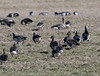

The above images may not be of the site on this page, but were taken nearby. They are loaded from Flickr so please click on them for image credits.
Click here to see more info for this site
Nearby sites
Click here to view sites on an interactive map of the areaKey: Red: member's photo, Blue: 3rd party photo, Yellow: other image, Green: no photo - please go there and take one, Grey: site destroyed
Download sites to:
KML (Google Earth)
GPX (GPS waypoints)
CSV (Garmin/Navman)
CSV (Excel)
To unlock full downloads you need to sign up as a Contributory Member. Otherwise downloads are limited to 50 sites.
Turn off the page maps and other distractions
Nearby sites listing. In the following links * = Image available
7.0km NE 39° Hundikangrud* Cist
9.5km NW 309° Augusuurkivi* Natural Stone / Erratic / Other Natural Feature
16.9km W 267° Jõelähtme* Barrow Cemetery
18.6km W 262° Kostivere Sliding Stone* Natural Stone / Erratic / Other Natural Feature
19.6km W 274° Rebala* Barrow Cemetery
24.9km ENE 60° Tammispea rändrahn* Natural Stone / Erratic / Other Natural Feature
25.4km NE 48° Jaani-Tooma Suurkivi* Natural Stone / Erratic / Other Natural Feature
31.2km ENE 59° Saadumetsa suurkivi* Natural Stone / Erratic / Other Natural Feature
34.2km SW 221° Blue Springs of Saula* Holy Well or Sacred Spring
36.7km W 265° Linda Kivi* Natural Stone / Erratic / Other Natural Feature
49.7km ENE 73° Kaarnakivi* Natural Stone / Erratic / Other Natural Feature
66.1km E 80° Ehalkivi* Natural Stone / Erratic / Other Natural Feature
85.4km NNW 341° National Museum of Finland Museum
87.2km NNW 340° Pronssikautinen hauta Meilahti (1)* Cairn
87.3km NNW 338° Pronssikautinen hauta Lehtisaari (2)* Cairn
87.4km NNW 339° Pronssikautinen hauta Lehtisaari (1)* Cairn
89.4km NNW 342° Käpylä Hiidenkirnu* Natural Stone / Erratic / Other Natural Feature
91.0km NNW 345° Pihlajamäki Hiidenkirnu Natural Stone / Erratic / Other Natural Feature
109.7km SE 143° Kalevipoja lingukivi* Natural Stone / Erratic / Other Natural Feature
110.2km NE 51° Megaliths of Hogland Island* Standing Stones
113.6km ESE 109° Iisaku Muuseum* Museum
130.6km NNE 26° Ahvenkoski Harbour Ancient Village or Settlement
139.7km SSE 148° Toomemäe ohvrikivi* Holed Stone
152.5km WNW 303° Lupaja* Barrow Cemetery
166.1km NW 311° Puonti* Cairn
View more nearby sites and additional images


 We would like to know more about this location. Please feel free to add a brief description and any relevant information in your own language.
 Wir möchten mehr über diese Stätte erfahren. Bitte zögern Sie nicht, eine kurze Beschreibung und relevante Informationen in Deutsch hinzuzufügen.
 Nous aimerions en savoir encore un peu sur les lieux. S'il vous plaît n'hesitez pas à ajouter une courte description et tous les renseignements pertinents dans votre propre langue.
 Quisieramos informarnos un poco más de las lugares. No dude en añadir una breve descripción y otros datos relevantes en su propio idioma.