<< Text Pages >> Kootsaare Labyrinth - Turf Maze in Estonia
Submitted by Sui on Saturday, 12 February 2011 Page Views: 5941
Neolithic and Bronze AgeSite Name: Kootsaare LabyrinthCountry: Estonia
NOTE: This site is 75.962 km away from the location you searched for.
Type: Turf Maze
Nearest Town: Kuressaare Nearest Village: Reigi
Latitude: 59.000000N Longitude: 22.486400E
Condition:
| 5 | Perfect |
| 4 | Almost Perfect |
| 3 | Reasonable but with some damage |
| 2 | Ruined but still recognisable as an ancient site |
| 1 | Pretty much destroyed, possibly visible as crop marks |
| 0 | No data. |
| -1 | Completely destroyed |
| 5 | Superb |
| 4 | Good |
| 3 | Ordinary |
| 2 | Not Good |
| 1 | Awful |
| 0 | No data. |
| 5 | Can be driven to, probably with disabled access |
| 4 | Short walk on a footpath |
| 3 | Requiring a bit more of a walk |
| 2 | A long walk |
| 1 | In the middle of nowhere, a nightmare to find |
| 0 | No data. |
| 5 | co-ordinates taken by GPS or official recorded co-ordinates |
| 4 | co-ordinates scaled from a detailed map |
| 3 | co-ordinates scaled from a bad map |
| 2 | co-ordinates of the nearest village |
| 1 | co-ordinates of the nearest town |
| 0 | no data |
Internal Links:
External Links:
Estonian old stone classical labyrinth. Mystical place on Hiiumaa island. Typical coastal area. Settled by Swedesh settlers. Have been used for meditation, magic also for different games and incantations. Kootssare labyrinths were called Sailors Games. They were built by Swedish sailors who couls not get away from Hiiumaa after ship was wrecked. The labyrinth was built in about the 16th century.
According to information found in the Estonian Folklore Archive , the labyrinth is also called Jerusalem and it is said to have been built by a sailor who survived a shipwreck.
Source: Wikipedia (translated https://et.wikipedia.org/wiki/Kootsaare_kivilab%C3%BCrint 8911 Stone Labyrinth. - Register of cultural monuments https://register.muinas.ee/public.php?menuID=monument&action=view&id=8911
You may be viewing yesterday's version of this page. To see the most up to date information please register for a free account.
Do not use the above information on other web sites or publications without permission of the contributor.
Nearby Images from Flickr
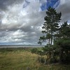

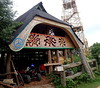
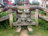
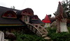

The above images may not be of the site on this page, but were taken nearby. They are loaded from Flickr so please click on them for image credits.
Click here to see more info for this site
Nearby sites
Click here to view sites on an interactive map of the areaKey: Red: member's photo, Blue: 3rd party photo, Yellow: other image, Green: no photo - please go there and take one, Grey: site destroyed
Download sites to:
KML (Google Earth)
GPX (GPS waypoints)
CSV (Garmin/Navman)
CSV (Excel)
To unlock full downloads you need to sign up as a Contributory Member. Otherwise downloads are limited to 50 sites.
Turn off the page maps and other distractions
Nearby sites listing. In the following links * = Image available
136.6km NNE 15° Lupaja* Barrow Cemetery
138.3km S 177° Kolkasrags, Jūras Panemtiem* Modern Stone Circle etc
139.0km ENE 69° Linda Kivi* Natural Stone / Erratic / Other Natural Feature
147.9km E 80° Blue Springs of Saula* Holy Well or Sacred Spring
156.5km ENE 71° Kostivere Sliding Stone* Natural Stone / Erratic / Other Natural Feature
156.6km ENE 70° Rebala* Barrow Cemetery
158.4km ENE 71° Jõelähtme* Barrow Cemetery
161.6km NNE 13° Puonti* Cairn
165.4km N 358° Old Castle of Lieto* Hillfort
166.3km N 354° Altar Raisio* NOT SET
169.5km ENE 70° Augusuurkivi* Natural Stone / Erratic / Other Natural Feature
175.0km ENE 72° Lauritsakivi* Natural Stone / Erratic / Other Natural Feature
179.3km N 353° Isotalo, Nousiainen* Cairn
180.7km ENE 71° Hundikangrud* Cist
184.0km S 176° Vandzenes akmens (Stone of Vandzene)* Natural Stone / Erratic / Other Natural Feature
186.9km NE 44° Pronssikautinen hauta Lehtisaari (2)* Cairn
187.0km NE 44° Pronssikautinen hauta Lehtisaari (1)* Cairn
189.6km NE 45° Pronssikautinen hauta Meilahti (1)* Cairn
189.8km NE 45° National Museum of Finland Museum
193.2km NE 45° Käpylä Hiidenkirnu* Natural Stone / Erratic / Other Natural Feature
194.6km NW 317° Borgboda Hillfort* Hillfort
195.5km NW 315° Björkens/Söderskog* Artificial Mound
195.9km NW 315° Flyhagen/Knösäkern* Artificial Mound
196.9km NW 317° Johannisberg (Kvarnbo)* Artificial Mound
197.5km NE 45° Pihlajamäki Hiidenkirnu Natural Stone / Erratic / Other Natural Feature
View more nearby sites and additional images


 We would like to know more about this location. Please feel free to add a brief description and any relevant information in your own language.
 Wir möchten mehr über diese Stätte erfahren. Bitte zögern Sie nicht, eine kurze Beschreibung und relevante Informationen in Deutsch hinzuzufügen.
 Nous aimerions en savoir encore un peu sur les lieux. S'il vous plaît n'hesitez pas à ajouter une courte description et tous les renseignements pertinents dans votre propre langue.
 Quisieramos informarnos un poco más de las lugares. No dude en añadir una breve descripción y otros datos relevantes en su propio idioma.