 with our Megalithic Portal iPhone app")

<< Text Pages >> An Dun, Strath Canaird - Stone Fort or Dun in Scotland in Highlands
Submitted by Andy B on Wednesday, 01 September 2010 Page Views: 4883
Multi-periodSite Name: An Dun, Strath CanairdCountry: Scotland
NOTE: This site is 7.309 km away from the location you searched for.
County: Highlands Type: Stone Fort or Dun
Map Ref: NC16530196
Latitude: 57.968965N Longitude: 5.103483W
Condition:
| 5 | Perfect |
| 4 | Almost Perfect |
| 3 | Reasonable but with some damage |
| 2 | Ruined but still recognisable as an ancient site |
| 1 | Pretty much destroyed, possibly visible as crop marks |
| 0 | No data. |
| -1 | Completely destroyed |
| 5 | Superb |
| 4 | Good |
| 3 | Ordinary |
| 2 | Not Good |
| 1 | Awful |
| 0 | No data. |
| 5 | Can be driven to, probably with disabled access |
| 4 | Short walk on a footpath |
| 3 | Requiring a bit more of a walk |
| 2 | A long walk |
| 1 | In the middle of nowhere, a nightmare to find |
| 0 | No data. |
| 5 | co-ordinates taken by GPS or official recorded co-ordinates |
| 4 | co-ordinates scaled from a detailed map |
| 3 | co-ordinates scaled from a bad map |
| 2 | co-ordinates of the nearest village |
| 1 | co-ordinates of the nearest town |
| 0 | no data |
Internal Links:
External Links:
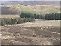
Stone Fort or Dun in Highlands. An Dun, 300 yds SE of the River Kanaird and 700 yds due E of Drienach, occupies the flat-topped summit of a rocky knoll lying in the angle formed by the confluence of two burns. The knoll is precipitous or steeply inclined and the only easy approach to the dun is from the S where a gap in the debris probably represents the site of the entrance.
Owing to the wasted condition of the remains, no useful plan can be made without excavation. Superficial indications, however, suggest that the structure was shaped like a squat letter D with rounded corners, the W side forming the upright stroke, and that it measured about 34' E-W by 32' N-S within a wall some 14' thick. At the NW corner a short segment of the outer face of the wall is visible, a few courses high, behind which two slabs, embedded in the soil, may indicate the presence of a chamber.
Another stretch of the same face, 10' long, can be seen on the straight W side, rising with a batter of 1'6" to a height of 6'6"; its top is approximately level with the present ground surface in the interior. It is built of large blocks of local freestone levelled and jointed with pinnings. Elsewhere the walling has either disappeared over the precipices or lies in a heap of debris on the upper slopes of the knoll. Natural erosion has no doubt been accelerated by stone-robbing to build a late cottage and a dyke at the foot of the approach on the S. It is probable, however, that the foundations and floor are still intact.
You may be viewing yesterday's version of this page. To see the most up to date information please register for a free account.
Do not use the above information on other web sites or publications without permission of the contributor.
Nearby Images from Geograph Britain and Ireland:

©2026(licence)
©2009(licence)
©2018(licence)
©2009(licence)
©2009(licence)
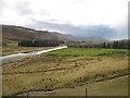
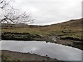
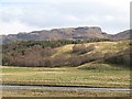
The above images may not be of the site on this page, they are loaded from Geograph.
Please Submit an Image of this site or go out and take one for us!
Click here to see more info for this site
Nearby sites
Key: Red: member's photo, Blue: 3rd party photo, Yellow: other image, Green: no photo - please go there and take one, Grey: site destroyed
Download sites to:
KML (Google Earth)
GPX (GPS waypoints)
CSV (Garmin/Navman)
CSV (Excel)
To unlock full downloads you need to sign up as a Contributory Member. Otherwise downloads are limited to 50 sites.
Turn off the page maps and other distractions
Nearby sites listing. In the following links * = Image available
5.5km WSW 255° Dun Canna* Stone Fort or Dun (NC11160080)
7.6km WSW 244° Isle Martin Cross Stone* Ancient Cross (NH096989)
10.8km S 190° Dun Lagaidh* Stone Fort or Dun (NH14239135)
11.6km NNE 27° Glacbain* Cairn (NC2231112011)
11.9km S 175° Allt Raon A'Chroisg Broch or Nuraghe (NH16959008)
12.0km S 185° Dun An Ruigh Ruadh* Stone Fort or Dun (NH14939008)
12.5km NNE 33° Ledmore* Chambered Cairn (NC23821215)
13.1km NNE 29° Cam Loch B Chambered Cairn (NC23431314)
13.1km NNE 29° Cam Loch A Cairn (NC23501312)
13.1km NE 42° Loch Borralan Crannog* Crannog (NC25741138)
13.2km NE 43° Loch Borralan West* Chambered Cairn (NC2603811142)
13.2km NE 45° Loch Borralan SE Crannog* Crannog (NC26361085)
13.4km NE 44° Loch Borralan East* Chambered Cairn (NC26241118)
13.5km SW 217° Beinn Ghobhlach Standing Stone* Standing Stone (Menhir) (NH080915)
13.5km NE 45° Altnacealgach* Chambered Cairn (NC2652811033)
14.4km WNW 287° Achlochan Broch* Broch or Nuraghe (NC029069)
14.7km NNE 32° Ledbeg River* Chambered Cairn (NC24891411)
14.8km ENE 62° Cnoc Chaornaidh North West* Chambered Cairn (NC299084)
14.9km ENE 63° Cnoc Chaornaidh Central* Cairn (NC30170818)
15.0km ENE 64° Cnoc Chaornaidh South-east* Chambered Cairn (NC30320793)
16.8km NW 321° Inverpolly Stone Fort or Dun (NC06611551)
16.9km SSW 193° Bruthach Na Garbh Choille Ancient Village or Settlement (NH120856)
18.2km NNE 32° Allt nan Uamh Bone Caves* Cave or Rock Shelter (NC268170)
18.9km NW 306° Brae of Achnahaird Stone Fort or Dun (NC01701380)
21.5km WSW 243° Stones near Mungasdale Natural Stone / Erratic / Other Natural Feature (NG9686393111)
View more nearby sites and additional images


 We would like to know more about this location. Please feel free to add a brief description and any relevant information in your own language.
 Wir möchten mehr über diese Stätte erfahren. Bitte zögern Sie nicht, eine kurze Beschreibung und relevante Informationen in Deutsch hinzuzufügen.
 Nous aimerions en savoir encore un peu sur les lieux. S'il vous plaît n'hesitez pas à ajouter une courte description et tous les renseignements pertinents dans votre propre langue.
 Quisieramos informarnos un poco más de las lugares. No dude en añadir una breve descripción y otros datos relevantes en su propio idioma.