<< Our Photo Pages >> Runkesten - Natural Stone / Erratic / Other Natural Feature in Sweden in Småland
Submitted by Meginring on Thursday, 15 February 2007 Page Views: 12619
Natural PlacesSite Name: RunkestenCountry: Sweden
NOTE: This site is 49.81 km away from the location you searched for.
Landskap: Småland Type: Natural Stone / Erratic / Other Natural Feature
Nearest Town: Mariannelund Nearest Village: Rumskulla
Latitude: 57.633300N Longitude: 15.610000E
Condition:
| 5 | Perfect |
| 4 | Almost Perfect |
| 3 | Reasonable but with some damage |
| 2 | Ruined but still recognisable as an ancient site |
| 1 | Pretty much destroyed, possibly visible as crop marks |
| 0 | No data. |
| -1 | Completely destroyed |
| 5 | Superb |
| 4 | Good |
| 3 | Ordinary |
| 2 | Not Good |
| 1 | Awful |
| 0 | No data. |
| 5 | Can be driven to, probably with disabled access |
| 4 | Short walk on a footpath |
| 3 | Requiring a bit more of a walk |
| 2 | A long walk |
| 1 | In the middle of nowhere, a nightmare to find |
| 0 | No data. |
| 5 | co-ordinates taken by GPS or official recorded co-ordinates |
| 4 | co-ordinates scaled from a detailed map |
| 3 | co-ordinates scaled from a bad map |
| 2 | co-ordinates of the nearest village |
| 1 | co-ordinates of the nearest town |
| 0 | no data |
Internal Links:
External Links:
I have visited· I would like to visit
regina has visited here
")
Experts appoint Runkesten to be the largest movable glacial erratic in the world.
The melting ice deposited this block and left it in such a way that even a child can fairly easy move it back and forth some 5 to 10 cm.
But be aware that according to legend the giant woman Kåra, who once hurled the stone at the church in Rumskulla, will come back and kill anyone who brings it to fall over!
The name Runkesten refers to a jerking back and forward motion, but it can just as well bring modern people to giggle and even a few embarrassed faces!
Directions: A sign along the road between Mariannelund and Rumskulla.
Picture courtesy of Vimmerby Tourist Bureau
http://www.turism.vimmerby.se/eng/eturism/et16.asp
You may be viewing yesterday's version of this page. To see the most up to date information please register for a free account.
")
")
Do not use the above information on other web sites or publications without permission of the contributor.
Nearby Images from Flickr
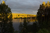
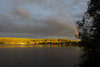
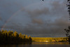

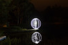
The above images may not be of the site on this page, but were taken nearby. They are loaded from Flickr so please click on them for image credits.
Click here to see more info for this site
Nearby sites
Click here to view sites on an interactive map of the areaKey: Red: member's photo, Blue: 3rd party photo, Yellow: other image, Green: no photo - please go there and take one, Grey: site destroyed
Download sites to:
KML (Google Earth)
GPX (GPS waypoints)
CSV (Garmin/Navman)
CSV (Excel)
To unlock full downloads you need to sign up as a Contributory Member. Otherwise downloads are limited to 50 sites.
Turn off the page maps and other distractions
Nearby sites listing. In the following links * = Image available
57.8km ESE 102° Snäckedal Grävfält* Barrow Cemetery
58.2km NW 321° Balancing stone Tranås Natural Stone / Erratic / Other Natural Feature
79.8km W 279° Rogbergastenen* Carving
80.9km NNW 339° Mjölbystenen* Carving
82.1km N 358° Slakastenen (2)* Carving
82.1km N 358° Slakastenen (1)* Carving
86.2km NNW 340° Högbystenen (1)* Carving
86.2km NNW 340° Högbystenen (2)* Carving
86.3km NNW 340° Högbystenen (3)* Carving
86.3km NNW 340° Högbystenen (4)* Carving
88.5km NNW 327° Rökstenen* Carving
90.1km NNW 340° Skänningestenen* Carving
90.3km N 354° Ledbergs kulle* Round Barrow(s)
90.3km ESE 110° Forgalla Skepp* Stone Circle
90.5km N 354° Ledbergsstenen* Carving
91.1km ESE 114° Hunderum* Stone Circle
92.6km NNW 342° Orsnäs* Stone Row / Alignment
93.0km ESE 115° Rosendal* Ancient Village or Settlement
93.2km NNW 343° Lunds Backe* Stone Row / Alignment
99.0km SE 125° Vi Alvar* Burial Chamber or Dolmen
100.2km NNW 335° Vadstenastenen* Carving
103.7km NNW 333° Nässja domarring* Stone Circle
105.4km NNW 342° Kanaljorden* Ancient Village or Settlement
105.6km SE 142° Blå Bör* Chambered Cairn
105.9km SE 142° Borgholm* Stone Circle
View more nearby sites and additional images


 We would like to know more about this location. Please feel free to add a brief description and any relevant information in your own language.
 Wir möchten mehr über diese Stätte erfahren. Bitte zögern Sie nicht, eine kurze Beschreibung und relevante Informationen in Deutsch hinzuzufügen.
 Nous aimerions en savoir encore un peu sur les lieux. S'il vous plaît n'hesitez pas à ajouter une courte description et tous les renseignements pertinents dans votre propre langue.
 Quisieramos informarnos un poco más de las lugares. No dude en añadir una breve descripción y otros datos relevantes en su propio idioma.