


<< Text Pages >> Stroangassel - Stone Circle in Scotland in Dumfries and Galloway
Submitted by Anonymous on Saturday, 02 November 2002 Page Views: 6555
Neolithic and Bronze AgeSite Name: StroangasselCountry: Scotland
NOTE: This site is 1.695 km away from the location you searched for.
County: Dumfries and Galloway Type: Stone Circle
Map Ref: NX589869 Landranger Map Number: 77
Latitude: 55.156253N Longitude: 4.216051W
Condition:
| 5 | Perfect |
| 4 | Almost Perfect |
| 3 | Reasonable but with some damage |
| 2 | Ruined but still recognisable as an ancient site |
| 1 | Pretty much destroyed, possibly visible as crop marks |
| 0 | No data. |
| -1 | Completely destroyed |
| 5 | Superb |
| 4 | Good |
| 3 | Ordinary |
| 2 | Not Good |
| 1 | Awful |
| 0 | No data. |
| 5 | Can be driven to, probably with disabled access |
| 4 | Short walk on a footpath |
| 3 | Requiring a bit more of a walk |
| 2 | A long walk |
| 1 | In the middle of nowhere, a nightmare to find |
| 0 | No data. |
| 5 | co-ordinates taken by GPS or official recorded co-ordinates |
| 4 | co-ordinates scaled from a detailed map |
| 3 | co-ordinates scaled from a bad map |
| 2 | co-ordinates of the nearest village |
| 1 | co-ordinates of the nearest town |
| 0 | no data |
Internal Links:
External Links:
Stone Circle in Dumfries & Galloway
Have you visited this site? Please contribute a description or any thoughts by adding a comment.
You may be viewing yesterday's version of this page. To see the most up to date information please register for a free account.
Do not use the above information on other web sites or publications without permission of the contributor.
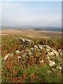
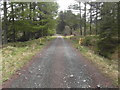
Nearby Images from Geograph Britain and Ireland:

©2011(licence)
©2011(licence)

©2013(licence)
©2013(licence)

©2013(licence)
The above images may not be of the site on this page, they are loaded from Geograph.
Please Submit an Image of this site or go out and take one for us!
Click here to see more info for this site
Nearby sites
Key: Red: member's photo, Blue: 3rd party photo, Yellow: other image, Green: no photo - please go there and take one, Grey: site destroyed
Download sites to:
KML (Google Earth)
GPX (GPS waypoints)
CSV (Garmin/Navman)
CSV (Excel)
To unlock full downloads you need to sign up as a Contributory Member. Otherwise downloads are limited to 50 sites.
Turn off the page maps and other distractions
Nearby sites listing. In the following links * = Image available
2.7km WNW 281° Physic Well (Kells) Holy Well or Sacred Spring (NX5622587525)
3.1km E 90° Mackilston N* Cairn (NX61968682)
3.1km E 90° Mackilston S* Cairn (NX61968678)
4.3km NNW 333° Braidenoch Cross Slabs* Early Christian Sculptured Stone (NX57099081)
4.8km NNW 333° Bardennoch* Cairn (NX56859120)
6.3km NNW 330° Cairn Avel* Cairn (NX55949245)
6.7km NE 40° Smittons Bridge* Cairn (NX63409188)
6.8km NE 47° Stroanfreggan Cairn* Cairn (NX64019142)
7.0km NE 41° Stroanfreggan Craig* Hillfort (NX63709206)
7.6km NNW 336° Lagwine* Cairn (NX56069398)
8.1km NNW 333° Holm of Daltallochan Standing Stone* Standing Stone (Menhir) (NX55399420)
8.2km NNW 332° Holm Of Daltallochan Stone Circle* Stone Circle (NX55289422)
8.3km NNW 336° Green Well of Scotland (Carsphairn)* Holy Well or Sacred Spring (NX5573494565)
8.4km NE 43° Chalybeate Well (Dalry)* Holy Well or Sacred Spring (NX6488792815)
8.5km NNE 25° Craigengillan* Cairn (NX62699448)
8.7km NE 38° Round Craigs* Cairn (NX64519355)
9.2km SE 145° Dalarran Holm* Standing Stone (Menhir) (NX6388179164)
9.3km NE 48° Stellhead S* Cairn (NX66059285)
9.4km NE 48° Stellhead N* Cairn (NX66089297)
9.5km WNW 296° King's Well (Carsphairn) Holy Well or Sacred Spring (NX5043591268)
9.5km WNW 295° King's Stone (Carsphairn) Natural Stone / Erratic / Other Natural Feature (NX50419127)
9.8km SSE 155° Physic Well (Kells) Holy Well or Sacred Spring (NX6270677877)
9.9km ESE 109° Corriedoo* Cairn (NX6814083327)
10.2km SE 146° Lady's Well (Balmaclellan) Holy Well or Sacred Spring (NX6435678263)
10.6km SSW 199° Bruce's Stone (Clatteringshaws)* Natural Stone / Erratic / Other Natural Feature (NX55107696)
View more nearby sites and additional images


 We would like to know more about this location. Please feel free to add a brief description and any relevant information in your own language.
 Wir möchten mehr über diese Stätte erfahren. Bitte zögern Sie nicht, eine kurze Beschreibung und relevante Informationen in Deutsch hinzuzufügen.
 Nous aimerions en savoir encore un peu sur les lieux. S'il vous plaît n'hesitez pas à ajouter une courte description et tous les renseignements pertinents dans votre propre langue.
 Quisieramos informarnos un poco más de las lugares. No dude en añadir una breve descripción y otros datos relevantes en su propio idioma.