


<< Image Pages >> St Wilfred's Well (Wreay) - Holy Well or Sacred Spring in England in Cumbria
Submitted by Anne T on Tuesday, 13 September 2022 Page Views: 1023
Springs and Holy WellsSite Name: St Wilfred's Well (Wreay)Country: England
NOTE: This site is 1.1 km away from the location you searched for.
County: Cumbria Type: Holy Well or Sacred Spring
Nearest Town: Carlisle Nearest Village: Wreay
Map Ref: NY443478
Latitude: 54.821933N Longitude: 2.868416W
Condition:
| 5 | Perfect |
| 4 | Almost Perfect |
| 3 | Reasonable but with some damage |
| 2 | Ruined but still recognisable as an ancient site |
| 1 | Pretty much destroyed, possibly visible as crop marks |
| 0 | No data. |
| -1 | Completely destroyed |
| 5 | Superb |
| 4 | Good |
| 3 | Ordinary |
| 2 | Not Good |
| 1 | Awful |
| 0 | No data. |
| 5 | Can be driven to, probably with disabled access |
| 4 | Short walk on a footpath |
| 3 | Requiring a bit more of a walk |
| 2 | A long walk |
| 1 | In the middle of nowhere, a nightmare to find |
| 0 | No data. |
| 5 | co-ordinates taken by GPS or official recorded co-ordinates |
| 4 | co-ordinates scaled from a detailed map |
| 3 | co-ordinates scaled from a bad map |
| 2 | co-ordinates of the nearest village |
| 1 | co-ordinates of the nearest town |
| 0 | no data |
Internal Links:
External Links:
 (PID:247469)")
This well is listed in McIntyre's 1944 publication "The Holy Wells of Cumberland" (page 15). He tells us the well is "S(outh) of the village in a lane between the railway and the (river) Petteril. The water is still held in high repute by the inhabitants of the village who formerly used to visit the well with the usual ceremonies".
St Wilfred's Well is also listed in Jim Taylor Page's 1990 publication "Cumbrian Holy Wells" (page 27). He tells us that the well had both pagan and Christian associations, was known to be used in May-day ceremonies "in high reputation", that there was no church associated with the well, and its present condition (at the time of publication) was "overgrown and long forgotten". Taylor Page refers to Hope's "Legendary Lore of the Holy Wells of England" (1893), but tells us to look at page 409. My version of Hope finishes on page 222, so I'm unsure if Taylor Page has an incorrect reference, of if there is a longer version of Hope's book.
The well is no longer mentioned on any of the OS maps (using the National Library of Scotland's map database), although using the grid reference given - accurate to within a 100m radius - I've compared the approximate location shown on the Historic England map search with the 1868 6 inch map (see National Library of Scotland map, Cumberland Sheet XXXI (Creative Commons Attribution-NonCommercial-ShareAlike 4.0 International (CC-BY-NC-SA) licence).
Does anyone have any information about this well, please? Or do you have a version of Hope's "Legendary Lore" that has the page 409 referenced by Taylor Page? If so, would you be able to post a comment to this site page? Many thanks.
You may be viewing yesterday's version of this page. To see the most up to date information please register for a free account.
Do not use the above information on other web sites or publications without permission of the contributor.
Nearby Images from Geograph Britain and Ireland:
©2014(licence)
©2015(licence)
©2014(licence)
©2008(licence)
©2008(licence)
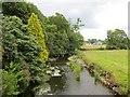
The above images may not be of the site on this page, they are loaded from Geograph.
Please Submit an Image of this site or go out and take one for us!
Click here to see more info for this site
Nearby sites
Key: Red: member's photo, Blue: 3rd party photo, Yellow: other image, Green: no photo - please go there and take one, Grey: site destroyed
Download sites to:
KML (Google Earth)
GPX (GPS waypoints)
CSV (Garmin/Navman)
CSV (Excel)
To unlock full downloads you need to sign up as a Contributory Member. Otherwise downloads are limited to 50 sites.
Turn off the page maps and other distractions
Nearby sites listing. In the following links * = Image available
1.4km NW 325° St Mary's Well (Wreay)* Holy Well or Sacred Spring (NY4352548921)
3.6km NE 43° St Anne's Well (Cotehill)* Holy Well or Sacred Spring (NY4684050420)
3.8km SSW 208° Broad Field Stone Circle (NY425445)
4.7km NNW 333° St Ninian's Well (Brisco)* Holy Well or Sacred Spring (NY42265201)
5.3km NW 306° Tarn plantation* Stone Circle (NY4051)
5.7km SW 221° High Head Sculpture Valley Stone Circle* Modern Stone Circle etc (NY405435)
6.1km NNE 25° Wetheral Woods Sharpening stone* Polissoir (NY46995332)
7.0km NNE 19° Wetheral Village Cross* Ancient Cross (NY4665954370)
7.0km NNE 20° Anglo Saxon Cross Base, Wetheral Parish Church* Ancient Cross (NY46835436)
7.6km NNE 18° St Cuthbert's Holy Well* Holy Well or Sacred Spring (NY46735496)
7.6km WNW 286° Chapel Flat Stone Circle (NY370500)
8.4km ENE 67° Chapel Well (Cumwhitton) Holy Well or Sacred Spring (NY5209050930)
9.1km NNW 332° Carlisle Cross* Ancient Cross (NY4008455931)
9.3km NNW 331° Carlisle Anglo Saxon Crosses* Ancient Cross (NY39885595)
9.4km NNW 331° Tullie House Museum* Museum (NY3978556106)
9.6km ENE 58° Carlatton Demesne* Standing Stone (Menhir) (NY5252352810)
9.6km ENE 70° Carlatton Stone Row Stone Row / Alignment (NY534510)
10.0km NNW 331° Roman Bridge Remains (Bitts Park)* Ancient Trackway (NY3961056670)
10.1km NNW 337° Homeacres Holy Well (Stanwix)* Holy Well or Sacred Spring (NY40415709)
10.1km NNW 333° Hyssop Holme Well (Carlisle)* Holy Well or Sacred Spring (NY3974856801)
10.2km E 84° Grey Yauds* Stone Circle (NY5448748668)
10.2km E 84° Grey Yauds Multiple Stone Rows / Avenue (NY545487)
10.2km ESE 116° Cross House Incised Stone* Ancient Cross (NY5350843277)
10.3km W 266° St Michael's Well (Shawk)* Holy Well or Sacred Spring (NY3395047280)
10.4km ESE 115° Chapel Well (Staffield)* Holy Well or Sacred Spring (NY53744326)
View more nearby sites and additional images


 We would like to know more about this location. Please feel free to add a brief description and any relevant information in your own language.
 Wir möchten mehr über diese Stätte erfahren. Bitte zögern Sie nicht, eine kurze Beschreibung und relevante Informationen in Deutsch hinzuzufügen.
 Nous aimerions en savoir encore un peu sur les lieux. S'il vous plaît n'hesitez pas à ajouter une courte description et tous les renseignements pertinents dans votre propre langue.
 Quisieramos informarnos un poco más de las lugares. No dude en añadir una breve descripción y otros datos relevantes en su propio idioma.