<< Our Photo Pages >> St Ninian's Well (Brisco) - Holy Well or Sacred Spring in England in Cumbria
Submitted by Anne T on Friday, 18 August 2017 Page Views: 4831
Springs and Holy WellsSite Name: St Ninian's Well (Brisco)Country: England County: Cumbria Type: Holy Well or Sacred Spring
Nearest Town: Carlisle Nearest Village: Brisco
Map Ref: NY42265201
Latitude: 54.859530N Longitude: 2.901004W
Condition:
| 5 | Perfect |
| 4 | Almost Perfect |
| 3 | Reasonable but with some damage |
| 2 | Ruined but still recognisable as an ancient site |
| 1 | Pretty much destroyed, possibly visible as crop marks |
| 0 | No data. |
| -1 | Completely destroyed |
| 5 | Superb |
| 4 | Good |
| 3 | Ordinary |
| 2 | Not Good |
| 1 | Awful |
| 0 | No data. |
| 5 | Can be driven to, probably with disabled access |
| 4 | Short walk on a footpath |
| 3 | Requiring a bit more of a walk |
| 2 | A long walk |
| 1 | In the middle of nowhere, a nightmare to find |
| 0 | No data. |
| 5 | co-ordinates taken by GPS or official recorded co-ordinates |
| 4 | co-ordinates scaled from a detailed map |
| 3 | co-ordinates scaled from a bad map |
| 2 | co-ordinates of the nearest village |
| 1 | co-ordinates of the nearest town |
| 0 | no data |
Internal Links:
External Links:
I have visited· I would like to visit
Anne T visited on 17th Aug 2017 - their rating: Cond: 3 Amb: 3 Access: 4 St Ninian's Well, Brisco, Cumbria: From Carlatton Demesne Standing Stone, heading back onto the A69, we took the M6 to junction 42, then the third exit towards Durdar. Brisco (Briscoe according to Pastscape) is the first turn to the right. The village is a line of houses on both sides of the road. We parked where the road widened slightly at Brisco Hall farm and walked back southwards to the footpath, which runs to the north of Well View cottage (they have a sign on the side of the house saying their drive is Elvis Presley Boulevard!), and followed the grassy lane down towards the railway line. Where the path does a right hand turn, there is a small set of stone steps. The footpath then turns north east towards the railway line, going through a gate into a field. The well is in this small enclosed area, tucked away at its south eastern end, mostly hidden by shrubs and brambles.
There is an arched well head that looks Victorian, and Pastscape and Historic England says was erected in the 1830s to 1840s. A step goes down to the well basin, in which, under the water, is a circular structure with a circular hole in its middle. In the corner of the fence facing the well is a small wooden bench, covered by brambles when we visited, but we used sticks to move these away and sit and admire this spot.
From the well, a gate leads through a fence-line down into a field of pasture below (the ground drops by 3-4 feet and there are steps down to the new ground level). This ground is wet and boggy and in line with the well head and pool is a cattle truck. A steady trickle of water comes through the bottom of the trough into a pool which has large boulders pushed around it in a partial circle, now partly destroyed. It looks like this might have been the original well pool. At the bottom of the field, the main west coast railway line runs and we watched several intercity trains and a steam train go by before returning to go into Carlisle for a late lunch then onto our next stop – a wheel-headed cross north west of Carlisle in Rockcliffe.
 (PID:169464)")
Marked on the OS Map, a number of references can be found to give us details about this well:
Pastscape Monument No. 11545, which tells us that: "a 19th century arched building protects the well with the head wall about 5 feet above the water." Below the well head is a pool of water, which has a couple of stone steps leading down to it.
Both Historic England ID 1087745 and British Listed Buildings Ref. 101087745 contain the same details, which read: "Wellhead. 183O's-184O's by Sarah Losh. Dressed sandstone. Square flagged trough, round-headed arch with incised roll moulding decorated with crosses and lozenges. Site of an ancient well dedicated to St Ninian and rebuilt by Sarah Losh with an inscription which is now no longer visible." [Update July 2019: see the comment below for the inscription. With thanks to Derick Quinn for the information - much appreciated, thank you!]
Nothing much appears to be recorded about why the well was considered holy or its origins, although the Cumbria Directory says it is thought to date from AD 400 when it was used as the site of baptisms by St. Ninian. Strangely, there were no offerings left by this obviously once loved well.
The well can be reached by walking down a lane immediately to the north of Well View cottage (part of the lane forms their driveway and has a name sign of 'Elvis Presley Boulevard), to where the lane dog-legs right/left. The well is located at the far corner of this dog-leg, just past where the footpath goes through a gate and down some steps into a field towards the main west coast railway line.
Water trickles into a well pool, which has a circular drain, from which water runs into a cattle trough and a ruined stone-lined pool in the field below. At the time of our visit, the well was very overgrown with brambles, although a little seat tucked in the corner of the fence opposite the well gave us the opportunity to sit and reflect in this hidden spot.
You may be viewing yesterday's version of this page. To see the most up to date information please register for a free account.
 (PID:169465)")
 (PID:169463)")
 (PID:169466)")
Do not use the above information on other web sites or publications without permission of the contributor.
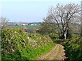
Nearby Images from Geograph Britain and Ireland:
©2009(licence)

©2021(licence)
©2021(licence)
©2009(licence)
©2021(licence)
The above images may not be of the site on this page, they are loaded from Geograph.
Please Submit an Image of this site or go out and take one for us!
Click here to see more info for this site
Nearby sites
Key: Red: member's photo, Blue: 3rd party photo, Yellow: other image, Green: no photo - please go there and take one, Grey: site destroyed
Download sites to:
KML (Google Earth)
GPX (GPS waypoints)
CSV (Garmin/Navman)
CSV (Excel)
To unlock full downloads you need to sign up as a Contributory Member. Otherwise downloads are limited to 50 sites.
Turn off the page maps and other distractions
Nearby sites listing. In the following links * = Image available
2.5km WSW 245° Tarn plantation* Stone Circle (NY4051)
3.3km SSE 157° St Mary's Well (Wreay)* Holy Well or Sacred Spring (NY4352548921)
4.5km NNW 330° Carlisle Cross* Ancient Cross (NY4008455931)
4.6km NNW 328° Carlisle Anglo Saxon Crosses* Ancient Cross (NY39885595)
4.7km SSE 153° St Wilfred's Well (Wreay)* Holy Well or Sacred Spring (NY443478)
4.8km NNW 328° Tullie House Museum* Museum (NY3978556106)
4.8km ESE 108° St Anne's Well (Cotehill)* Holy Well or Sacred Spring (NY4684050420)
5.0km ENE 61° Wetheral Village Cross* Ancient Cross (NY4665954370)
5.1km ENE 62° Anglo Saxon Cross Base, Wetheral Parish Church* Ancient Cross (NY46835436)
5.3km NE 56° St Cuthbert's Holy Well* Holy Well or Sacred Spring (NY46735496)
5.4km NNW 330° Roman Bridge Remains (Bitts Park)* Ancient Trackway (NY3961056670)
5.4km NNW 339° Homeacres Holy Well (Stanwix)* Holy Well or Sacred Spring (NY40415709)
5.4km NNW 332° Hyssop Holme Well (Carlisle)* Holy Well or Sacred Spring (NY3974856801)
5.6km WSW 248° Chapel Flat Stone Circle (NY370500)
6.9km NW 317° Stainton West Ancient Mine, Quarry or other Industry (NY3759457137)
7.5km S 177° Broad Field Stone Circle (NY425445)
8.1km NE 40° Cardinal Well (Irthington) Holy Well or Sacred Spring (NY4755058220)
8.7km S 191° High Head Sculpture Valley Stone Circle* Modern Stone Circle etc (NY405435)
9.4km NW 313° St Andrew's Well (Kirkandrews-on-Eden)* Holy Well or Sacred Spring (NY35395851)
9.5km WSW 240° St Michael's Well (Shawk)* Holy Well or Sacred Spring (NY3395047280)
9.8km WSW 239° Shawk Quarries Holy Well (Dalston) Holy Well or Sacred Spring (NY3380047100)
9.9km E 96° Chapel Well (Cumwhitton) Holy Well or Sacred Spring (NY5209050930)
10.3km E 85° Carlatton Demesne* Standing Stone (Menhir) (NY5252352810)
10.4km NW 314° St Mary's Motte (Beaumont)* Misc. Earthwork (NY3480459296)
11.2km E 94° Carlatton Stone Row Stone Row / Alignment (NY534510)
View more nearby sites and additional images


 We would like to know more about this location. Please feel free to add a brief description and any relevant information in your own language.
 Wir möchten mehr über diese Stätte erfahren. Bitte zögern Sie nicht, eine kurze Beschreibung und relevante Informationen in Deutsch hinzuzufügen.
 Nous aimerions en savoir encore un peu sur les lieux. S'il vous plaît n'hesitez pas à ajouter une courte description et tous les renseignements pertinents dans votre propre langue.
 Quisieramos informarnos un poco más de las lugares. No dude en añadir una breve descripción y otros datos relevantes en su propio idioma.