


<< Our Photo Pages >> Daleside Tumulus - Round Barrow(s) in England in Cumbria
Submitted by nicoladidsbury on Tuesday, 03 April 2007 Page Views: 6880
Neolithic and Bronze AgeSite Name: Daleside TumulusCountry: England
NOTE: This site is 1.428 km away from the location you searched for.
County: Cumbria Type: Round Barrow(s)
Nearest Town: Wigton Nearest Village: Ireby
Map Ref: NY259387
Latitude: 54.737786N Longitude: 3.152402W
Condition:
| 5 | Perfect |
| 4 | Almost Perfect |
| 3 | Reasonable but with some damage |
| 2 | Ruined but still recognisable as an ancient site |
| 1 | Pretty much destroyed, possibly visible as crop marks |
| 0 | No data. |
| -1 | Completely destroyed |
| 5 | Superb |
| 4 | Good |
| 3 | Ordinary |
| 2 | Not Good |
| 1 | Awful |
| 0 | No data. |
| 5 | Can be driven to, probably with disabled access |
| 4 | Short walk on a footpath |
| 3 | Requiring a bit more of a walk |
| 2 | A long walk |
| 1 | In the middle of nowhere, a nightmare to find |
| 0 | No data. |
| 5 | co-ordinates taken by GPS or official recorded co-ordinates |
| 4 | co-ordinates scaled from a detailed map |
| 3 | co-ordinates scaled from a bad map |
| 2 | co-ordinates of the nearest village |
| 1 | co-ordinates of the nearest town |
| 0 | no data |
Internal Links:
External Links:
I have visited· I would like to visit
nicoladidsbury has visited here
")
this is a ramble - to see if you would be happy to list this as an ancient site.
There is a round earth work, with ditch and mound, on my parents farm. It has never been excavated. A few hundred meters across the valley are the remains of three other tumuli, two iron age/romano british settlements, and a causwayed enclosure. These earth works all lie on unimproved fell land. However the earth work on my parents' farm lies on the edge of a field that has been ploughed, leaving the ancient ridge and furrow marks.
For many years I have wondered if it could be a burial mound, as this hypothosis fits in so neatly with other remains so close by. But then dismissed the earth work as field clearence. I went back the site today. It is definately not field clearence. There is only evidence of one stone, the ditch is approx 1m deep, there is a definate mound. The circle is not completely enclosed by a ditch, and the mound is not completely circular. The view across to aughtertree fell or Green Howe earth works is brilliant. This earth work lies on typical early settlement land, on limestone, with a nearby supplies of water from springs.
I submit for your consideration :)
Please let me know who I should send photos to
Best wishes
Nicola
You may be viewing yesterday's version of this page. To see the most up to date information please register for a free account.
Do not use the above information on other web sites or publications without permission of the contributor.
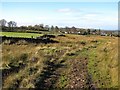
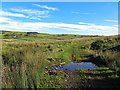
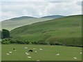
Nearby Images from Geograph Britain and Ireland:
©2017(licence)
©2017(licence)
©2016(licence)

©2025(licence)

©2025(licence)
The above images may not be of the site on this page, they are loaded from Geograph.
Please Submit an Image of this site or go out and take one for us!
Click here to see more info for this site
Nearby sites
Key: Red: member's photo, Blue: 3rd party photo, Yellow: other image, Green: no photo - please go there and take one, Grey: site destroyed
Download sites to:
KML (Google Earth)
GPX (GPS waypoints)
CSV (Garmin/Navman)
CSV (Excel)
To unlock full downloads you need to sign up as a Contributory Member. Otherwise downloads are limited to 50 sites.
Turn off the page maps and other distractions
Nearby sites listing. In the following links * = Image available
880m SE 129° Aughertree Fell stone circle* Stone Circle (NY2658138140)
907m ESE 109° Aughertree Fell outlier standing stones* Stone Row / Alignment (NY2675338384)
1.1km SSE 158° Aughertree fell standing stones* Standing Stones (NY2627837699)
1.2km S 186° Green How Enclosure* Causewayed Enclosure (NY25753751)
3.1km SW 233° High Ireby Standing Stone* Standing Stone (Menhir) (NY234369)
3.4km ENE 75° Faulds Brow Standing stones alignment* Stone Row / Alignment (NY2919339540)
3.6km W 279° Ireby Old Church* Ancient Cross (NY2238839305)
3.6km ENE 62° Faulds Brow Banjo Enclosure* Misc. Earthwork (NY2912340331)
4.0km ENE 60° Faulds Brow Banked Cairn Cairn (NY2937140629)
4.1km ENE 61° Faulds Brow Holed stone and Enclosure* Holed Stone (NY2950340623)
6.3km W 260° The Battery Enclosure* Misc. Earthwork (NY19653775)
6.7km ENE 79° St Mungo's Well (Cumbria)* Holy Well or Sacred Spring (NY3251339910)
8.3km ESE 113° Williwood Well Round Cairn Round Cairn (NY3343835291)
8.5km WNW 288° Blennerhasset Cross* Ancient Cross (NY1783141517)
9.0km ESE 123° Round Knott Cairn (NY334337)
9.3km ESE 115° Rospow Hills Cairn Field Barrow Cemetery (NY3428834698)
9.3km ESE 110° Weasel Hills Cairnfield* Round Cairn (NY3461435382)
9.7km ESE 121° Carrock Fell* Hillfort (NY342336)
9.8km SW 215° Castle How Fort* Hillfort (NY201308)
10.0km ESE 112° High Wath Ford Round Cairn North* Round Cairn (NY3512034821)
10.0km ESE 112° High Wath Ford Round Cairn South* Round Cairn (NY3510134773)
10.3km ESE 114° Linewath Round Cairn* Round Cairn (NY3522434360)
10.6km ESE 117° Mungrisedale Cairn (NY3530033700)
10.6km ESE 117° Apronful of Stones (Carrock Fell)* Natural Stone / Erratic / Other Natural Feature (NY3535533799)
10.7km SW 229° Elvaplain* Stone Circle (NY1770131716)
View more nearby sites and additional images


 We would like to know more about this location. Please feel free to add a brief description and any relevant information in your own language.
 Wir möchten mehr über diese Stätte erfahren. Bitte zögern Sie nicht, eine kurze Beschreibung und relevante Informationen in Deutsch hinzuzufügen.
 Nous aimerions en savoir encore un peu sur les lieux. S'il vous plaît n'hesitez pas à ajouter une courte description et tous les renseignements pertinents dans votre propre langue.
 Quisieramos informarnos un poco más de las lugares. No dude en añadir una breve descripción y otros datos relevantes en su propio idioma.