<< Our Photo Pages >> Drumaleague Lough Crannog - Crannog in Ireland (Republic of) in Co. Leitrim
Submitted by durhamnature on Thursday, 18 October 2012 Page Views: 2598
Iron Age and Later PrehistorySite Name: Drumaleague Lough CrannogCountry: Ireland (Republic of)
NOTE: This site is 5.81 km away from the location you searched for.
County: Co. Leitrim Type: Crannog
Map Ref: H0135007370
Latitude: 54.015643N Longitude: 7.980149W
Condition:
| 5 | Perfect |
| 4 | Almost Perfect |
| 3 | Reasonable but with some damage |
| 2 | Ruined but still recognisable as an ancient site |
| 1 | Pretty much destroyed, possibly visible as crop marks |
| 0 | No data. |
| -1 | Completely destroyed |
| 5 | Superb |
| 4 | Good |
| 3 | Ordinary |
| 2 | Not Good |
| 1 | Awful |
| 0 | No data. |
| 5 | Can be driven to, probably with disabled access |
| 4 | Short walk on a footpath |
| 3 | Requiring a bit more of a walk |
| 2 | A long walk |
| 1 | In the middle of nowhere, a nightmare to find |
| 0 | No data. |
| 5 | co-ordinates taken by GPS or official recorded co-ordinates |
| 4 | co-ordinates scaled from a detailed map |
| 3 | co-ordinates scaled from a bad map |
| 2 | co-ordinates of the nearest village |
| 1 | co-ordinates of the nearest town |
| 0 | no data |
Be the first person to rate this site - see the 'Contribute!' box in the right hand menu.
Internal Links:
External Links:
")
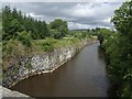
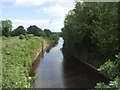
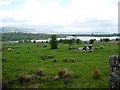
Crannog in Drumaleague Lough, excavated around 1900. Precise location uncertain, there are several possible sites on Google Earth aerials.
You may be viewing yesterday's version of this page. To see the most up to date information please register for a free account.
")
Do not use the above information on other web sites or publications without permission of the contributor.
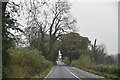
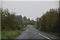
Nearby Images from Geograph Britain and Ireland:
©2010(licence)
©2022(licence)
©2022(licence)
©2010(licence)
©2007(licence)
The above images may not be of the site on this page, they are loaded from Geograph.
Please Submit an Image of this site or go out and take one for us!
Click here to see more info for this site
Nearby sites
Click here to view sites on an interactive map of the areaKey: Red: member's photo, Blue: 3rd party photo, Yellow: other image, Green: no photo - please go there and take one, Grey: site destroyed
Download sites to:
KML (Google Earth)
GPX (GPS waypoints)
CSV (Garmin/Navman)
CSV (Excel)
To unlock full downloads you need to sign up as a Contributory Member. Otherwise downloads are limited to 50 sites.
Turn off the page maps and other distractions
Nearby sites listing. In the following links * = Image available
9.5km E 85° Fenagh Beg* Portal Tomb
17.5km SSE 148° Druid's Altar (Clooncoe) Cist
18.2km NNW 335° Turlough Stone Row* Standing Stones (G935238)
21.9km ENE 70° Lissanover Stone Circle (H220150)
22.5km WNW 291° Shee Lugh* Chambered Cairn (G8029415486)
23.2km WNW 291° Carrickglass* Portal Tomb (G796157)
23.4km ENE 71° Kilnavert A Stone Circle (H235152)
23.4km ENE 71° Kilnavert B Stone Circle (H235152)
23.4km WNW 289° Cromleach Lodge* Chambered Tomb (G79181517)
24.1km ENE 69° Killycluggin Stone Circle (H239160)
24.8km ENE 72° Crom Cruaich Stone Circle (H250150)
25.0km WSW 258° Ballynanultagh* Portal Tomb (G76800237)
25.6km WNW 290° Heapstown Cairn* Chambered Cairn (G77251626)
25.6km W 280° Carrowkeel P Passage Grave (G760116)
25.7km W 280° Carrowkeel O Passage Grave (G759117)
26.0km W 279° Carrowkeel N Passage Grave (G756113)
26.1km W 279° Carrowkeel M Passage Grave (G755114)
26.3km W 280° Carrowkeel Cairn K* Chambered Cairn (G7533511726)
26.3km W 279° Carrowkeel L* Passage Grave (G753117)
26.3km W 280° Carrowkeel H* Passage Grave (G7530211863)
26.3km W 280° Carrowkeel Cairn G* Chambered Cairn (G7531111933)
26.4km W 280° Carrowkeel Cairn X* Cairn (G75251196)
26.5km W 280° Carrowkeel* Passage Grave (G75231206)
26.7km W 279° Carrowkeel F* Passage Grave (G749114)
26.7km W 279° Carrowkeel Cairn E* Court Tomb (G7492711606)
View more nearby sites and additional images


 We would like to know more about this location. Please feel free to add a brief description and any relevant information in your own language.
 Wir möchten mehr über diese Stätte erfahren. Bitte zögern Sie nicht, eine kurze Beschreibung und relevante Informationen in Deutsch hinzuzufügen.
 Nous aimerions en savoir encore un peu sur les lieux. S'il vous plaît n'hesitez pas à ajouter une courte description et tous les renseignements pertinents dans votre propre langue.
 Quisieramos informarnos un poco más de las lugares. No dude en añadir una breve descripción y otros datos relevantes en su propio idioma.