


<< Our Photo Pages >> Ben Rhydding (Ilkley) - Rock Art in England in Yorkshire (West)
Submitted by Anne T on Thursday, 25 January 2018 Page Views: 930
Rock ArtSite Name: Ben Rhydding (Ilkley) Alternative Name: ERA-2356; Boughey & Vickerman (331a); IAG331a; BR01Country: England County: Yorkshire (West) Type: Rock Art
Nearest Town: Ilkley
Map Ref: SE1337348050
Latitude: 53.928409N Longitude: 1.797828W
Condition:
| 5 | Perfect |
| 4 | Almost Perfect |
| 3 | Reasonable but with some damage |
| 2 | Ruined but still recognisable as an ancient site |
| 1 | Pretty much destroyed, possibly visible as crop marks |
| 0 | No data. |
| -1 | Completely destroyed |
| 5 | Superb |
| 4 | Good |
| 3 | Ordinary |
| 2 | Not Good |
| 1 | Awful |
| 0 | No data. |
| 5 | Can be driven to, probably with disabled access |
| 4 | Short walk on a footpath |
| 3 | Requiring a bit more of a walk |
| 2 | A long walk |
| 1 | In the middle of nowhere, a nightmare to find |
| 0 | No data. |
| 5 | co-ordinates taken by GPS or official recorded co-ordinates |
| 4 | co-ordinates scaled from a detailed map |
| 3 | co-ordinates scaled from a bad map |
| 2 | co-ordinates of the nearest village |
| 1 | co-ordinates of the nearest town |
| 0 | no data |
Be the first person to rate this site - see the 'Contribute!' box in the right hand menu.
Internal Links:
External Links:
 (PID:177721)")
This rock art panel was found in the garden of a private house at the northern perimeter of the former Ilkley Middle School, Ben Rhydding. It was moved to Manor House Museum in Ilkley. This museum has recently been closed to the public and fundraising plans are in place for it to be reopened as a community venture. It is not sure if this rock art panel is still in the museum or not, and I am trying to find out. This page will be updated once further information is known.
This panel is recorded as England's Rock Art entry for ERA-2356 Ben Rydding, which gives a description and includes photographs, a plan of the rock and its motifs, photogrammetry and a 3D model.
This rock is also described in Boughey & Vickerman's "Prehistoric Rock Art of the West Riding Supplement (2018)", pages 150 to 152 inclusive. The Supplement includes a photograph of the panel as it was in situ; a map showing the location of the carving at Ben Rhydding, an image of a wax rubbing, and a photograph of the rock as displayed in the museum. B&V adds: "(this is) a medium-sized fine gritstone boulder approx. 0.75m across by 0.67m high, part of the stone appears to have suffered recent damage, presumably by whatever mechanical device or means …. was responsible for transporting it from its 'original' location to where it had been dumped. The rock is a fragment of a larger boulder as the design clearly runs off its edge."
Note: Does anyone have any information on this rock art panel, or the timescale for the reopening of the museum? Thanks.
You may be viewing yesterday's version of this page. To see the most up to date information please register for a free account.
Do not use the above information on other web sites or publications without permission of the contributor.
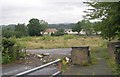
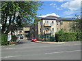
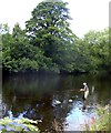
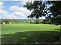
Nearby Images from Geograph Britain and Ireland:

©2023(licence)
©2008(licence)
©2014(licence)
©2011(licence)
©2014(licence)
The above images may not be of the site on this page, they are loaded from Geograph.
Please Submit an Image of this site or go out and take one for us!
Click here to see more info for this site
Nearby sites
Key: Red: member's photo, Blue: 3rd party photo, Yellow: other image, Green: no photo - please go there and take one, Grey: site destroyed
Download sites to:
KML (Google Earth)
GPX (GPS waypoints)
CSV (Garmin/Navman)
CSV (Excel)
To unlock full downloads you need to sign up as a Contributory Member. Otherwise downloads are limited to 50 sites.
Turn off the page maps and other distractions
Nearby sites listing. In the following links * = Image available
1.2km SSE 154° Gib Field 01 and 02 Rock Art (SE1392046950)
1.3km SSW 194° Cow and Calf Rocks* Rock Outcrop (SE1305646784)
1.4km SSW 203° Hanging Stone Rock* Rock Art (SE1282046762)
1.5km S 191° Cow and Calf 03* Rock Art (SE1310246613)
1.5km S 191° Cow and Calf 02* Rock Art (SE1309546602)
1.5km SSW 208° Hangingstone Rock 02 & 03* Rock Art (SE1267846747)
1.5km SSW 191° Cow and Calf 01* Rock Art (SE1308746601)
1.5km S 188° Cow and Calf 06* Rock Art (SE1317346585)
1.5km SW 214° Backstone Beck (Cowpasture Road) Rock Art (SE1254946814)
1.5km SSW 210° Hangingstones 01* Rock Art (SE1261446742)
1.5km SW 230° The Tarn 01 Rock Art (SE1220047070)
1.5km S 187° Cow and Calf 08* Rock Art (SE1318646514)
1.5km S 186° Cow and Calf 10* Rock Art (SE1322446507)
1.6km S 187° Cow and Calf 07* Rock Art (SE1317646498)
1.6km S 187° Cow and Calf 09* Rock Art (SE1319746490)
1.6km S 188° Cow and Calf 04* Rock Art (SE1317146489)
1.6km S 187° Cow and Calf 05* Rock Art (SE1317246486)
1.6km S 181° Cow and Calf* Rock Art (SE13354645)
1.6km SSW 205° Backstone Beck 02* Rock Art (SE1270946592)
1.7km SSW 196° Pancake Ridge 01a* Rock Art (SE1291746419)
1.7km SSW 194° The Planets* Rock Art (SE1296146396)
1.7km SSW 193° Pancake Ridge 02* Rock Art (SE1299146385)
1.7km W 263° All Saints (Ilkley)* Ancient Cross (SE1164547825)
1.8km S 172° Hangingstone Road 01* Rock Art (SE1362146315)
1.8km SSW 191° Haystack Rock* Rock Art (SE1302746309)
View more nearby sites and additional images


 We would like to know more about this location. Please feel free to add a brief description and any relevant information in your own language.
 Wir möchten mehr über diese Stätte erfahren. Bitte zögern Sie nicht, eine kurze Beschreibung und relevante Informationen in Deutsch hinzuzufügen.
 Nous aimerions en savoir encore un peu sur les lieux. S'il vous plaît n'hesitez pas à ajouter une courte description et tous les renseignements pertinents dans votre propre langue.
 Quisieramos informarnos un poco más de las lugares. No dude en añadir una breve descripción y otros datos relevantes en su propio idioma.