


<< Text Pages >> Pleasington Cemetery (Blackburn) - Cairn in England in Lancashire
Submitted by Anne T on Wednesday, 03 January 2018 Page Views: 2913
Neolithic and Bronze AgeSite Name: Pleasington Cemetery (Blackburn)Country: England
NOTE: This site is 2.651 km away from the location you searched for.
County: Lancashire Type: Cairn
Nearest Town: Blackburn
Map Ref: SD649272
Latitude: 53.739992N Longitude: 2.533628W
Condition:
| 5 | Perfect |
| 4 | Almost Perfect |
| 3 | Reasonable but with some damage |
| 2 | Ruined but still recognisable as an ancient site |
| 1 | Pretty much destroyed, possibly visible as crop marks |
| 0 | No data. |
| -1 | Completely destroyed |
| 5 | Superb |
| 4 | Good |
| 3 | Ordinary |
| 2 | Not Good |
| 1 | Awful |
| 0 | No data. |
| 5 | Can be driven to, probably with disabled access |
| 4 | Short walk on a footpath |
| 3 | Requiring a bit more of a walk |
| 2 | A long walk |
| 1 | In the middle of nowhere, a nightmare to find |
| 0 | No data. |
| 5 | co-ordinates taken by GPS or official recorded co-ordinates |
| 4 | co-ordinates scaled from a detailed map |
| 3 | co-ordinates scaled from a bad map |
| 2 | co-ordinates of the nearest village |
| 1 | co-ordinates of the nearest town |
| 0 | no data |
Be the first person to rate this site - see the 'Contribute!' box in the right hand menu.
Internal Links:
External Links:
Cairn in Lancashire
This tumulus is featured on The Northern Antiquarian (TNA) - see their entry for Pleasington Cemetery, Blackburn, Lancashire, which gives directions for finding this site, together with a brief archaeology & history.
TNA quotes from a 2009 article by John Dixon: "During the early spring of 1996, grave digger Grant Higson, whilst excavating a new grave, uncovered course fragments of pottery displaying a herringbone pattern and other material. Grant stopped work immediately and alerted Blackburn Museum worker Maggy Simms, who gathered together the shattered remains and brought in Lancaster University Archaeological Unit for identification. They identified the fragments to be a Bronze Age Urn some 12 inches in height, decorated with a herringbone pattern and containing bones and ashes of several cremations, some stained green by some copper object that had disintegrated over the years. The burial was assigned to c. 1500 BC, a period of history referred to as the Bronze Age. The urn and its contents are now held by Blackburn Museum. A geo-physical survey was undertaken by the Unit on the surrounding areas that displayed undulation of the ground surface but nothing was found, the undulations deemed natural features. No archaeological report or radiocarbon dating has been made to date by Blackburn Museum Service, the Lancaster University Archaeological Unit being now defunct ... Given the ‘sheltered’ location of the find I would ascribe the site as one of a primary domestic nature, the burial being a secondary feature, primary tumulus burials in prominent locations being the sole preserve of the ruling aristocracy. What we are looking at is a hearth burial within a communal living hut: following the Indo-European custom, the dead were given to the earth inside the human habitation. The dear departed, who had been so close to the family group in life, had to remain among them in death also and share the family’s joys and struggles, food and drink. While living they had enjoyed nightly rest under the roof of the communal hut, dead they slept the eternal slumber beneath the domestic heart."
Note: Have you visited this site? Have you seen the urn that was found? Do you have any photographs or information to contribute?
You may be viewing yesterday's version of this page. To see the most up to date information please register for a free account.
Do not use the above information on other web sites or publications without permission of the contributor.
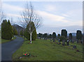
Nearby Images from Geograph Britain and Ireland:
©2012(licence)
©2012(licence)
©2013(licence)
©2008(licence)
©2022(licence)
The above images may not be of the site on this page, they are loaded from Geograph.
Please Submit an Image of this site or go out and take one for us!
Click here to see more info for this site
Nearby sites
Key: Red: member's photo, Blue: 3rd party photo, Yellow: other image, Green: no photo - please go there and take one, Grey: site destroyed
Download sites to:
KML (Google Earth)
GPX (GPS waypoints)
CSV (Garmin/Navman)
CSV (Excel)
To unlock full downloads you need to sign up as a Contributory Member. Otherwise downloads are limited to 50 sites.
Turn off the page maps and other distractions
Nearby sites listing. In the following links * = Image available
3.2km NE 36° Beardwood Holed Stone* Marker Stone (SD6684829793)
3.3km NE 49° Revidge Moor Barrow* Round Barrow(s) (SD674293)
3.9km N 4° Mellor Brow Mound* Misc. Earthwork (SD6517231081)
4.0km SSE 163° Norman Arch over Well Holy Well or Sacred Spring (SD6606023393)
4.3km SSE 167° Tocca's Stone* Ancient Cross (SD65842302)
6.3km NW 318° Marsden Well/Spring* Holy Well or Sacred Spring (SD607319)
7.4km SSE 168° Hollinshead Holy Well* Holy Well or Sacred Spring (SD66361994)
7.8km N 360° St Wilfrid's Church (Ribchester)* Ancient Cross (SD649350)
7.9km SE 143° White Hall* Round Barrow(s) (SD696208)
7.9km SW 233° St Helen's Well (Whittle-le-Woods) Holy Well or Sacred Spring (SD58552242)
8.1km WSW 246° Hawksclough Hillfort (SD574240)
8.8km N 3° St Saviour's Churchyard (Stydd) Ancient Cross (SD6539435971)
9.0km SSW 198° Black Coppice Chambered Cairn* Chambered Cairn (SD621186)
9.1km S 187° Round Loaf* Artificial Mound (SD638182)
9.1km E 101° Cocker Cobb* Stone Circle (SD7385225360)
10.2km SSW 192° Pikestones* Chambered Cairn (SD62691719)
10.9km NNW 348° The Written Stone* Sculptured Stone (SD6262237892)
11.1km W 280° Minspit Well (Preston) Holy Well or Sacred Spring (SD540293)
11.3km NW 304° Our Lady's Well, Fernyhalgh* Holy Well or Sacred Spring (SD55613362)
11.4km NNE 25° Billington Round Barrow(s) (SD699375)
11.6km SW 220° Astley Hall Farm Bronze Age Burial Round Barrow(s) (SD574183)
11.7km NNE 30° Winckley Lowe II* Round Barrow(s) (SD7084937308)
11.7km NNE 29° Winckley Lowe I* Round Barrow(s) (SD7064337457)
12.1km ESE 104° Thirteen Stone Hill* Stone Circle (SD7665324273)
12.2km S 181° Noon Hill Slack* Cairn (SD64691499)
View more nearby sites and additional images


 We would like to know more about this location. Please feel free to add a brief description and any relevant information in your own language.
 Wir möchten mehr über diese Stätte erfahren. Bitte zögern Sie nicht, eine kurze Beschreibung und relevante Informationen in Deutsch hinzuzufügen.
 Nous aimerions en savoir encore un peu sur les lieux. S'il vous plaît n'hesitez pas à ajouter une courte description et tous les renseignements pertinents dans votre propre langue.
 Quisieramos informarnos un poco más de las lugares. No dude en añadir una breve descripción y otros datos relevantes en su propio idioma.