

<< Our Photo Pages >> Winckley Lowe I - Round Barrow(s) in England in Lancashire
Submitted by LivingRocks on Wednesday, 23 March 2005 Page Views: 5546
Neolithic and Bronze AgeSite Name: Winckley Lowe I Alternative Name: Winckley MoundsCountry: England County: Lancashire Type: Round Barrow(s)
Nearest Town: Whalley Nearest Village: Hurst Green
Map Ref: SD7064337457
Latitude: 53.832535N Longitude: 2.447542W
Condition:
| 5 | Perfect |
| 4 | Almost Perfect |
| 3 | Reasonable but with some damage |
| 2 | Ruined but still recognisable as an ancient site |
| 1 | Pretty much destroyed, possibly visible as crop marks |
| 0 | No data. |
| -1 | Completely destroyed |
| 5 | Superb |
| 4 | Good |
| 3 | Ordinary |
| 2 | Not Good |
| 1 | Awful |
| 0 | No data. |
| 5 | Can be driven to, probably with disabled access |
| 4 | Short walk on a footpath |
| 3 | Requiring a bit more of a walk |
| 2 | A long walk |
| 1 | In the middle of nowhere, a nightmare to find |
| 0 | No data. |
| 5 | co-ordinates taken by GPS or official recorded co-ordinates |
| 4 | co-ordinates scaled from a detailed map |
| 3 | co-ordinates scaled from a bad map |
| 2 | co-ordinates of the nearest village |
| 1 | co-ordinates of the nearest town |
| 0 | no data |
Internal Links:
External Links:
I have visited· I would like to visit
SumDoood would like to visit
")
This bowl barrow is scheduled as Historic England List ID 1008908, which tells us the monument is 250m north of Hacking Boat House [note this is now a private house]. The 1894 excavation has left a hollow "approximately 9m in diameter and 1.7m deep at the monument's centre and a `tail' or spread of excavated material on the barrow's south west side". The barrow is also recorded as Pastscape Monument No. 44478.
The Journal of Antiquities also includes an entry for the Winckley Lowes I, Near Hurst Green, Lancashire, which includes photographs, directions for finding this grass covered burial mound near the ancient natural ford at Jumbles Rocks, plus a list of reference sources for more information.
You may be viewing yesterday's version of this page. To see the most up to date information please register for a free account.
")
Do not use the above information on other web sites or publications without permission of the contributor.
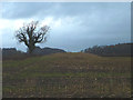
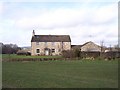
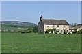
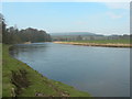
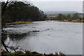
Nearby Images from Geograph Britain and Ireland:
©2013(licence)
©2011(licence)
©2009(licence)
©2012(licence)
©2016(licence)
The above images may not be of the site on this page, they are loaded from Geograph.
Please Submit an Image of this site or go out and take one for us!
Click here to see more info for this site
Nearby sites
Key: Red: member's photo, Blue: 3rd party photo, Yellow: other image, Green: no photo - please go there and take one, Grey: site destroyed
Download sites to:
KML (Google Earth)
GPX (GPS waypoints)
CSV (Garmin/Navman)
CSV (Excel)
To unlock full downloads you need to sign up as a Contributory Member. Otherwise downloads are limited to 50 sites.
Turn off the page maps and other distractions
Nearby sites listing. In the following links * = Image available
254m SE 126° Winckley Lowe II* Round Barrow(s) (SD7084937308)
742m W 273° Billington Round Barrow(s) (SD699375)
1.8km NNE 31° The Great Mitton Cross* Ancient Cross (SD7156438954)
2.2km NNE 15° Mitton Green Cross (Great Mitton) Ancient Cross (SD7121739613)
2.9km ESE 116° Whalley Crosses* Ancient Cross (SD73263616)
3.0km ESE 117° St Mary and All Saints Church (Whalley)* Sculptured Stone (SD733361)
3.0km E 98° High Wall Well (Bramley Meade)* Holy Well or Sacred Spring (SD73663702)
3.2km N 359° Withgill Cross (Great Mitton) Ancient Cross (SD70604062)
3.6km NW 326° Kemple End Cross* Ancient Cross (SD6864240438)
3.9km E 92° Wisa's Well (Wiswell)* Holy Well or Sacred Spring (SD746373)
4.4km ESE 116° Portfield* Hillfort (SD7458135499)
5.3km E 86° Jeppe Knave's Grave* Cairn (SD75993782)
5.4km WSW 254° St Saviour's Churchyard (Stydd) Ancient Cross (SD6539435971)
6.0km NNE 30° Peg o'Nell's Well* Holy Well or Sacred Spring (SD73684266)
6.2km WSW 246° St Wilfrid's Church (Ribchester)* Ancient Cross (SD649350)
6.6km E 82° Coffin Stone (Sabden) Standing Stone (Menhir) (SD77173830)
6.6km NNE 18° Pinder Hill (Waddington) Cairn (SD72724370)
6.7km E 81° Solar Wheel Year Stone (Sabden) Rock Art (SD77323846)
6.8km WNW 296° Thornley Hall Fell Cairn* Round Barrow(s) (SD64524047)
6.9km WNW 295° Jeffrey Hill Cairn Circle* Cairn (SD644404)
7.1km E 101° Simon's Cross (Padiham)* Ancient Cross (SD77603609)
7.3km ENE 77° Lower Apronful of Stones (Pendle Hill) Cairn (SD778390)
7.5km ENE 75° Devil's Apronful (Pendle Hill) Cairn (SD779393)
7.9km ENE 74° Badger Wells Cairn Cairn (SD783396)
8.0km W 273° The Written Stone* Sculptured Stone (SD6262237892)
View more nearby sites and additional images


 We would like to know more about this location. Please feel free to add a brief description and any relevant information in your own language.
 Wir möchten mehr über diese Stätte erfahren. Bitte zögern Sie nicht, eine kurze Beschreibung und relevante Informationen in Deutsch hinzuzufügen.
 Nous aimerions en savoir encore un peu sur les lieux. S'il vous plaît n'hesitez pas à ajouter une courte description et tous les renseignements pertinents dans votre propre langue.
 Quisieramos informarnos un poco más de las lugares. No dude en añadir una breve descripción y otros datos relevantes en su propio idioma.