


<< Text Pages >> Nanny's Well (Chapel le Frith) - Holy Well or Sacred Spring in England in Derbyshire
Submitted by Anne T on Wednesday, 06 December 2017 Page Views: 1747
Springs and Holy WellsSite Name: Nanny''s Well (Chapel le Frith)Country: England
NOTE: This site is 0.931 km away from the location you searched for.
County: Derbyshire Type: Holy Well or Sacred Spring
Nearest Town: Chapel le Frith
Map Ref: SK061810
Latitude: 53.325886N Longitude: 1.909878W
Condition:
| 5 | Perfect |
| 4 | Almost Perfect |
| 3 | Reasonable but with some damage |
| 2 | Ruined but still recognisable as an ancient site |
| 1 | Pretty much destroyed, possibly visible as crop marks |
| 0 | No data. |
| -1 | Completely destroyed |
| 5 | Superb |
| 4 | Good |
| 3 | Ordinary |
| 2 | Not Good |
| 1 | Awful |
| 0 | No data. |
| 5 | Can be driven to, probably with disabled access |
| 4 | Short walk on a footpath |
| 3 | Requiring a bit more of a walk |
| 2 | A long walk |
| 1 | In the middle of nowhere, a nightmare to find |
| 0 | No data. |
| 5 | co-ordinates taken by GPS or official recorded co-ordinates |
| 4 | co-ordinates scaled from a detailed map |
| 3 | co-ordinates scaled from a bad map |
| 2 | co-ordinates of the nearest village |
| 1 | co-ordinates of the nearest town |
| 0 | no data |
Be the first person to rate this site - see the 'Contribute!' box in the right hand menu.
Internal Links:
External Links:
Holy Well or Sacred Spring in Derbyshire
The Northern Antiquarian (TNA) features a page for this holy well - see their entry for Nanny’s Well, Chapel le Frith, Derbyshire, which gives directions for finding this well and related pump, together with photographs, a description and local folklore.
TNA adds: "The site is now an iron pump (plus a slab with a plaque) by the side of Crossings Road, known as Nanny Well Road, enclosed in a low wall along which. The pump no longer works and the well capped but it can be heard and just about seen through a crack beneath ... The site is one of four wells dressed annually since the 1980s in July and the site is blessed."
Note: Have you visited this site? Do you have any photographs or information to add?
You may be viewing yesterday's version of this page. To see the most up to date information please register for a free account.
Do not use the above information on other web sites or publications without permission of the contributor.
Nearby Images from Geograph Britain and Ireland:
©2011(licence)
©2018(licence)
©2018(licence)
©2012(licence)
©2012(licence)
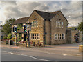
The above images may not be of the site on this page, they are loaded from Geograph.
Please Submit an Image of this site or go out and take one for us!
Click here to see more info for this site
Nearby sites
Key: Red: member's photo, Blue: 3rd party photo, Yellow: other image, Green: no photo - please go there and take one, Grey: site destroyed
Download sites to:
KML (Google Earth)
GPX (GPS waypoints)
CSV (Garmin/Navman)
CSV (Excel)
To unlock full downloads you need to sign up as a Contributory Member. Otherwise downloads are limited to 50 sites.
Turn off the page maps and other distractions
Nearby sites listing. In the following links * = Image available
397m WSW 243° St Thomas Becket (Chapel en le Frith)* Ancient Cross (SK0574580820)
1.5km WSW 259° Nanny Well* Holy Well or Sacred Spring (SK046807)
1.8km ENE 68° Mag Low* Round Barrow(s) (SK078817)
2.4km S 170° Cow Low* Round Barrow(s) (SK0653378666)
2.6km SSW 196° Castle Naze* Hillfort (SK054785)
2.6km ENE 61° Ford Hall Cairn (SK084823)
2.7km ESE 119° Ebbing and Flowing Well (Chapel)* Holy Well or Sacred Spring (SK08437972)
2.9km S 171° Lady Low Barrow* Round Cairn (SK06537818)
3.0km NE 49° Green Low ringcairn* Ring Cairn (SK084830)
3.3km SSE 148° Bullring* Henge (SK07857824)
3.7km NW 315° Chinley Churn Barrow Round Barrow(s) (SK035836)
3.7km E 96° Harrod Low* Long Barrow (SK098806)
4.1km WSW 248° Ladder Hill* Ring Cairn (SK0230579434)
4.2km N 353° Mount Famine burial cist* Cist (SK056852)
4.6km WSW 253° The Shall Cross* Ancient Cross (SK0165579615)
4.8km E 88° Perryfoot Long Barrow (SK109812)
4.8km N 353° Coldwell Clough Anglo Saxon cross Ancient Cross (SK055858)
5.0km N 354° Fog Field Well* Holy Well or Sacred Spring (SK05578602)
5.3km N 352° White Lady standing stone* Standing Stone (Menhir) (SK0534286250)
5.3km NNE 18° Edale Cross* Ancient Cross (SK0772586092)
5.4km E 89° Eldon Hill* Round Barrow(s) (SK11568114)
5.7km ENE 64° The Lords Seat* Round Barrow(s) (SK112835)
5.8km NNE 12° Kinderlow Bowl Barrow* Round Barrow(s) (SK073867)
5.8km N 354° Tunstead Clough* Ancient Village or Settlement (SK055868)
5.9km E 90° Eldon Hill 2* Round Barrow(s) (SK12028099)
View more nearby sites and additional images


 We would like to know more about this location. Please feel free to add a brief description and any relevant information in your own language.
 Wir möchten mehr über diese Stätte erfahren. Bitte zögern Sie nicht, eine kurze Beschreibung und relevante Informationen in Deutsch hinzuzufügen.
 Nous aimerions en savoir encore un peu sur les lieux. S'il vous plaît n'hesitez pas à ajouter une courte description et tous les renseignements pertinents dans votre propre langue.
 Quisieramos informarnos un poco más de las lugares. No dude en añadir una breve descripción y otros datos relevantes en su propio idioma.