


<< Our Photo Pages >> New Church - Standing Stone (Menhir) in Wales in Anglesey (Sir Ynys Mon)
Submitted by RustyLi on Monday, 24 March 2003 Page Views: 5158
Neolithic and Bronze AgeSite Name: New ChurchCountry: Wales
NOTE: This site is 0.158 km away from the location you searched for.
County: Anglesey (Sir Ynys Mon) Type: Standing Stone (Menhir)
Nearest Town: Holyhead Nearest Village: Llantrisant
Map Ref: SH363837 Landranger Map Number: 114
Latitude: 53.324833N Longitude: 4.459356W
Condition:
| 5 | Perfect |
| 4 | Almost Perfect |
| 3 | Reasonable but with some damage |
| 2 | Ruined but still recognisable as an ancient site |
| 1 | Pretty much destroyed, possibly visible as crop marks |
| 0 | No data. |
| -1 | Completely destroyed |
| 5 | Superb |
| 4 | Good |
| 3 | Ordinary |
| 2 | Not Good |
| 1 | Awful |
| 0 | No data. |
| 5 | Can be driven to, probably with disabled access |
| 4 | Short walk on a footpath |
| 3 | Requiring a bit more of a walk |
| 2 | A long walk |
| 1 | In the middle of nowhere, a nightmare to find |
| 0 | No data. |
| 5 | co-ordinates taken by GPS or official recorded co-ordinates |
| 4 | co-ordinates scaled from a detailed map |
| 3 | co-ordinates scaled from a bad map |
| 2 | co-ordinates of the nearest village |
| 1 | co-ordinates of the nearest town |
| 0 | no data |
Internal Links:
External Links:
I have visited· I would like to visit
RustyLi visited on 12th Jul 2023 - their rating: Cond: 4 Amb: 2 Access: 1 In the corner of a field behind houses right up against a fence and trees which spoils the ambience somewhat, would probably have been significantly different prior to the houses being built.
The stone can be viewed best from the gate on the "main" road.
Triangular shaped and partially covered with the usual Anglesey lichen. Probably about 6' tall.
Picture(s) to follow as only had 35mm camera with me so I need to get them developed! 😁
")
In the corner of a field behind houses right up against a fence and trees which spoils the ambience somewhat, would probably have been significantly different prior to the houses being built.
Page originally by Vicky.
You may be viewing yesterday's version of this page. To see the most up to date information please register for a free account.
")
Do not use the above information on other web sites or publications without permission of the contributor.
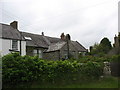
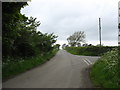
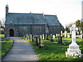
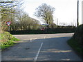
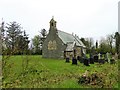
Nearby Images from Geograph Britain and Ireland:
©2009(licence)
©2009(licence)
©2006(licence)
©2006(licence)
©2017(licence)
The above images may not be of the site on this page, they are loaded from Geograph.
Please Submit an Image of this site or go out and take one for us!
Click here to see more info for this site
Nearby sites
Key: Red: member's photo, Blue: 3rd party photo, Yellow: other image, Green: no photo - please go there and take one, Grey: site destroyed
Download sites to:
KML (Google Earth)
GPX (GPS waypoints)
CSV (Garmin/Navman)
CSV (Excel)
To unlock full downloads you need to sign up as a Contributory Member. Otherwise downloads are limited to 50 sites.
Turn off the page maps and other distractions
Nearby sites listing. In the following links * = Image available
1.3km N 350° Bedd Branwen* Ring Cairn (SH3611184978)
2.1km NNE 13° Bod Deiniol* Standing Stone (Menhir) (SH3683285739)
2.3km WSW 255° Tre-Gwehelydd* Standing Stone (Menhir) (SH34068318)
2.7km WNW 301° Llynnon Mill and Iron Age Settlement* Museum (SH340852)
3.1km SE 143° Maen Llechgynfarwy* Standing Stone (Menhir) (SH38108116)
3.2km SSW 207° Presaddfed* Chambered Tomb (SH34768089)
3.5km E 99° Carmel Standing Stone* Standing Stone (Menhir) (SH39798304)
3.7km NNE 22° St Pabo's Church Memorial Stone* Early Christian Sculptured Stone (SH378871)
4.9km ESE 102° Mynydd Mwyn Mawr standing stones* Standing Stones (SH41058256)
5.1km WNW 299° Soar Stone* Standing Stone (Menhir) (SH3192286327)
5.1km WSW 239° Shop Farm* Standing Stone (Menhir) (SH3180581223)
6.4km E 81° Bedd y Foel* Burial Chamber or Dolmen (SH42698444)
6.6km NNE 27° Maen y Goges* Natural Stone / Erratic / Other Natural Feature (SH39518948)
7.1km ENE 70° Bryn Dyfrydog* Standing Stone (Menhir) (SH431859)
7.2km ENE 72° Maen Chwyf* Natural Stone / Erratic / Other Natural Feature (SH43268574)
7.3km NNW 334° Pen Yr Orsedd* Standing Stone (Menhir) (SH3334190391)
7.3km E 83° Llwydiarth Esgob Stone* Rock Art (SH436844)
7.5km NNW 335° Pen yr Orsedd 2* Standing Stone (Menhir) (SH33399062)
7.8km NNE 31° Bodewryd* Standing Stone (Menhir) (SH406902)
7.9km NNW 348° Caerdegog Uchaf* Modern Stone Circle etc (SH349915)
7.9km SSE 168° A55 Erratic* Natural Stone / Erratic / Other Natural Feature (SH3774475886)
8.0km N 3° Llanfechell 2* Standing Stone (Menhir) (SH3699291640)
8.0km N 359° Llanfechell 1* Standing Stones (SH3639791688)
8.3km E 84° Carreg Leidr* Standing Stone (Menhir) (SH446843)
8.3km N 356° Foel Fawr (Anglesey)* Chambered Tomb (SH3604692003)
View more nearby sites and additional images


 We would like to know more about this location. Please feel free to add a brief description and any relevant information in your own language.
 Wir möchten mehr über diese Stätte erfahren. Bitte zögern Sie nicht, eine kurze Beschreibung und relevante Informationen in Deutsch hinzuzufügen.
 Nous aimerions en savoir encore un peu sur les lieux. S'il vous plaît n'hesitez pas à ajouter une courte description et tous les renseignements pertinents dans votre propre langue.
 Quisieramos informarnos un poco más de las lugares. No dude en añadir una breve descripción y otros datos relevantes en su propio idioma.