


<< Our Photo Pages >> St Pancras Well - Holy Well or Sacred Spring in England in Lincolnshire
Submitted by HOLYWELL on Sunday, 27 February 2011 Page Views: 4868
Springs and Holy WellsSite Name: St Pancras WellCountry: England
NOTE: This site is 1.6 km away from the location you searched for.
County: Lincolnshire Type: Holy Well or Sacred Spring
Nearest Village: Scampton
Map Ref: SK954785
Latitude: 53.294880N Longitude: 0.570151W
Condition:
| 5 | Perfect |
| 4 | Almost Perfect |
| 3 | Reasonable but with some damage |
| 2 | Ruined but still recognisable as an ancient site |
| 1 | Pretty much destroyed, possibly visible as crop marks |
| 0 | No data. |
| -1 | Completely destroyed |
| 5 | Superb |
| 4 | Good |
| 3 | Ordinary |
| 2 | Not Good |
| 1 | Awful |
| 0 | No data. |
| 5 | Can be driven to, probably with disabled access |
| 4 | Short walk on a footpath |
| 3 | Requiring a bit more of a walk |
| 2 | A long walk |
| 1 | In the middle of nowhere, a nightmare to find |
| 0 | No data. |
| 5 | co-ordinates taken by GPS or official recorded co-ordinates |
| 4 | co-ordinates scaled from a detailed map |
| 3 | co-ordinates scaled from a bad map |
| 2 | co-ordinates of the nearest village |
| 1 | co-ordinates of the nearest town |
| 0 | no data |
Internal Links:
External Links:
")
Considering its associations probably had an ancient pre-Christian origin. A Roman villa was discovered in 1795 in a field south-east of the village. Amongst the considerable amount of Roman antiquities were discovered remains in stone coffins placed east-west. This suggests a Christian burial either at the time of the villa or rather upon its remains. This suggests that a chapel was placed here and that this was likely to be dedicated to St Pancras. Local traditions suggests that there was a well dedicated to the saint nearby which existed certainly in the twelfth century. The spring was said to be a chalybeate spring one but is now lost. The site is marked on the first OS as site of, nothing now remains but a reservoir is located nearby.
You may be viewing yesterday's version of this page. To see the most up to date information please register for a free account.
")
Do not use the above information on other web sites or publications without permission of the contributor.
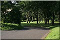
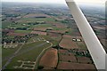
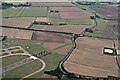
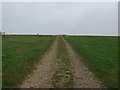
Nearby Images from Geograph Britain and Ireland:

©2013(licence)
©2009(licence)
©2019(licence)
©2019(licence)
©2014(licence)
The above images may not be of the site on this page, they are loaded from Geograph.
Please Submit an Image of this site or go out and take one for us!
Click here to see more info for this site
Nearby sites
Key: Red: member's photo, Blue: 3rd party photo, Yellow: other image, Green: no photo - please go there and take one, Grey: site destroyed
Download sites to:
KML (Google Earth)
GPX (GPS waypoints)
CSV (Garmin/Navman)
CSV (Excel)
To unlock full downloads you need to sign up as a Contributory Member. Otherwise downloads are limited to 50 sites.
Turn off the page maps and other distractions
Nearby sites listing. In the following links * = Image available
3.6km SE 130° Riseholme Barrow* Round Barrow(s) (SK98177624)
6.1km WSW 256° South Ingleby Tumulus Misc. Earthwork (SK8946576860)
6.9km SSE 162° Roman Lincoln Ancient Village or Settlement (SK976720)
7.3km SSE 163° Lincoln Museum* Museum (SK9771471547)
8.9km SSE 147° Lincoln Greetwell Henge/disc barrow* Barrow Cemetery (TF00407110)
9.6km S 176° Lincoln stone circle* Modern Stone Circle etc (SK962689)
10.0km SE 141° Washingborough Ancient Settlement* Ancient Village or Settlement (TF019709)
11.4km N 2° Aisthorpe springs Holy Well or Sacred Spring (SK956899)
11.5km NNE 15° Newell's Well (Glentham) Holy Well or Sacred Spring (SK981897)
11.8km SE 127° Fiskerton Iron Age causeway* Ancient Village or Settlement (TF05007159)
12.8km N 351° St. Helen's Well (Hemswell)* Holy Well or Sacred Spring (SK932911)
14.4km ESE 112° Barlings Well* Holy Well or Sacred Spring (TF08937347)
14.7km ENE 72° Wickenby Ancient Village or Settlement (TF0928883432)
19.3km SW 223° Besthorpe Ancient Village or Settlement (SK825641)
19.5km WSW 256° Kingshaugh* Hillfort (SK765735)
20.1km N 356° Ashwell* Holy Well or Sacred Spring (SK936985)
20.5km W 270° Lady well (Headon)* Holy Well or Sacred Spring (SK7483877954)
21.3km W 277° Castle Hill (Nottinghamshire) Hillfort (SK741806)
22.0km WSW 252° Holy well (Tuxford) Holy Well or Sacred Spring (SK745714)
23.0km NE 54° Walesby All Saints church carvings* Sculptured Stone (TF1382892388)
23.2km WNW 282° St John's Well (Welham) Holy Well or Sacred Spring (SK72558280)
23.4km SSW 212° Langford, Brough and Glebe Farm sites on the A46* Ancient Village or Settlement (SK833584)
23.9km WSW 250° Holy well ( Tuxford ) Holy Well or Sacred Spring (SK7370)
24.7km NNE 23° The Maiden-Well Holy Well or Sacred Spring (TA045015)
24.8km NNE 23° Maiden Well (Maidenwell) Holy Well or Sacred Spring (TA047015)
View more nearby sites and additional images


 We would like to know more about this location. Please feel free to add a brief description and any relevant information in your own language.
 Wir möchten mehr über diese Stätte erfahren. Bitte zögern Sie nicht, eine kurze Beschreibung und relevante Informationen in Deutsch hinzuzufügen.
 Nous aimerions en savoir encore un peu sur les lieux. S'il vous plaît n'hesitez pas à ajouter une courte description et tous les renseignements pertinents dans votre propre langue.
 Quisieramos informarnos un poco más de las lugares. No dude en añadir una breve descripción y otros datos relevantes en su propio idioma.