


<< Our Photo Pages >> Monyash Round Barrow 1 - Round Barrow(s) in England in Derbyshire
Submitted by twentytrees on Monday, 13 February 2006 Page Views: 4835
Neolithic and Bronze AgeSite Name: Monyash Round Barrow 1Country: England
NOTE: This site is 1.1 km away from the location you searched for.
County: Derbyshire Type: Round Barrow(s)
Nearest Town: Buxton Nearest Village: Monyash
Map Ref: SK148672
Latitude: 53.201672N Longitude: 1.779897W
Condition:
| 5 | Perfect |
| 4 | Almost Perfect |
| 3 | Reasonable but with some damage |
| 2 | Ruined but still recognisable as an ancient site |
| 1 | Pretty much destroyed, possibly visible as crop marks |
| 0 | No data. |
| -1 | Completely destroyed |
| 5 | Superb |
| 4 | Good |
| 3 | Ordinary |
| 2 | Not Good |
| 1 | Awful |
| 0 | No data. |
| 5 | Can be driven to, probably with disabled access |
| 4 | Short walk on a footpath |
| 3 | Requiring a bit more of a walk |
| 2 | A long walk |
| 1 | In the middle of nowhere, a nightmare to find |
| 0 | No data. |
| 5 | co-ordinates taken by GPS or official recorded co-ordinates |
| 4 | co-ordinates scaled from a detailed map |
| 3 | co-ordinates scaled from a bad map |
| 2 | co-ordinates of the nearest village |
| 1 | co-ordinates of the nearest town |
| 0 | no data |
Internal Links:
External Links:
")
North of Monyash take the track which heads west by Dalehouse Farm. The barrow is clearly visible in the second field on the right. The barrow is around 1m at its highest point and around 10m in diameter.
Looking north-west Chelmorton Low with its two round barrows at the western end of the ridge at which Five Wells chambered cairn is located on the eastern end. Looking SSW Arbor Low is probably visible - needs confirmation.
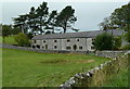
A second barrow (SK146675) is located nearby - continue up the path to a point where five paths meet by a derelict barn. The barrow is located 380m ene at the highpoinit of the fields where two walls cross - difficult to spot.
Both are shown as Tumulus on the OS map but not listed in http://www.peakdistrict.gov.uk/appendix8.htm which is reliable.
You may be viewing yesterday's version of this page. To see the most up to date information please register for a free account.
")
Do not use the above information on other web sites or publications without permission of the contributor.
Nearby Images from Geograph Britain and Ireland:

©2026(licence)

©2019(licence)

©2011(licence)
©2011(licence)

©2011(licence)
The above images may not be of the site on this page, they are loaded from Geograph.
Please Submit an Image of this site or go out and take one for us!
Click here to see more info for this site
Nearby sites
Key: Red: member's photo, Blue: 3rd party photo, Yellow: other image, Green: no photo - please go there and take one, Grey: site destroyed
Download sites to:
KML (Google Earth)
GPX (GPS waypoints)
CSV (Garmin/Navman)
CSV (Excel)
To unlock full downloads you need to sign up as a Contributory Member. Otherwise downloads are limited to 50 sites.
Turn off the page maps and other distractions
Nearby sites listing. In the following links * = Image available
360m NNW 327° Monyash Round Barrow 2 Round Barrow(s) (SK146675)
2.2km ESE 111° Ringham Low* Chambered Cairn (SK169664)
2.8km NE 50° Sheldon 1 (Derbyshire)* Round Barrow(s) (SK16926898)
2.9km NE 45° Sheldon 2 (Derbyshire) Round Barrow(s) (SK16836925)
2.9km ESE 123° One Ash Shelter* Cave or Rock Shelter (SK17266559)
3.0km S 184° Benty Grange Barrow* Barrow Cemetery (SK1461064220)
3.2km N 357° Taddington Barrow* Round Barrow(s) (SK146704)
3.4km SSE 147° Cales Dale* Round Barrow(s) (SK16636437)
3.4km ENE 65° Sheldon Henge* Henge (SK1788068650)
3.5km E 82° Bole Hill Bowl Barrow* Round Barrow(s) (SK18286771)
3.5km WSW 255° Cronkston Low* Round Barrow(s) (SK114663)
3.6km N 354° Taddington High Well* Holy Well or Sacred Spring (SK1442470824)
3.8km SSW 197° Custard Field Farm* Round Barrow(s) (SK137636)
3.8km NW 309° Chelmorton 2 Bowl Barrow* Round Barrow(s) (SK11866956)
3.8km SSE 162° Arbor Low 1* Stone Circle (SK16036355)
3.9km NNE 33° Demons Dale Cave* Cave or Rock Shelter (SK16897045)
3.9km SSE 162° Arbor Low Earthwork* Multiple Stone Rows / Avenue (SK16026350)
4.0km NE 47° Skinner's Well* Holy Well or Sacred Spring (SK177699)
4.0km N 350° Taddington Cross* Ancient Cross (SK141711)
4.0km SSE 167° Arbor Low 2* Henge (SK157633)
4.0km SSE 165° Gib Hill* Long Barrow (SK15826332)
4.0km ESE 117° Calling Low Dale* Cave or Rock Shelter (SK184654)
4.1km S 186° Parsley Hay* Round Cairn (SK144631)
4.1km SSE 165° Gib Hill Plantation* Misc. Earthwork (SK15876322)
4.4km WNW 297° Nether Low* Round Barrow(s) (SK10896917)
View more nearby sites and additional images


 We would like to know more about this location. Please feel free to add a brief description and any relevant information in your own language.
 Wir möchten mehr über diese Stätte erfahren. Bitte zögern Sie nicht, eine kurze Beschreibung und relevante Informationen in Deutsch hinzuzufügen.
 Nous aimerions en savoir encore un peu sur les lieux. S'il vous plaît n'hesitez pas à ajouter une courte description et tous les renseignements pertinents dans votre propre langue.
 Quisieramos informarnos un poco más de las lugares. No dude en añadir una breve descripción y otros datos relevantes en su propio idioma.