


<< Our Photo Pages >> Dewa Roman Experience - Museum in England in Cheshire
Submitted by TimPrevett on Monday, 30 August 2004 Page Views: 10127
MuseumsSite Name: Dewa Roman ExperienceCountry: England County: Cheshire Type: Museum
Nearest Town: Chester
Map Ref: SJ405663
Latitude: 53.190444N Longitude: 2.891963W
Condition:
| 5 | Perfect |
| 4 | Almost Perfect |
| 3 | Reasonable but with some damage |
| 2 | Ruined but still recognisable as an ancient site |
| 1 | Pretty much destroyed, possibly visible as crop marks |
| 0 | No data. |
| -1 | Completely destroyed |
| 5 | Superb |
| 4 | Good |
| 3 | Ordinary |
| 2 | Not Good |
| 1 | Awful |
| 0 | No data. |
| 5 | Can be driven to, probably with disabled access |
| 4 | Short walk on a footpath |
| 3 | Requiring a bit more of a walk |
| 2 | A long walk |
| 1 | In the middle of nowhere, a nightmare to find |
| 0 | No data. |
| 5 | co-ordinates taken by GPS or official recorded co-ordinates |
| 4 | co-ordinates scaled from a detailed map |
| 3 | co-ordinates scaled from a bad map |
| 2 | co-ordinates of the nearest village |
| 1 | co-ordinates of the nearest town |
| 0 | no data |
Internal Links:
External Links:
I have visited· I would like to visit
TimPrevett has visited here
")
The collection is in one display panel late in the tour of the site, consisting of an axe head, palstave, spear head, votive head, several coins and brooches, among a few other items.
Obviously the attraction primarily focuses on Roman archaeology, mostly in Chester.
It also provides an excellent overview of basic archaeological practices, and shows very clearly the stratification of layers of human activity over time with previous excavations under the site being accessible.
A visit is indeed an 'experience' consisting of sights, smells, sounds, and a very good 'hands on' room for children and adults. The smells made national news in January 2003 when a new variety for the Roman latrine actually made several school children vomit! The smell concerned has since been lessened.
There are charges for admission.
Dewa Roman Experience
Pierpoint Lane
off Bridge Street
Chester CH1 1NL
Telephone: 01244 343407
Open all year round except Christmas Day & Boxing Day.
Visit their website for more information.
You may be viewing yesterday's version of this page. To see the most up to date information please register for a free account.
Do not use the above information on other web sites or publications without permission of the contributor.
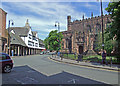
Nearby Images from Geograph Britain and Ireland:
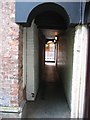
©2007(licence)
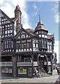
©2008(licence)
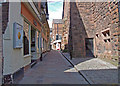
©2008(licence)
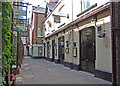
©2008(licence)
©2008(licence)
The above images may not be of the site on this page, they are loaded from Geograph.
Please Submit an Image of this site or go out and take one for us!
Click here to see more info for this site
Nearby sites
Key: Red: member's photo, Blue: 3rd party photo, Yellow: other image, Green: no photo - please go there and take one, Grey: site destroyed
Download sites to:
KML (Google Earth)
GPX (GPS waypoints)
CSV (Garmin/Navman)
CSV (Excel)
To unlock full downloads you need to sign up as a Contributory Member. Otherwise downloads are limited to 50 sites.
Turn off the page maps and other distractions
Nearby sites listing. In the following links * = Image available
28m SE 130° Chester High Cross* Ancient Cross (SJ4052166282)
74m ESE 104° Edinburgh Woollen Mill Hypocaust* Museum (SJ4057266281)
284m ESE 118° South East Angle Tower of Legionary Fortress* Stone Fort or Dun (SJ4075166165)
352m S 186° Grosvenor Museum* Museum (SJ40466595)
358m ESE 112° Roman Amphitheatre (Chester)* Ancient Palace (SJ4083066160)
362m SE 129° Roman Garden & Hypocaust (Chester)* Ancient Village or Settlement (SJ4078066070)
443m ESE 112° St John the Baptist Church, Chester* Ancient Cross (SJ40916613)
507m ESE 117° The Hermitage (Chester)* Ancient Temple (SJ4095066064)
560m SW 215° Roodee Cross, Chester Race Course* Ancient Cross (SJ4017065847)
710m SSE 165° Chester Minerva shrine* Ancient Temple (SJ40676561)
781m E 96° Billy Hobby's Well* Holy Well or Sacred Spring (SJ4127766202)
2.5km SSE 168° Heronbridge Roman Strip Settlement Ancient Village or Settlement (SJ410639)
6.4km NE 53° St Plegmund's Well* Holy Well or Sacred Spring (SJ457701)
7.8km S 180° Poulton Timber Circle* Ancient Village or Settlement (SJ4033558472)
8.9km WNW 302° Modern Stones at Deeside Industrial Area* Modern Stone Circle etc (SJ330711)
9.0km NNE 23° St Mary (Thornton Le Moors)* Ancient Cross (SJ44157455)
9.3km SSW 203° St Peter's Well (Denbighshire) Holy Well or Sacred Spring (SJ36735784)
9.5km ESE 104° Brookhouse Farm Ancient Village or Settlement (SJ497639)
10.2km S 176° Knowl Plantation Barrow Cemetery (SJ410561)
10.5km S 176° Churton* Long Barrow (SJ411558)
12.3km SW 229° Hope Church Early Medieval Stones* Ancient Cross (SJ310584)
12.4km NW 309° Hampston's Well* Holy Well or Sacred Spring (SJ3099074309)
12.6km NW 305° Burton Point* Promontory Fort / Cliff Castle (SJ302736)
12.6km NE 43° Helsby Hill* Hillfort (SJ493754)
12.7km E 84° Kelsborrow Castle* Hillfort (SJ5315567509)
View more nearby sites and additional images


 We would like to know more about this location. Please feel free to add a brief description and any relevant information in your own language.
 Wir möchten mehr über diese Stätte erfahren. Bitte zögern Sie nicht, eine kurze Beschreibung und relevante Informationen in Deutsch hinzuzufügen.
 Nous aimerions en savoir encore un peu sur les lieux. S'il vous plaît n'hesitez pas à ajouter une courte description et tous les renseignements pertinents dans votre propre langue.
 Quisieramos informarnos un poco más de las lugares. No dude en añadir una breve descripción y otros datos relevantes en su propio idioma.