<< Our Photo Pages >> Städtisches Museum Medebach - Museum in Germany in North Rhine-Westphalia
Submitted by Harald_Platta on Thursday, 09 March 2017 Page Views: 882
MuseumsSite Name: Städtisches Museum MedebachCountry: Germany Land: North Rhine-Westphalia Type: Museum
Nearest Town: Medebach
Latitude: 51.200380N Longitude: 8.701050E
Condition:
| 5 | Perfect |
| 4 | Almost Perfect |
| 3 | Reasonable but with some damage |
| 2 | Ruined but still recognisable as an ancient site |
| 1 | Pretty much destroyed, possibly visible as crop marks |
| 0 | No data. |
| -1 | Completely destroyed |
| 5 | Superb |
| 4 | Good |
| 3 | Ordinary |
| 2 | Not Good |
| 1 | Awful |
| 0 | No data. |
| 5 | Can be driven to, probably with disabled access |
| 4 | Short walk on a footpath |
| 3 | Requiring a bit more of a walk |
| 2 | A long walk |
| 1 | In the middle of nowhere, a nightmare to find |
| 0 | No data. |
| 5 | co-ordinates taken by GPS or official recorded co-ordinates |
| 4 | co-ordinates scaled from a detailed map |
| 3 | co-ordinates scaled from a bad map |
| 2 | co-ordinates of the nearest village |
| 1 | co-ordinates of the nearest town |
| 0 | no data |
Internal Links:
External Links:
I have visited· I would like to visit
Harald_Platta visited on 11th Mar 2017 - their rating: Access: 5
")
The collection displays finds from the history of Medebach, including artefacts from the Mesolithic, Neolithic, Iron Age and the Middle Ages. Homepage: Städtisches Museum Medebach
You may be viewing yesterday's version of this page. To see the most up to date information please register for a free account.
Do not use the above information on other web sites or publications without permission of the contributor.
Nearby Images from Flickr

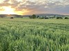
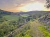

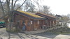
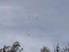
The above images may not be of the site on this page, but were taken nearby. They are loaded from Flickr so please click on them for image credits.
Click here to see more info for this site
Nearby sites
Click here to view sites on an interactive map of the areaKey: Red: member's photo, Blue: 3rd party photo, Yellow: other image, Green: no photo - please go there and take one, Grey: site destroyed
Download sites to:
KML (Google Earth)
GPX (GPS waypoints)
CSV (Garmin/Navman)
CSV (Excel)
To unlock full downloads you need to sign up as a Contributory Member. Otherwise downloads are limited to 50 sites.
Turn off the page maps and other distractions
Nearby sites listing. In the following links * = Image available
17.2km NW 312° Strücker Stein* Rock Outcrop
17.3km NW 322° Wallburg Bruchhauser Steine* Hillfort
17.4km NW 322° Bruchhauser Steine.* Rock Outcrop
17.4km NW 320° Ewige Quelle* Holy Well or Sacred Spring
17.8km NNW 332° Kleinenberg Menhir* Standing Stone (Menhir)
18.7km E 97° Huenselburg* Hillfort
20.7km E 99° Wellen Menhir* Standing Stone (Menhir)
21.0km NNW 339° Summstein Hängeberg Modern Stone Circle etc
21.6km SW 233° Wallburg Wemlinghausen* Hillfort
23.4km N 355° Hollenloch* Cave or Rock Shelter
23.5km NNW 337° Brilon Furchensteine* Polissoir
24.1km WNW 299° Venetianer-Stollen* Ancient Mine, Quarry or other Industry
24.3km NW 313° Bronze Urn of Gevelinghausen* Round Barrow(s)
24.6km WSW 250° Altarstein Latrop* Natural Stone / Erratic / Other Natural Feature
26.3km W 259° Wallburg Wilzenberg* Hillfort
26.9km S 174° Lützelburg* Hillfort
27.5km S 173° Christenberg* Hillfort
27.7km N 360° Madfeld Iron Age Settlement and Forge Ancient Village or Settlement
27.8km NW 306° Veledahöhle* Cave or Rock Shelter
29.2km NE 47° Summstein Arolsen Modern Stone Circle etc
29.7km NNE 21° Eresburg* Hillfort
30.0km NNE 20° Drakenhöhlen* Cave or Rock Shelter
32.4km WSW 237° Wallburg Aue* Hillfort
33.4km NW 322° Hohler Stein bei Kallenhardt* Cave or Rock Shelter
34.0km NNW 328° Wallburg Schaftsköppen* Hillfort
View more nearby sites and additional images


 We would like to know more about this location. Please feel free to add a brief description and any relevant information in your own language.
 Wir möchten mehr über diese Stätte erfahren. Bitte zögern Sie nicht, eine kurze Beschreibung und relevante Informationen in Deutsch hinzuzufügen.
 Nous aimerions en savoir encore un peu sur les lieux. S'il vous plaît n'hesitez pas à ajouter une courte description et tous les renseignements pertinents dans votre propre langue.
 Quisieramos informarnos un poco más de las lugares. No dude en añadir una breve descripción y otros datos relevantes en su propio idioma.