

<< Text Pages >> Blunds Hole - Cave or Rock Shelter in England in East Sussex
Submitted by coldrum on Tuesday, 11 August 2009 Page Views: 5771
Natural PlacesSite Name: Blunds HoleCountry: England
NOTE: This site is 1.054 km away from the location you searched for.
County: East Sussex Type: Cave or Rock Shelter
Map Ref: TQ41103670
Latitude: 51.112231N Longitude: 0.014359E
Condition:
| 5 | Perfect |
| 4 | Almost Perfect |
| 3 | Reasonable but with some damage |
| 2 | Ruined but still recognisable as an ancient site |
| 1 | Pretty much destroyed, possibly visible as crop marks |
| 0 | No data. |
| -1 | Completely destroyed |
| 5 | Superb |
| 4 | Good |
| 3 | Ordinary |
| 2 | Not Good |
| 1 | Awful |
| 0 | No data. |
| 5 | Can be driven to, probably with disabled access |
| 4 | Short walk on a footpath |
| 3 | Requiring a bit more of a walk |
| 2 | A long walk |
| 1 | In the middle of nowhere, a nightmare to find |
| 0 | No data. |
| 5 | co-ordinates taken by GPS or official recorded co-ordinates |
| 4 | co-ordinates scaled from a detailed map |
| 3 | co-ordinates scaled from a bad map |
| 2 | co-ordinates of the nearest village |
| 1 | co-ordinates of the nearest town |
| 0 | no data |
Be the first person to rate this site - see the 'Contribute!' box in the right hand menu.
Internal Links:
External Links:
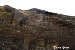
Cave or Rock Shelter in East Sussex
Information from Pastscape:
"A possible rock shelter. CF Tebbutt reported finding 8 flakes, some calcined, from two small areas where the sand under the rocks is exposed. He described them all as "probably Mesolithic"."
http://www.pastscape.org.uk/hob.aspx?hob_id=896414
You may be viewing yesterday's version of this page. To see the most up to date information please register for a free account.
Do not use the above information on other web sites or publications without permission of the contributor.
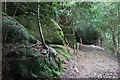
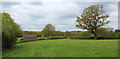
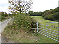
Nearby Images from Geograph Britain and Ireland:
©2013(licence)
©2013(licence)
©2016(licence)
©2016(licence)
©2016(licence)
The above images may not be of the site on this page, they are loaded from Geograph.
Please Submit an Image of this site or go out and take one for us!
Click here to see more info for this site
Nearby sites
Key: Red: member's photo, Blue: 3rd party photo, Yellow: other image, Green: no photo - please go there and take one, Grey: site destroyed
Download sites to:
KML (Google Earth)
GPX (GPS waypoints)
CSV (Garmin/Navman)
CSV (Excel)
To unlock full downloads you need to sign up as a Contributory Member. Otherwise downloads are limited to 50 sites.
Turn off the page maps and other distractions
Nearby sites listing. In the following links * = Image available
2.0km NW 313° East Grinstead Museum* Museum (TQ3960338031)
3.6km WSW 238° Stone Rocks West Sussex Cave or Rock Shelter (TQ381347)
4.0km W 260° Ridge Hill Rock Shelter Cave or Rock Shelter (TQ37203590)
4.3km WSW 255° Cinder Mead and Furnace Mead Ancient Mine, Quarry or other Industry (TQ37003552)
4.9km SSE 156° Ashdown Forest Centre* Museum (TQ432323)
5.4km NNE 24° Dry Hill Fort* Hillfort (TQ432417)
5.5km SW 218° St Mary's Rocks Cave or Rock Shelter (TQ37773226)
5.8km SSE 147° The Park Fort (Ashdown Forest) Hillfort (TQ44373195)
5.8km S 179° The Danes Churchyard Ancient Village or Settlement (TQ41343089)
6.3km SE 146° Birch Wood Ironworks Ancient Mine, Quarry or other Industry (TQ448316)
7.3km SE 131° A.A.Milne & E.H.Shephard Memorial* Modern Stone Circle etc (TQ468321)
7.5km ESE 123° Lone Oak Spring Holy Well or Sacred Spring (TQ475328)
7.7km WSW 237° Philpots Promontory Camp* Hillfort (TQ348323)
7.7km SW 235° Philpots Camp Mesolithic Rock Shelters Cave or Rock Shelter (TQ34873212)
7.8km SW 235° Big on Little* Rock Outcrop (TQ348320)
7.9km SE 136° Peat Lump Hill* Round Barrow(s) (TQ46773120)
8.1km NNW 344° St. Margaret's Well (Lingfield)* Holy Well or Sacred Spring (TQ386444)
8.3km SE 133° Greenwood Gate Clump Enclosure Ancient Village or Settlement (TQ47373127)
8.3km SSE 158° Millbrook Barrow Round Barrow(s) (TQ444291)
9.3km WSW 256° Ashdown Forest - Horsham ridgeway Ancient Trackway (TQ32153416)
9.5km SE 138° Kings Standing* Ancient Village or Settlement (TQ477298)
10.0km SSE 150° Duddleswell Round Barrow(s) (TQ463282)
10.5km ENE 59° Stonewall Park Rock Shelters Cave or Rock Shelter (TQ49974241)
12.3km NE 48° The Chiding stone* Natural Stone / Erratic / Other Natural Feature (TQ50064509)
12.7km E 85° Harness Well Holy Well or Sacred Spring (TQ538381)
View more nearby sites and additional images


 We would like to know more about this location. Please feel free to add a brief description and any relevant information in your own language.
 Wir möchten mehr über diese Stätte erfahren. Bitte zögern Sie nicht, eine kurze Beschreibung und relevante Informationen in Deutsch hinzuzufügen.
 Nous aimerions en savoir encore un peu sur les lieux. S'il vous plaît n'hesitez pas à ajouter une courte description et tous les renseignements pertinents dans votre propre langue.
 Quisieramos informarnos un poco más de las lugares. No dude en añadir una breve descripción y otros datos relevantes en su propio idioma.