


<< Our Photo Pages >> Piper's Copse Fort - Hillfort in England in West Sussex
Submitted by Andy B on Thursday, 25 March 2004 Page Views: 9349
Iron Age and Later PrehistorySite Name: Piper's Copse Fort Alternative Name: Piper's Copse SettlementCountry: England
NOTE: This site is 2.26 km away from the location you searched for.
County: West Sussex Type: Hillfort
Nearest Town: Haselmere Nearest Village: Northchapel
Map Ref: SU978295 Landranger Map Number: 186
Latitude: 51.056524N Longitude: 0.605926W
Condition:
| 5 | Perfect |
| 4 | Almost Perfect |
| 3 | Reasonable but with some damage |
| 2 | Ruined but still recognisable as an ancient site |
| 1 | Pretty much destroyed, possibly visible as crop marks |
| 0 | No data. |
| -1 | Completely destroyed |
| 5 | Superb |
| 4 | Good |
| 3 | Ordinary |
| 2 | Not Good |
| 1 | Awful |
| 0 | No data. |
| 5 | Can be driven to, probably with disabled access |
| 4 | Short walk on a footpath |
| 3 | Requiring a bit more of a walk |
| 2 | A long walk |
| 1 | In the middle of nowhere, a nightmare to find |
| 0 | No data. |
| 5 | co-ordinates taken by GPS or official recorded co-ordinates |
| 4 | co-ordinates scaled from a detailed map |
| 3 | co-ordinates scaled from a bad map |
| 2 | co-ordinates of the nearest village |
| 1 | co-ordinates of the nearest town |
| 0 | no data |
Internal Links:
External Links:
I have visited· I would like to visit
Andy B has visited here
")
The rampart is over 8 feet (2.4 m) high in places and almost circular, enclosing an area of just over 1-acre (4,000 m2). Iron Age pottery and iron slag have been found on the site. Roman and medieval pottery have also been found at Pipers Copse.
You may be viewing yesterday's version of this page. To see the most up to date information please register for a free account.
")
")
")
Do not use the above information on other web sites or publications without permission of the contributor.
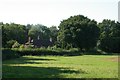
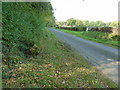
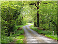
Nearby Images from Geograph Britain and Ireland:
©2005(licence)
©2011(licence)

©2024(licence)

©2024(licence)
©2020(licence)
The above images may not be of the site on this page, they are loaded from Geograph.
Please Submit an Image of this site or go out and take one for us!
Click here to see more info for this site
Nearby sites
Key: Red: member's photo, Blue: 3rd party photo, Yellow: other image, Green: no photo - please go there and take one, Grey: site destroyed
Download sites to:
KML (Google Earth)
GPX (GPS waypoints)
CSV (Garmin/Navman)
CSV (Excel)
To unlock full downloads you need to sign up as a Contributory Member. Otherwise downloads are limited to 50 sites.
Turn off the page maps and other distractions
Nearby sites listing. In the following links * = Image available
7.1km NNE 17° St Mary the Virgin's Well* Holy Well or Sacred Spring (SU997363)
8.0km WNW 298° Haslemere Educational Museum* Museum (SU9061833107)
8.1km SW 216° St. Peter's Well (Lodsworth)* Holy Well or Sacred Spring (SU9313022861)
8.4km S 177° Virgin Mary Spring* Holy Well or Sacred Spring (SU9838721139)
9.5km NNE 17° Hascombe Hill* Hillfort (TQ004386)
9.6km NNE 21° The Dragonstones* Modern Stone Circle etc (TQ0105038489)
12.6km N 357° Lady Well (Tuesley)* Holy Well or Sacred Spring (SU968421)
12.9km WNW 292° Wishing Well at Waggoners Wells* Holy Well or Sacred Spring (SU857342)
13.4km SE 135° Beedings Early Upper Palaeolithic Site Ancient Village or Settlement (TQ075202)
13.5km NNW 331° Thor's Stone (Thursley Common) Marker Stone (SU910412)
14.2km WSW 248° Hammer Wood Fort* Hillfort (SU847240)
14.8km WSW 240° Fitzhall Heath 2* Barrow Cemetery (SU8513721803)
14.8km SSW 210° Heyshott Down Cross Dyke* Misc. Earthwork (SU9070416492)
14.9km WSW 246° St Mary's Church (Chithurst) Artificial Mound (SU84252310)
15.0km WSW 242° Fitzhall Heath 5* Barrow Cemetery (SU8473122134)
15.1km WSW 238° Minsted Round Barrows* Barrow Cemetery (SU85152125)
15.1km WSW 240° Fitzhall Heath 1* Barrow Cemetery (SU849216)
15.3km WSW 242° Fitzhall Heath 4* Barrow Cemetery (SU8441621923)
15.5km WSW 241° Fitzhall Heath 3* Round Barrow(s) (SU84332180)
15.8km SSW 199° Oxen Down Tumuli* Barrow Cemetery (SU929145)
15.9km WSW 242° Goldrings Warren* Round Barrow(s) (SU8392821677)
16.6km S 183° Stane Street (Chichester section)* Ancient Trackway (SU9713012913)
16.7km NW 313° Frensham Common Barrows* Barrow Cemetery (SU85334070)
16.9km S 182° Barkhale* Causewayed Enclosure (SU976126)
17.1km SW 223° Cocking Down* Round Barrow(s) (SU8629216825)
View more nearby sites and additional images


 We would like to know more about this location. Please feel free to add a brief description and any relevant information in your own language.
 Wir möchten mehr über diese Stätte erfahren. Bitte zögern Sie nicht, eine kurze Beschreibung und relevante Informationen in Deutsch hinzuzufügen.
 Nous aimerions en savoir encore un peu sur les lieux. S'il vous plaît n'hesitez pas à ajouter une courte description et tous les renseignements pertinents dans votre propre langue.
 Quisieramos informarnos un poco más de las lugares. No dude en añadir una breve descripción y otros datos relevantes en su propio idioma.