<< Text Pages >> Duddleswell - Round Barrow(s) in England in East Sussex
Submitted by coldrum on Tuesday, 13 October 2009 Page Views: 3374
Neolithic and Bronze AgeSite Name: DuddleswellCountry: England
NOTE: This site is 2.602 km away from the location you searched for.
County: East Sussex Type: Round Barrow(s)
Nearest Village: Duddleswell
Map Ref: TQ463282
Latitude: 51.034546N Longitude: 0.085158E
Condition:
| 5 | Perfect |
| 4 | Almost Perfect |
| 3 | Reasonable but with some damage |
| 2 | Ruined but still recognisable as an ancient site |
| 1 | Pretty much destroyed, possibly visible as crop marks |
| 0 | No data. |
| -1 | Completely destroyed |
| 5 | Superb |
| 4 | Good |
| 3 | Ordinary |
| 2 | Not Good |
| 1 | Awful |
| 0 | No data. |
| 5 | Can be driven to, probably with disabled access |
| 4 | Short walk on a footpath |
| 3 | Requiring a bit more of a walk |
| 2 | A long walk |
| 1 | In the middle of nowhere, a nightmare to find |
| 0 | No data. |
| 5 | co-ordinates taken by GPS or official recorded co-ordinates |
| 4 | co-ordinates scaled from a detailed map |
| 3 | co-ordinates scaled from a bad map |
| 2 | co-ordinates of the nearest village |
| 1 | co-ordinates of the nearest town |
| 0 | no data |
Be the first person to rate this site - see the 'Contribute!' box in the right hand menu.
Internal Links:
External Links:
Site in Ashdown Forest, East Sussex
From Pastscape:
"A number of round mounds, possibly round barrows, were noted on a southward running ridge about 700 meters west of Duddleswell. Two large ones are close together at TQ 463 282 and five or six very low mounds lower down the ridge at TQ 462279. None of these have been excavated and all appear to be of "ancient origin". "
http://www.pastscape.org.uk/hob.aspx?hob_id=406808
You may be viewing yesterday's version of this page. To see the most up to date information please register for a free account.
Do not use the above information on other web sites or publications without permission of the contributor.
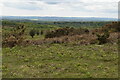
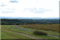
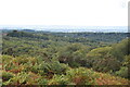
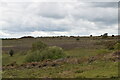
Nearby Images from Geograph Britain and Ireland:
©2022(licence)
©2023(licence)
©2023(licence)

©2023(licence)
©2022(licence)
The above images may not be of the site on this page, they are loaded from Geograph.
Please Submit an Image of this site or go out and take one for us!
Click here to see more info for this site
Nearby sites
Key: Red: member's photo, Blue: 3rd party photo, Yellow: other image, Green: no photo - please go there and take one, Grey: site destroyed
Download sites to:
KML (Google Earth)
GPX (GPS waypoints)
CSV (Garmin/Navman)
CSV (Excel)
To unlock full downloads you need to sign up as a Contributory Member. Otherwise downloads are limited to 50 sites.
Turn off the page maps and other distractions
Nearby sites listing. In the following links * = Image available
2.1km WNW 297° Millbrook Barrow Round Barrow(s) (TQ444291)
2.1km NE 43° Kings Standing* Ancient Village or Settlement (TQ477298)
3.0km N 10° Peat Lump Hill* Round Barrow(s) (TQ46773120)
3.2km NNE 21° Greenwood Gate Clump Enclosure Ancient Village or Settlement (TQ47373127)
3.7km NNW 338° Birch Wood Ironworks Ancient Mine, Quarry or other Industry (TQ448316)
3.9km N 9° A.A.Milne & E.H.Shephard Memorial* Modern Stone Circle etc (TQ468321)
4.2km NNW 334° The Park Fort (Ashdown Forest) Hillfort (TQ44373195)
4.5km SE 137° Hermit's Well (East Sussex)* Holy Well or Sacred Spring (TQ495250)
4.8km NNE 16° Lone Oak Spring Holy Well or Sacred Spring (TQ475328)
5.1km NW 325° Ashdown Forest Centre* Museum (TQ432323)
5.6km WNW 300° The Danes Churchyard Ancient Village or Settlement (TQ41343089)
6.5km SSW 201° Piltdown* Natural Stone / Erratic / Other Natural Feature (TQ441221)
9.4km WNW 297° St Mary's Rocks Cave or Rock Shelter (TQ37773226)
10.0km NNW 330° Blunds Hole Cave or Rock Shelter (TQ41103670)
10.4km NW 310° Stone Rocks West Sussex Cave or Rock Shelter (TQ381347)
11.8km NW 310° Cinder Mead and Furnace Mead Ancient Mine, Quarry or other Industry (TQ37003552)
11.9km NNW 327° East Grinstead Museum* Museum (TQ3960338031)
11.9km NW 312° Ridge Hill Rock Shelter Cave or Rock Shelter (TQ37203590)
12.1km WNW 291° Philpots Camp Mesolithic Rock Shelters Cave or Rock Shelter (TQ34873212)
12.1km ENE 62° Eridge Old Park Caves and Spring Cave or Rock Shelter (TQ568342)
12.1km WNW 290° Big on Little* Rock Outcrop (TQ348320)
12.2km WNW 291° Philpots Promontory Camp* Hillfort (TQ348323)
12.4km ENE 69° Saxonbury Fort Hillfort (TQ578329)
12.4km NE 39° Harness Well Holy Well or Sacred Spring (TQ538381)
12.4km E 97° St Dunstan's Well Holy Well or Sacred Spring (TQ587271)
View more nearby sites and additional images


 We would like to know more about this location. Please feel free to add a brief description and any relevant information in your own language.
 Wir möchten mehr über diese Stätte erfahren. Bitte zögern Sie nicht, eine kurze Beschreibung und relevante Informationen in Deutsch hinzuzufügen.
 Nous aimerions en savoir encore un peu sur les lieux. S'il vous plaît n'hesitez pas à ajouter une courte description et tous les renseignements pertinents dans votre propre langue.
 Quisieramos informarnos un poco más de las lugares. No dude en añadir una breve descripción y otros datos relevantes en su propio idioma.