<< Our Photo Pages >> St James's Well, Ball - Holy Well or Sacred Spring in England in Cornwall
Submitted by cazzyjane on Saturday, 18 February 2012 Page Views: 7664
Springs and Holy WellsSite Name: St James's Well, BallCountry: England County: Cornwall Type: Holy Well or Sacred Spring
Nearest Village: Mawgan in Pydar
Map Ref: SW8709865269
Latitude: 50.448539N Longitude: 5.000226W
Condition:
| 5 | Perfect |
| 4 | Almost Perfect |
| 3 | Reasonable but with some damage |
| 2 | Ruined but still recognisable as an ancient site |
| 1 | Pretty much destroyed, possibly visible as crop marks |
| 0 | No data. |
| -1 | Completely destroyed |
| 5 | Superb |
| 4 | Good |
| 3 | Ordinary |
| 2 | Not Good |
| 1 | Awful |
| 0 | No data. |
| 5 | Can be driven to, probably with disabled access |
| 4 | Short walk on a footpath |
| 3 | Requiring a bit more of a walk |
| 2 | A long walk |
| 1 | In the middle of nowhere, a nightmare to find |
| 0 | No data. |
| 5 | co-ordinates taken by GPS or official recorded co-ordinates |
| 4 | co-ordinates scaled from a detailed map |
| 3 | co-ordinates scaled from a bad map |
| 2 | co-ordinates of the nearest village |
| 1 | co-ordinates of the nearest town |
| 0 | no data |
Internal Links:
External Links:
I have visited· I would like to visit
lucasn visited on 15th Aug 2019 - their rating: Cond: 4 Amb: 3 Access: 4
")
You may be viewing yesterday's version of this page. To see the most up to date information please register for a free account.
")
")
")
")
Do not use the above information on other web sites or publications without permission of the contributor.
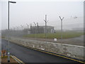
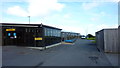
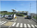
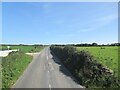
Nearby Images from Geograph Britain and Ireland:
©2008(licence)
©2015(licence)
©2023(licence)

©2005(licence)
©2023(licence)
The above images may not be of the site on this page, they are loaded from Geograph.
Please Submit an Image of this site or go out and take one for us!
Click here to see more info for this site
Nearby sites
Key: Red: member's photo, Blue: 3rd party photo, Yellow: other image, Green: no photo - please go there and take one, Grey: site destroyed
Download sites to:
KML (Google Earth)
GPX (GPS waypoints)
CSV (Garmin/Navman)
CSV (Excel)
To unlock full downloads you need to sign up as a Contributory Member. Otherwise downloads are limited to 50 sites.
Turn off the page maps and other distractions
Nearby sites listing. In the following links * = Image available
673m NNE 12° St Mawgan's Holy Well* Holy Well or Sacred Spring (SW87276592)
688m N 10° Mawgan Cross* Ancient Cross (SW87256594)
2.8km N 359° St Eval Airport Stone* Standing Stone (Menhir) (SW87146803)
2.8km NW 313° Mawgan Porth Settlement* Ancient Village or Settlement (SW85126727)
3.1km WNW 291° Griffin's point fort* Promontory Fort / Cliff Castle (SW842665)
3.3km SSW 201° St. Pedyr's Well* Holy Well or Sacred Spring (SW8579462245)
3.7km NNE 24° Trevisker Round* Ancient Village or Settlement (SW88726859)
3.9km N 359° St Eval Church Stones* Standing Stones (SW87196916)
3.9km NW 320° High Cove Tumulus* Round Cairn (SW84706837)
4.0km NW 322° Trerathick Cove Kerb Cairn* Round Cairn (SW84766855)
4.0km WSW 245° Zachry's Barrows* Barrow Cemetery (SW83356371)
4.1km SSW 213° Rialton Manor* Holy Well or Sacred Spring (SW847619)
4.3km NW 325° Carnewas Longstone* Standing Stone (Menhir) (SW84756885)
4.9km NE 43° Water Music Stone* Standing Stone (Menhir) (SW9055068697)
4.9km S 179° Our Lady of Nance* Holy Well or Sacred Spring (SW870604)
4.9km NNW 331° Redcliff Castle* Promontory Fort / Cliff Castle (SW84926965)
4.9km WSW 240° Trevelgue Head* Promontory Fort / Cliff Castle (SW82756300)
5.0km NNW 343° Treburrick menhir* Standing Stone (Menhir) (SW85867011)
5.1km WSW 241° Trevelgue Barrows* Barrow Cemetery (SW825630)
6.0km WSW 237° Barrowfields* Barrow Cemetery (SW819622)
6.1km N 352° Porthcothan Cave* Cave or Rock Shelter (SW865713)
6.2km ESE 120° Devil's Quoit (St Columb Major)* Burial Chamber or Dolmen (SW9234161952)
6.3km NNW 330° Park Head Fort* Promontory Fort / Cliff Castle (SW84157080)
6.5km ENE 61° Trelow Downs Stone Row / Alignment (SW92906817)
6.9km ENE 68° Nine Maidens Stone Row* Stone Row / Alignment (SW93636754)
View more nearby sites and additional images


 We would like to know more about this location. Please feel free to add a brief description and any relevant information in your own language.
 Wir möchten mehr über diese Stätte erfahren. Bitte zögern Sie nicht, eine kurze Beschreibung und relevante Informationen in Deutsch hinzuzufügen.
 Nous aimerions en savoir encore un peu sur les lieux. S'il vous plaît n'hesitez pas à ajouter une courte description et tous les renseignements pertinents dans votre propre langue.
 Quisieramos informarnos un poco más de las lugares. No dude en añadir una breve descripción y otros datos relevantes en su propio idioma.