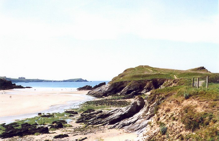
Featured: Ark of Secrets - Neolithic spirit alive in the Middle Ages

Ark of Secrets - Neolithic spirit alive in the Middle Ages

Random Image


Golden Cap Barrows

The Archaeology of People: Dimensions of Neolithic Life, Whittle

The Archaeology of People: Dimensions of Neolithic Life, Whittle

Who's Online

There are currently, 428 guests and 3 members online.

You are a guest. To join in, please register for free by clicking here

Sponsors

<< Our Photo Pages >> Trevelgue - Barrow Cemetery in England in Cornwall

Submitted by Thorgrim on Tuesday, 30 September 2003  Page Views: 6602

Neolithic and Bronze AgeSite Name: Trevelgue
Country: England County: Cornwall Type: Barrow Cemetery
 Nearest Village: Porth
Map Ref: SW825631  Landranger Map Number: 200
Latitude: 50.427374N  Longitude: 5.063636W
Condition:
5Perfect
4Almost Perfect
3Reasonable but with some damage
2Ruined but still recognisable as an ancient site
1Pretty much destroyed, possibly visible as crop marks
0No data.
-1Completely destroyed
4 Ambience:
5Superb
4Good
3Ordinary
2Not Good
1Awful
0No data.
4 Access:
5Can be driven to, probably with disabled access
4Short walk on a footpath
3Requiring a bit more of a walk
2A long walk
1In the middle of nowhere, a nightmare to find
0No data.
3 Accuracy:
5co-ordinates taken by GPS or official recorded co-ordinates
4co-ordinates scaled from a detailed map
3co-ordinates scaled from a bad map
2co-ordinates of the nearest village
1co-ordinates of the nearest town
0no data
3

Internal Links:
External Links:

I have visited· I would like to visit

lucasn visited - their rating: Cond: 4 Amb: 4 Access: 4

Bladup AngieLake have visited here

Trevelgue
Trevelgue submitted by Thorgrim : These Bronze Age barrows are to be found on the cliff top near the resort of Porth to the north of Trevelgue Head cliff castle SW8250 6310. Threatened by the sea which is undermining the cliff and by the rapid spread of villas, chalets and hotels; they might not be there for much longer. (Vote or comment on this photo)
Barrow Cemetery in Cornwall

These Bronze Age barrows are to be found on the cliff top near the resort of Porth to the north of Trevelgue Head cliff castle SW8250 6310. Threatened by the sea which is undermining the cliff and by the rapid spread of villas, chalets and hotels; they might not be there for much longer.
You may be viewing yesterday's version of this page. To see the most up to date information please register for a free account.

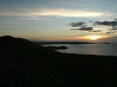
Trevelgue Head
Trevelgue Head submitted by Bladup : Trevelgue Head fort. (5 comments - Vote or comment on this photo)

Trevelgue
Trevelgue submitted by Bladup : Looking out past one of the barrows to Trevelgue cliff castle at sunset. (Vote or comment on this photo)

Trevelgue Head
Trevelgue Head submitted by AngieLake : Standing beside the eastern (land side) barrow of the two Bronze Age barrows on Trevelgue promontory fort, looking towards the two barrows on Trevelgue Down, on the next headland to the north. (Vote or comment on this photo)

Trevelgue Head
Trevelgue Head submitted by AngieLake : Looking back through the causeway opening in the first 'island' rampart at Trevelgue towards the eastern barrow, on the north side of the promontory, nearest the land. (Vote or comment on this photo)

Trevelgue Head
Trevelgue Head submitted by AngieLake : Porth Island or Trevelgue Iron Age Promontory fort with its defensive banks. (1 comment - Vote or comment on this photo)

Trevelgue Head
Trevelgue Head submitted by Bladup : The middle [with it's bridge], Western defences and Western barrow. (2 comments)

Trevelgue Head
Trevelgue Head submitted by Bladup : Looking East over the interior of the fort from it's Western point. (1 comment)

Trevelgue Head
Trevelgue Head submitted by Bladup : The large bank and ditch of the biggest middle defences, Looking South.

Trevelgue Head
Trevelgue Head submitted by AngieLake : An old photo of Trevelgue Head cliff castle. Taken from booklet (old) acquired in second-hand shop of Old Photos of Newquay.

Trevelgue
Trevelgue submitted by AngieLake : An interesting shot of the two barrows - high on the skyline - on Trevelgue Downs, taken from the old footpath from St Columb Minor near Newquay. This path leads up a lane near the church towards Porth, where Trevelgue promontory fort can be found. It's a pleasant walk along a fenced lane between fields, then down tracks through a field (here) sloping towards the coast. These barrows are on the ... (1 comment)

Trevelgue Head
Trevelgue Head submitted by AngieLake : Looking back from the 'island' of Trevelgue promontory fort, along its north edge, towards the eastern barrow, visible to the right of the hotels. It is a particularly nice place to visit in summer, with the pink 'Thrift' and the turquoise sea with its white breakers.

Trevelgue Head
Trevelgue Head submitted by AngieLake : Two shots of Trevelgue Head Promontory fort, showing (right) the causeway and first high ramparts of the 'island', with the highest western (seaward end) barrow (?), and, on the left, the strata of the cut-through rampart. (1 comment)

Trevelgue Head
Trevelgue Head submitted by Thorgrim : Trevelgue Head cliff castle is an outstanding Iron Age headland to the north of Newquay. Located at SW8250 6310, the ramparts are still impressive and the site is most dramatic when a heavy sea attacks the cliffs.

Trevelgue Head
Trevelgue Head submitted by Bladup : On the right is the Eastern Barrow and in the background on the left is the Western Barrow

Trevelgue Head
Trevelgue Head submitted by Bladup : The lovely North East view from the fort

Trevelgue Head
Trevelgue Head submitted by Bladup : The Western part of the fort from the Eastern Barrow

Trevelgue Head
Trevelgue Head submitted by Bladup : The Eastern Barrow

Trevelgue Head
Trevelgue Head submitted by Bladup : A onsite plan of Trevelgue Head Iron Age Fort

Trevelgue Head
Trevelgue Head submitted by Bladup : Looking at the Western side of the fort and the Western defences and Western Barrow

Trevelgue Head
Trevelgue Head submitted by Bladup : Trevelgue Head Iron Age Fort, The large middle defences

Trevelgue Head
Trevelgue Head submitted by Bladup : The Western Barrow

Trevelgue Head
Trevelgue Head submitted by Bladup : Trevelgue Head Iron Age Fort, Looking down over the main settlement site within the blue ellipse, Under the red lines are the two Bronze Age Barrows and under the yellow lines are the forts inner defences

Trevelgue Head
Trevelgue Head submitted by Bladup : Trevelgue Head Iron Age Fort from Porth Beach, You can see the two Bronze Age Barrows underneath the two red lines

Trevelgue Head
Trevelgue Head submitted by Bladup : Trevelgue Head from the South

These are just the first 25 photos of Trevelgue. If you log in with a free user account you will be able to see our entire collection.

Do not use the above information on other web sites or publications without permission of the contributor.
Click here to see more info for this site

Nearby sites

Click here to view sites on an interactive OS map

Key: Red: member's photo, Blue: 3rd party photo, Yellow: other image, Green: no photo - please go there and take one, Grey: site destroyed

Download sites to:
KML (Google Earth)
GPX (GPS waypoints)
CSV (Garmin/Navman)
CSV (Excel)

To unlock full downloads you need to sign up as a Contributory Member. Otherwise downloads are limited to 50 sites.


Turn off the page maps and other distractions

Nearby sites listing. In the following links * = Image available
 1m W 270° Trevelgue Head* Promontory Fort / Cliff Castle (SW82506310)
 1.0km NE 52° Zachry's Barrows* Barrow Cemetery (SW83356371)
 1.1km SSW 211° Barrowfields* Barrow Cemetery (SW819622)
 2.5km ESE 116° Rialton Manor* Holy Well or Sacred Spring (SW847619)
 3.1km SSW 207° Treringey Round* Ancient Village or Settlement (SW810604)
 3.4km ESE 102° St. Pedyr's Well* Holy Well or Sacred Spring (SW8579462245)
 3.8km NNE 24° Griffin's point fort* Promontory Fort / Cliff Castle (SW842665)
 4.3km SW 234° St Ambrusca's Well* Holy Well or Sacred Spring (SW789607)
 4.5km SW 231° Crantock* Holy Well or Sacred Spring (SW789604)
 4.6km WSW 249° East Pentire Barrow* Round Barrow(s) (SW781616)
 4.9km NNE 30° Mawgan Porth Settlement Ancient Village or Settlement (SW85126727)
 5.1km ENE 62° St James's Well, Ball* Holy Well or Sacred Spring (SW8709865269)
 5.2km ESE 119° Our Lady of Nance* Holy Well or Sacred Spring (SW870604)
 5.5km ENE 57° Mawgan Cross* Ancient Cross (SW87256594)
 5.5km ENE 57° St Mawgan's Holy Well* Holy Well or Sacred Spring (SW87276592)
 5.8km SW 228° Cubert Common Tumulus* Round Barrow(s) (SW78055943)
 6.2km NNE 19° Carnewas Longstone* Standing Stone (Menhir) (SW84756885)
 6.2km SE 142° Dairyland Farm World* Modern Stone Circle etc (SW861580)
 6.4km SSW 205° Cubert Round* Ancient Village or Settlement (SW796574)
 6.4km WSW 247° Kelsey Head* Promontory Fort / Cliff Castle (SW765608)
 6.6km SW 214° Cubert.* Early Christian Sculptured Stone (SW786578)
 6.6km WSW 240° Holywell Bay* Holy Well or Sacred Spring (SW76636002)
 6.6km SW 228° Trevornick Farm* Holy Well or Sacred Spring (SW7733958890)
 6.8km NE 41° St Eval Airport Stone* Standing Stone (Menhir) (SW87146803)
 7.0km NNE 18° Redcliff Castle* Promontory Fort / Cliff Castle (SW84926965)
View more nearby sites and additional images

<< Horncliffe Circle

Therfield Heath Five Hills >>

Please add your thoughts on this site

Cornovia: Ancient Sites of Cornwall and Scilly, Craig Weatherhill

Cornovia: Ancient Sites of Cornwall and Scilly, Craig Weatherhill

Sponsors

Auto-Translation (Google)

Translate from English into:

"Trevelgue" | Login/Create an Account | 1 comment
  
Go back to top of page    Comments are owned by the poster. We aren't responsible for their content.
Re: Trevelgue by AngieLake on Friday, 24 February 2006
(User Info | Send a Message)
Trevelgue Barrow Cemetery is referred to in Nicholas Thomas's book 'A Guide to Prehistoric England' (Batsfort/Book Club Associates, 1976). This is what he says:

"The 2 massive barrows here were opened in 1872. The E was found to cover a stone cist containing the crouched skeleton of an adult with a stone battle-axe. The cist in the other mound also contained unburnt human bones. It appeared that a huge fire had been kept alight upon this cist for several days before the barrow was heaped over it. Date, c. 1700-1,400 BC."

Isn't it fascinating to have that kind of information - about the fire being kept alight for several days? It brings the place to 'life' and helps us to imagine what ceremonies they held there.
Typically, I didn't know any of this when I visited! (Nor did I have time to dowse for ritual movement. The pathways for those ceremonies may have led me over the edge of the cliff, so *not* a very good idea!)

He also mentioned that grave goods were in Truro Museum, but as this edition of the book was written in 1976, they may now be elsewhere.
[ Reply to This ]

Your Name: Anonymous [ Register Now ]
Subject:


Add your comment or contribution to this page. Spam or offensive posts are deleted immediately, don't even bother

<<< What is five plus one as a number? (Please type the answer to this question in the little box on the left)
You can also embed videos and other things. For Youtube please copy and paste the 'embed code'.
For Google Street View please include Street View in the text.
Create a web link like this: <a href="https://www.megalithic.co.uk">This is a link</a>  

Allowed HTML is:
<p> <b> <i> <a> <img> <em> <br> <strong> <blockquote> <tt> <li> <ol> <ul> <object> <param> <embed> <iframe>

We would like to know more about this location. Please feel free to add a brief description and any relevant information in your own language.
Wir möchten mehr über diese Stätte erfahren. Bitte zögern Sie nicht, eine kurze Beschreibung und relevante Informationen in Deutsch hinzuzufügen.
Nous aimerions en savoir encore un peu sur les lieux. S'il vous plaît n'hesitez pas à ajouter une courte description et tous les renseignements pertinents dans votre propre langue.
Quisieramos informarnos un poco más de las lugares. No dude en añadir una breve descripción y otros datos relevantes en su propio idioma.