<< Our Photo Pages >> Aalburg Befort - Hillfort in Luxembourg
Submitted by Laumesfeld on Tuesday, 12 April 2022 Page Views: 568
Iron Age and Later PrehistorySite Name: Aalburg Befort Alternative Name: AltburgCountry: Luxembourg
NOTE: This site is 10.45 km away from the location you searched for.
Type: Hillfort
Nearest Town: Echternach Nearest Village: Beaufort
Latitude: 49.503200N Longitude: 6.164800E
Condition:
| 5 | Perfect |
| 4 | Almost Perfect |
| 3 | Reasonable but with some damage |
| 2 | Ruined but still recognisable as an ancient site |
| 1 | Pretty much destroyed, possibly visible as crop marks |
| 0 | No data. |
| -1 | Completely destroyed |
| 5 | Superb |
| 4 | Good |
| 3 | Ordinary |
| 2 | Not Good |
| 1 | Awful |
| 0 | No data. |
| 5 | Can be driven to, probably with disabled access |
| 4 | Short walk on a footpath |
| 3 | Requiring a bit more of a walk |
| 2 | A long walk |
| 1 | In the middle of nowhere, a nightmare to find |
| 0 | No data. |
| 5 | co-ordinates taken by GPS or official recorded co-ordinates |
| 4 | co-ordinates scaled from a detailed map |
| 3 | co-ordinates scaled from a bad map |
| 2 | co-ordinates of the nearest village |
| 1 | co-ordinates of the nearest town |
| 0 | no data |
Internal Links:
External Links:
I have visited· I would like to visit
Janek visited on 10th Mar 2022 - their rating: Cond: 3 Amb: 4 Access: 3
")
You may be viewing yesterday's version of this page. To see the most up to date information please register for a free account.
")
")
Do not use the above information on other web sites or publications without permission of the contributor.
Nearby Images from Flickr

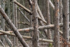
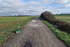
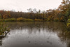

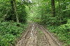
The above images may not be of the site on this page, but were taken nearby. They are loaded from Flickr so please click on them for image credits.
Click here to see more info for this site
Nearby sites
Click here to view sites on an interactive map of the areaKey: Red: member's photo, Blue: 3rd party photo, Yellow: other image, Green: no photo - please go there and take one, Grey: site destroyed
Download sites to:
KML (Google Earth)
GPX (GPS waypoints)
CSV (Garmin/Navman)
CSV (Excel)
To unlock full downloads you need to sign up as a Contributory Member. Otherwise downloads are limited to 50 sites.
Turn off the page maps and other distractions
Nearby sites listing. In the following links * = Image available
7.8km ENE 59° Vicus Ricciaco* Ancient Village or Settlement
15.7km E 81° Molknopp* Round Barrow(s)
16.0km WSW 256° Nécropole Mérovingienne Audun-le-Tiche Barrow Cemetery
16.1km E 80° Villa Nennig* Ancient Palace
20.0km E 93° Hunnenschanze Borg Misc. Earthwork
21.0km ESE 119° Stèle de Paffenacker* Standing Stone (Menhir)
21.2km E 92° Villa Borg Ancient Palace
21.2km E 92° Roman Villa (Borg)* Ancient Village or Settlement
21.2km SSW 204° Eperon barré du bois des Chênes Hillfort
22.1km N 359° Blaschette Modern Stone Circle* Modern Stone Circle etc
25.1km NNW 348° Mamerlayen Ancient Mine, Quarry or other Industry
25.3km N 9° La Roche des Payens* Rock Art
25.3km N 8° Freylay* Natural Stone / Erratic / Other Natural Feature
25.3km N 9° Schleifrillen Häerdcheslee* Polissoir
25.6km NNW 346° Wichtelslee* Hillfort
26.1km N 349° Mamerlach Cave or Rock Shelter
26.3km SE 143° Nonnenfels* Rock Art
26.9km ESE 107° Site des Menhirs de l´Europe Modern Stone Circle etc
27.3km ESE 106° Steine an der Grenze Modern Stone Circle etc
27.5km S 182° Archéosite Celte Museum
28.4km E 92° Breitenstein Felsen* Rock Art
29.2km NNW 347° Beisenerbierg Menhir* Standing Stone (Menhir)
29.4km ENE 76° Kastel Felsplateau Ancient Village or Settlement
29.6km NE 40° Pierre du Diable (Manternach) Modern Stone Circle etc
30.0km NNE 16° Loschbur* Natural Stone / Erratic / Other Natural Feature
View more nearby sites and additional images


 We would like to know more about this location. Please feel free to add a brief description and any relevant information in your own language.
 Wir möchten mehr über diese Stätte erfahren. Bitte zögern Sie nicht, eine kurze Beschreibung und relevante Informationen in Deutsch hinzuzufügen.
 Nous aimerions en savoir encore un peu sur les lieux. S'il vous plaît n'hesitez pas à ajouter une courte description et tous les renseignements pertinents dans votre propre langue.
 Quisieramos informarnos un poco más de las lugares. No dude en añadir una breve descripción y otros datos relevantes en su propio idioma.