<< Text Pages >> Roman bridge over Moštanica - Ancient Mine, Quarry or other Industry in Montenegro
Submitted by Alice_Wallaby on Saturday, 15 February 2020 Page Views: 597
Multi-periodSite Name: Roman bridge over Moštanica Alternative Name: Niksic Roman bridgeCountry: Montenegro Type: Ancient Mine, Quarry or other Industry
Nearest Town: Niksic
Latitude: 42.769112N Longitude: 18.911661E
Condition:
| 5 | Perfect |
| 4 | Almost Perfect |
| 3 | Reasonable but with some damage |
| 2 | Ruined but still recognisable as an ancient site |
| 1 | Pretty much destroyed, possibly visible as crop marks |
| 0 | No data. |
| -1 | Completely destroyed |
| 5 | Superb |
| 4 | Good |
| 3 | Ordinary |
| 2 | Not Good |
| 1 | Awful |
| 0 | No data. |
| 5 | Can be driven to, probably with disabled access |
| 4 | Short walk on a footpath |
| 3 | Requiring a bit more of a walk |
| 2 | A long walk |
| 1 | In the middle of nowhere, a nightmare to find |
| 0 | No data. |
| 5 | co-ordinates taken by GPS or official recorded co-ordinates |
| 4 | co-ordinates scaled from a detailed map |
| 3 | co-ordinates scaled from a bad map |
| 2 | co-ordinates of the nearest village |
| 1 | co-ordinates of the nearest town |
| 0 | no data |
Internal Links:
External Links:
Ancient Mine, Quarry or other Industry in Montenegro
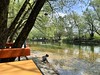
Beautiful 3rd-century Roman bridge on the road to Skadar. Strongly damaged in WWII, it was restored in the 50's. The river itself has since dried up.
More info on Sitngo car rental website
You may be viewing yesterday's version of this page. To see the most up to date information please register for a free account.
Do not use the above information on other web sites or publications without permission of the contributor.
Nearby Images from Flickr
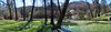

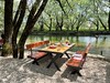
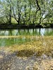
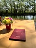
The above images may not be of the site on this page, but were taken nearby. They are loaded from Flickr so please click on them for image credits.
Click here to see more info for this site
Nearby sites
Click here to view sites on an interactive map of the areaKey: Red: member's photo, Blue: 3rd party photo, Yellow: other image, Green: no photo - please go there and take one, Grey: site destroyed
Download sites to:
KML (Google Earth)
GPX (GPS waypoints)
CSV (Garmin/Navman)
CSV (Excel)
To unlock full downloads you need to sign up as a Contributory Member. Otherwise downloads are limited to 50 sites.
Turn off the page maps and other distractions
Nearby sites listing. In the following links * = Image available
32.3km W 271° Crvena Stjena Cave or Rock Shelter
33.5km SSW 212° Risan Roman mosaics Museum
40.0km SSW 196° Kotor St. John Castel* Hillfort
43.3km SE 144° Gruda Boljevica Artificial Mound
44.2km SE 139° Doclea Ancient Village or Settlement
45.3km SSW 198° Velika Gruda Artificial Mound
49.7km SE 132° Meteon* Ancient Temple
50.9km SSE 163° Seocka pecina Ancient Village or Settlement
54.9km S 186° Budva Ancient Village or Settlement
70.4km S 172° Mogila na Rake Burial Chamber or Dolmen
88.4km WNW 295° Osanici Hillfort* Hillfort
103.5km WNW 291° Klepci tumuli 2* Round Barrow(s)
103.6km WNW 291° Klepci tumuli 1* Round Barrow(s)
110.3km WNW 289° Narona Town Wall* Hillfort
110.4km WNW 289° Narona Museum* Museum
112.2km WNW 298° Citluk-Greda-Illyrian observatory* Carving
117.3km NW 305° Polog.* Hillfort
120.2km NW 305° Zvonigrad - fortification wall* Hillfort
120.2km NW 305° Zvonigrad* Hillfort
127.5km NNW 341° Butmir* Ancient Village or Settlement
144.7km NNW 336° Pyramid of Dragon* Natural Stone / Erratic / Other Natural Feature
145.1km NNW 337° Pyramid of Love* Natural Stone / Erratic / Other Natural Feature
145.6km NNW 337° Visoko Pyramid of the Moon* Natural Stone / Erratic / Other Natural Feature
146.2km NNW 336° Visoko Pyramid of Earth* Natural Stone / Erratic / Other Natural Feature
146.9km NNW 336° Visoko Pyramid of the Sun* Natural Stone / Erratic / Other Natural Feature
View more nearby sites and additional images


 We would like to know more about this location. Please feel free to add a brief description and any relevant information in your own language.
 Wir möchten mehr über diese Stätte erfahren. Bitte zögern Sie nicht, eine kurze Beschreibung und relevante Informationen in Deutsch hinzuzufügen.
 Nous aimerions en savoir encore un peu sur les lieux. S'il vous plaît n'hesitez pas à ajouter une courte description et tous les renseignements pertinents dans votre propre langue.
 Quisieramos informarnos un poco más de las lugares. No dude en añadir una breve descripción y otros datos relevantes en su propio idioma.