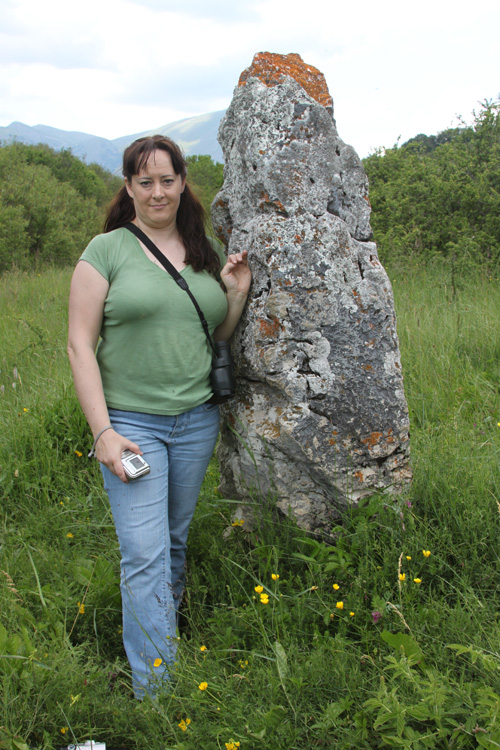
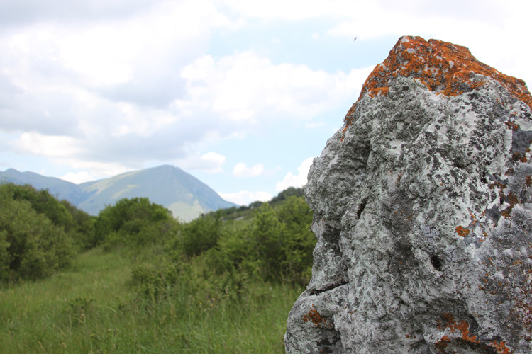
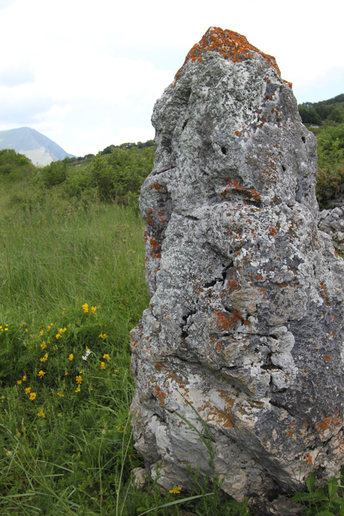
<< Our Photo Pages >> Lu Termine - Standing Stone (Menhir) in Italy in Abruzzo
Submitted by AlexHunger on Thursday, 15 February 2001 Page Views: 14766
Neolithic and Bronze AgeSite Name: Lu TermineCountry: Italy
NOTE: This site is 20.118 km away from the location you searched for.
Region: Abruzzo Type: Standing Stone (Menhir)
Nearest Town: L'Aquila Nearest Village: Rocca di Mezzo
Latitude: 42.190710N Longitude: 13.528170E
Condition:
| 5 | Perfect |
| 4 | Almost Perfect |
| 3 | Reasonable but with some damage |
| 2 | Ruined but still recognisable as an ancient site |
| 1 | Pretty much destroyed, possibly visible as crop marks |
| 0 | No data. |
| -1 | Completely destroyed |
| 5 | Superb |
| 4 | Good |
| 3 | Ordinary |
| 2 | Not Good |
| 1 | Awful |
| 0 | No data. |
| 5 | Can be driven to, probably with disabled access |
| 4 | Short walk on a footpath |
| 3 | Requiring a bit more of a walk |
| 2 | A long walk |
| 1 | In the middle of nowhere, a nightmare to find |
| 0 | No data. |
| 5 | co-ordinates taken by GPS or official recorded co-ordinates |
| 4 | co-ordinates scaled from a detailed map |
| 3 | co-ordinates scaled from a bad map |
| 2 | co-ordinates of the nearest village |
| 1 | co-ordinates of the nearest town |
| 0 | no data |
Internal Links:
External Links:
I have visited· I would like to visit
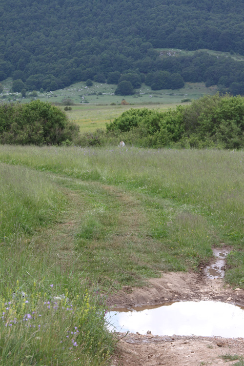
kengelma visited - their rating: Cond: 4 Amb: 5 Access: 3 N 42.19071; E013.52817; Elevation 2.7762 M. Nearest intersection is Sp28 & Viale Padre Giovanni Minozzi; we found it by asking a local farmer. It's a wonderfully atmospheric place, out in the middle of nowhere. It is possible to drive very close by turning off the main road onto a dirt road, and then walking across a field to the stone. It is much smaller than it appears in most photos--about five feet tall. There are no markings from the road.

Have you visited this site? Please contribute a description or any thoughts by adding a comment.
You may be viewing yesterday's version of this page. To see the most up to date information please register for a free account.


Do not use the above information on other web sites or publications without permission of the contributor.
Nearby Images from Flickr


The above images may not be of the site on this page, but were taken nearby. They are loaded from Flickr so please click on them for image credits.
Click here to see more info for this site
Nearby sites
Click here to view sites on an interactive map of the areaKey: Red: member's photo, Blue: 3rd party photo, Yellow: other image, Green: no photo - please go there and take one, Grey: site destroyed
Download sites to:
KML (Google Earth)
GPX (GPS waypoints)
CSV (Garmin/Navman)
CSV (Excel)
To unlock full downloads you need to sign up as a Contributory Member. Otherwise downloads are limited to 50 sites.
Turn off the page maps and other distractions
Nearby sites listing. In the following links * = Image available
11.9km NNW 345° Fossa Standing Stones* Stone Row / Alignment
51.1km SSW 197° Alatri Temple* Ancient Temple
54.0km SSW 196° Alatri Acropolis* Hillfort
60.7km S 173° Arpino Acropolis* Ancient Village or Settlement
68.9km SW 217° Giunone Moneta (Segni)* Ancient Village or Settlement
81.6km SW 215° Antica Norba* Ancient Village or Settlement
85.3km SW 233° Nemi Temple of Diana* Ancient Temple
91.0km WSW 250° Heliopolis Ramesses II Termini Obelisk* Standing Stone (Menhir)
91.0km WSW 249° Karnak Temple of Amun Lateran Obelisk* Standing Stone (Menhir)
92.3km WSW 251° Heliopolis Seti I Piazza del Popolo Obelisk* Standing Stone (Menhir)
92.4km WSW 249° Rome.* Ancient Village or Settlement
92.4km WSW 250° Lupercale Shrine* Cave or Rock Shelter
92.7km WSW 250° Sais - Piazza Minerva Obelisk* Standing Stone (Menhir)
94.0km WNW 302° Carsulae Ancient Village or Settlement
94.1km WSW 251° Gregorian Etruscan Museum* Museum
105.6km SW 222° Nettuno Tomb Burial Chamber or Dolmen
107.1km W 273° Sutri amphitheatre* Ancient Village or Settlement
107.2km W 273° Sutri Necropolis* Rock Cut Tomb
109.0km WNW 288° Bomarzo Etruscan 'Pyramid' Altar* Ancient Temple
111.9km WNW 283° Mount Cimino Votive Site* Ancient Temple
112.7km SSW 199° Mura Ciclopiche San Felice Circeo Stone Fort or Dun
113.6km NW 322° Hispellum* Ancient Village or Settlement
119.3km W 274° Barbarano Romano Etruscan Necropolis Chambered Tomb
119.5km W 261° Cerveteri Necropoli della Banditaceia* Rock Cut Tomb
121.0km SSE 166° Roccia San Sebastiano Cave or Rock Shelter
View more nearby sites and additional images


 We would like to know more about this location. Please feel free to add a brief description and any relevant information in your own language.
 Wir möchten mehr über diese Stätte erfahren. Bitte zögern Sie nicht, eine kurze Beschreibung und relevante Informationen in Deutsch hinzuzufügen.
 Nous aimerions en savoir encore un peu sur les lieux. S'il vous plaît n'hesitez pas à ajouter une courte description et tous les renseignements pertinents dans votre propre langue.
 Quisieramos informarnos un poco más de las lugares. No dude en añadir una breve descripción y otros datos relevantes en su propio idioma.