<< Other Photo Pages >> Dunleith Mounds - Artificial Mound in United States in Great Lakes Midwest
Submitted by AKFisher on Saturday, 12 August 2023 Page Views: 3744
Pre-ColumbianSite Name: Dunleith Mounds Alternative Name: Gramercy Park, Dunleith Mound GroupCountry: United States
NOTE: This site is 25.146 km away from the location you searched for.
Region: Great Lakes Midwest Type: Artificial Mound
Nearest Town: East Dubuque, IL
Latitude: 42.494380N Longitude: 90.64431W
Condition:
| 5 | Perfect |
| 4 | Almost Perfect |
| 3 | Reasonable but with some damage |
| 2 | Ruined but still recognisable as an ancient site |
| 1 | Pretty much destroyed, possibly visible as crop marks |
| 0 | No data. |
| -1 | Completely destroyed |
| 5 | Superb |
| 4 | Good |
| 3 | Ordinary |
| 2 | Not Good |
| 1 | Awful |
| 0 | No data. |
| 5 | Can be driven to, probably with disabled access |
| 4 | Short walk on a footpath |
| 3 | Requiring a bit more of a walk |
| 2 | A long walk |
| 1 | In the middle of nowhere, a nightmare to find |
| 0 | No data. |
| 5 | co-ordinates taken by GPS or official recorded co-ordinates |
| 4 | co-ordinates scaled from a detailed map |
| 3 | co-ordinates scaled from a bad map |
| 2 | co-ordinates of the nearest village |
| 1 | co-ordinates of the nearest town |
| 0 | no data |
Internal Links:
External Links:
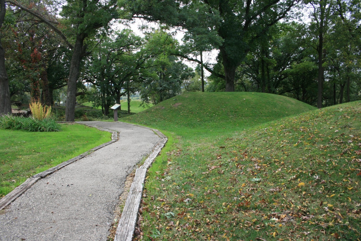
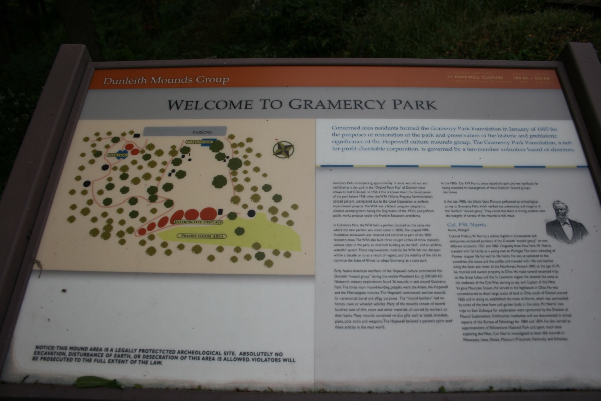
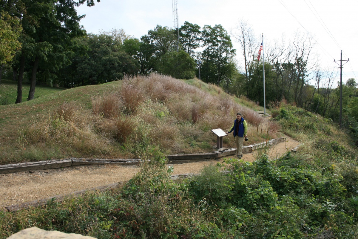
Before the Gramercy Park Foundation began its preservation efforts the mounds had become overgrown with trees and other vegetation. The mounds were inaccessible and it was impossible to walk amongst them. Because of the efforts of the foundation, visitors can now walk along newly constructed trails and learn about the site from recently installed wayside markers.
Further reading and information:
1. State of Illinois Department of Natural Resources:
https://dnr.illinois.gov/content/dam/soi/en/web/dnr/naturalresources/cultural/documents/dunleithmounds.pdf (PDF file)
2. Smithsonian Institution:
https://repository.si.edu/bitstream/handle/10088/91634/Burial%20Mounds%20of%20the%20Northern%20Sections.pdf (PDF file)
Directions: From Dubuque, IA via US-20E, 2.9 mi.
Note: More photos courtesy of Dr Greg Little, author of the Illustrated Encyclopedia of Native American Indian Mounds & Earthworks kindly uploaded by AKFisher
You may be viewing yesterday's version of this page. To see the most up to date information please register for a free account.
Do not use the above information on other web sites or publications without permission of the contributor.
Click here to see more info for this site
Nearby sites
Click here to view sites on an interactive map of the areaKey: Red: member's photo, Blue: 3rd party photo, Yellow: other image, Green: no photo - please go there and take one, Grey: site destroyed
Download sites to:
KML (Google Earth)
GPX (GPS waypoints)
CSV (Garmin/Navman)
CSV (Excel)
To unlock full downloads you need to sign up as a Contributory Member. Otherwise downloads are limited to 50 sites.
Turn off the page maps and other distractions
Nearby sites listing. In the following links * = Image available
66.1km NW 325° Wyalusing Mounds* Artificial Mound
70.1km NW 323° Pikes Peak State Park Effigy Mounds* Artificial Mound
74.3km SE 144° Thomson Causeway Artificial Mound
79.5km NNW 326° Effigy Mounds National Monument* Artificial Mound
80.7km NNW 338° Larsen Cave, Crawford Co* Rock Art
86.4km SSE 157° Albany Mounds* Barrow Cemetery
88.4km NE 43° Brighid's Spring at Circle Sanctuary* Holy Well or Sacred Spring
89.7km NE 44° Circle Sanctuary Nature Preserve* Modern Stone Circle etc
98.8km N 355° Tainter Cave Cave or Rock Shelter
112.2km SE 133° Sinnissippi Mounds* Artificial Mound
117.4km ENE 57° Forest Hill Cemetery* Artificial Mound
118.8km NNW 334° Fish Farm Mounds State Preserve Artificial Mound
119.4km NE 56° Picnic Point Effigy Mounds* Artificial Mound
120.8km NE 54° Governor Nelson State Park Effigy Mounds* Artificial Mound
123.8km NE 55° Mendota Mental Health Institute Effigy Mounds* Artificial Mound
124.2km ENE 57° Burrows Park Mound* Artificial Mound
127.3km NE 36° Devil's Lake Mounds* Artificial Mound
129.9km E 100° Beattie Park Mound Group* Misc. Earthwork
132.2km E 89° Beloit College Mounds* Artificial Mound
135.9km NE 35° Man Mound Park* Artificial Mound
148.1km ENE 73° Lake Koshkonong Mounds* Artificial Mound
149.9km ENE 73° The Finch Site Ancient Village or Settlement
153.2km SSW 193° Toolesboro Mound Group* Artificial Mound
158.7km ENE 66° Aztalan State Park* Ancient Village or Settlement
169.8km N 359° Fort McCoy Artificial Mound
View more nearby sites and additional images


 We would like to know more about this location. Please feel free to add a brief description and any relevant information in your own language.
 Wir möchten mehr über diese Stätte erfahren. Bitte zögern Sie nicht, eine kurze Beschreibung und relevante Informationen in Deutsch hinzuzufügen.
 Nous aimerions en savoir encore un peu sur les lieux. S'il vous plaît n'hesitez pas à ajouter une courte description et tous les renseignements pertinents dans votre propre langue.
 Quisieramos informarnos un poco más de las lugares. No dude en añadir una breve descripción y otros datos relevantes en su propio idioma.