<< Text Pages >> Daunian Arpi - Ancient Village or Settlement in Italy in Puglia
Submitted by KaiHofmann on Friday, 05 August 2016 Page Views: 1620
Multi-periodSite Name: Daunian ArpiCountry: Italy
NOTE: This site is 60.207 km away from the location you searched for.
Region: Puglia Type: Ancient Village or Settlement
Nearest Town: Foggia
Latitude: 41.515995N Longitude: 15.576454E
Condition:
| 5 | Perfect |
| 4 | Almost Perfect |
| 3 | Reasonable but with some damage |
| 2 | Ruined but still recognisable as an ancient site |
| 1 | Pretty much destroyed, possibly visible as crop marks |
| 0 | No data. |
| -1 | Completely destroyed |
| 5 | Superb |
| 4 | Good |
| 3 | Ordinary |
| 2 | Not Good |
| 1 | Awful |
| 0 | No data. |
| 5 | Can be driven to, probably with disabled access |
| 4 | Short walk on a footpath |
| 3 | Requiring a bit more of a walk |
| 2 | A long walk |
| 1 | In the middle of nowhere, a nightmare to find |
| 0 | No data. |
| 5 | co-ordinates taken by GPS or official recorded co-ordinates |
| 4 | co-ordinates scaled from a detailed map |
| 3 | co-ordinates scaled from a bad map |
| 2 | co-ordinates of the nearest village |
| 1 | co-ordinates of the nearest town |
| 0 | no data |
Internal Links:
External Links:
Ancient Village or Settlement in Puglia
Ancient capital of the civilization of Dauni of the 4th century BCE.
You may be viewing yesterday's version of this page. To see the most up to date information please register for a free account.
Do not use the above information on other web sites or publications without permission of the contributor.
Nearby Images from Flickr
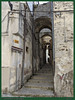
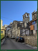
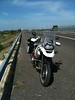
The above images may not be of the site on this page, but were taken nearby. They are loaded from Flickr so please click on them for image credits.
Click here to see more info for this site
Nearby sites
Click here to view sites on an interactive map of the areaKey: Red: member's photo, Blue: 3rd party photo, Yellow: other image, Green: no photo - please go there and take one, Grey: site destroyed
Download sites to:
KML (Google Earth)
GPX (GPS waypoints)
CSV (Garmin/Navman)
CSV (Excel)
To unlock full downloads you need to sign up as a Contributory Member. Otherwise downloads are limited to 50 sites.
Turn off the page maps and other distractions
Nearby sites listing. In the following links * = Image available
5.0km NE 35° Passo di Corvo* Henge
15.7km NNE 12° Grotta Paglicci Cave or Rock Shelter
15.7km N 10° Dolmen di Madonna di Cristo Burial Chamber or Dolmen
17.8km N 3° Museo Grotta Paglicci e il Paliolitico del Gargano Museum
27.4km ENE 69° Ipogei Capparelli Ancient Village or Settlement
28.5km NNE 33° Monte Calvo Ancient Village or Settlement
30.7km ENE 63° Scaloria Cavern Cave or Rock Shelter
35.9km ENE 60° Monte San Angelo Necropolis Rock Cut Tomb
36.4km NE 55° Valle dei Dolmen Monte Sant´Angelo Rock Cut Tomb
38.0km NE 56° Monte Sant´Angelo* Early Christian Sculptured Stone
44.5km ENE 63° Monte Saraceno Necropolis* Rock Cut Tomb
47.2km NE 55° Monte Sacro* Natural Stone / Erratic / Other Natural Feature
53.8km ESE 117° Mount of Cannae* Ancient Village or Settlement
54.2km ESE 117° Canne Standing Stone* Standing Stone (Menhir)
58.7km NE 38° Miniera di selce di Valle Sbernia Ancient Mine, Quarry or other Industry
61.6km NE 39° Grotta Di Manaccora Cave or Rock Shelter
63.1km NE 42° Sfinalicchio Cavern Rock Art
63.3km NE 44° Parco Archaologico della Salata Rock Cut Tomb
64.0km NE 49° Defensola Flintstone Mine Ancient Mine, Quarry or other Industry
83.3km ESE 117° Paladini Dolmen* Burial Chamber or Dolmen
84.0km ESE 115° Chianca Dolmen* Chambered Tomb
84.3km ESE 116° Dolmen di Albarosa Passage Grave
86.4km ESE 115° Frisari Dolmen Burial Chamber or Dolmen
94.3km ESE 123° Pietrefitte 10 Standing Stone (Menhir)
95.1km ESE 119° Pietrefitte 2 Standing Stone (Menhir)
View more nearby sites and additional images


 We would like to know more about this location. Please feel free to add a brief description and any relevant information in your own language.
 Wir möchten mehr über diese Stätte erfahren. Bitte zögern Sie nicht, eine kurze Beschreibung und relevante Informationen in Deutsch hinzuzufügen.
 Nous aimerions en savoir encore un peu sur les lieux. S'il vous plaît n'hesitez pas à ajouter une courte description et tous les renseignements pertinents dans votre propre langue.
 Quisieramos informarnos un poco más de las lugares. No dude en añadir una breve descripción y otros datos relevantes en su propio idioma.