<< Our Photo Pages >> Pharr Mounds - Artificial Mound in United States in The South
Submitted by bat400 on Thursday, 06 September 2012 Page Views: 3221
Neolithic and Bronze AgeSite Name: Pharr MoundsCountry: United States
NOTE: This site is 18.303 km away from the location you searched for.
Region: The South Type: Artificial Mound
Nearest Town: Tupelo, MS
Latitude: 34.468900N Longitude: 88.4171W
Condition:
| 5 | Perfect |
| 4 | Almost Perfect |
| 3 | Reasonable but with some damage |
| 2 | Ruined but still recognisable as an ancient site |
| 1 | Pretty much destroyed, possibly visible as crop marks |
| 0 | No data. |
| -1 | Completely destroyed |
| 5 | Superb |
| 4 | Good |
| 3 | Ordinary |
| 2 | Not Good |
| 1 | Awful |
| 0 | No data. |
| 5 | Can be driven to, probably with disabled access |
| 4 | Short walk on a footpath |
| 3 | Requiring a bit more of a walk |
| 2 | A long walk |
| 1 | In the middle of nowhere, a nightmare to find |
| 0 | No data. |
| 5 | co-ordinates taken by GPS or official recorded co-ordinates |
| 4 | co-ordinates scaled from a detailed map |
| 3 | co-ordinates scaled from a bad map |
| 2 | co-ordinates of the nearest village |
| 1 | co-ordinates of the nearest town |
| 0 | no data |
Internal Links:
External Links:
I have visited· I would like to visit
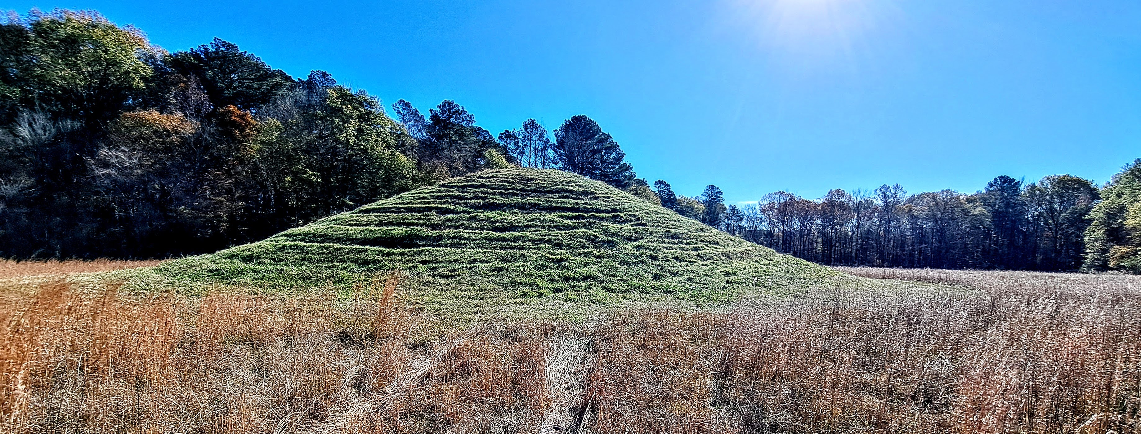
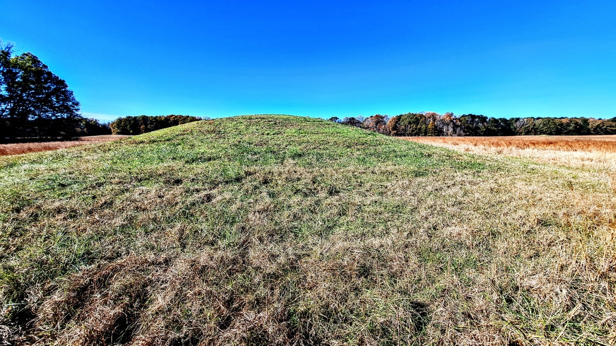
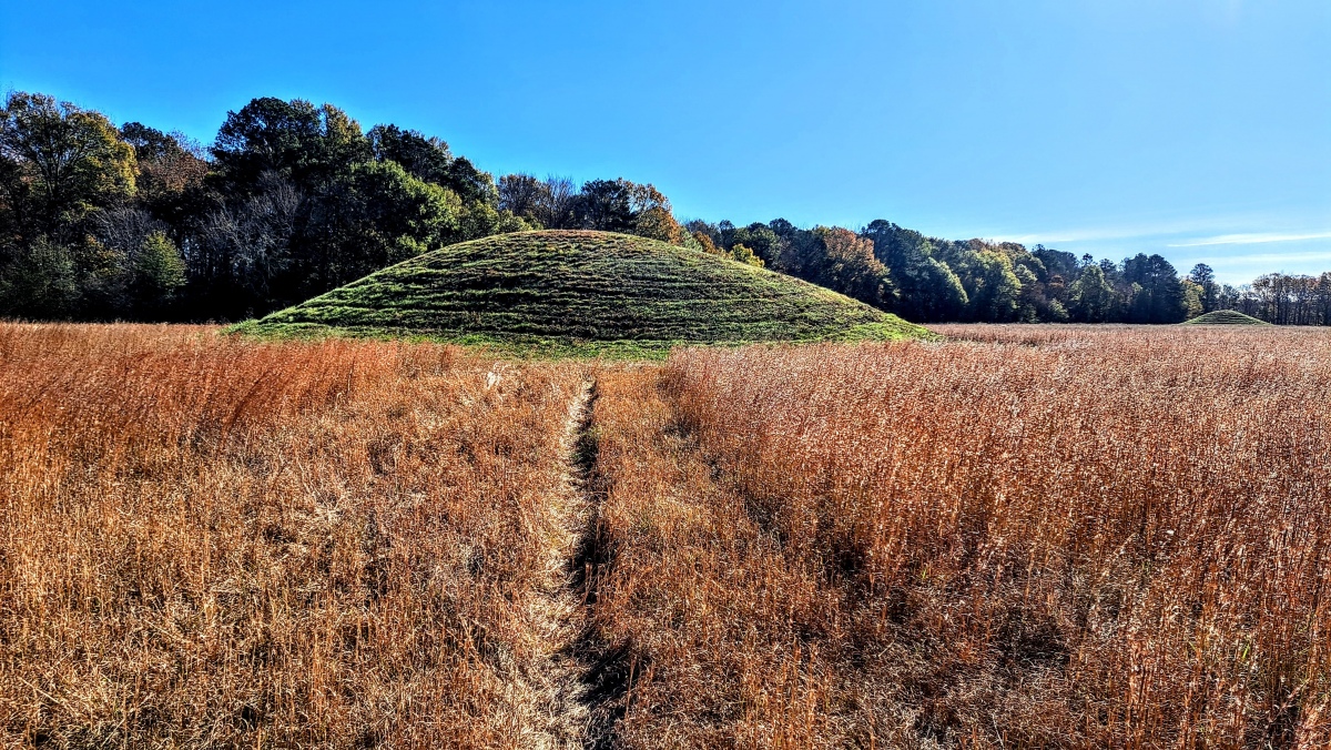
stonetracker visited on 1st Dec 2024 - their rating: Cond: 3 Amb: 5 Access: 2 This is a large Middle Woodland site of 8 conical or rounded mounds spread out over a 80-90 acre field. It is located at milepost 286 of the Natchez Trace in MS, on the north bound side of the highway. The mounds today range in height from 2 to 18 ft. Generally speaking, the tallest mounds are closest to the road. Four mounds were either partially or fully excavated in the 1960s by the NPS.
There is a large car park overlooking the site, complete with interpretation and rest rooms. Although 4-5 mounds can be seen from the lot, they are a considerable distance away so binoculars are helpful. Trails interconnect many of the mounds, but there is a fair amount of walking involved. A circuit of Mounds A-D, the four closest, was just under a mile including the return trip to the parking area. I did not visit the others.
bat400 have visited here

The mounds are scattered over 90 acres and the burial ground is considered one of the largest and most important of its type. It is also one of the most picturesque ancient sites along the Natchez Trace.
Eight domed burial mounds, several being as high as 18 feet, and the largest being 165 feet in diameter. They are identified as part of the "Miller culture" (1 and 200 AD) of the broader Middle Woodland period. Four of the mounds were partially excavated in the mid 1960's (and were later reconstructed to their original size and shape.)
Excavations discovered human remains, some cremated. The mounds were originally build over clay floored fire pits. Grave goods included non-local materials, including objects of carved green stone, galena, and mica, and copper earspools.
The site is on the Natchez Trace Parkway. It is signposted and has interpretive signage on site.
National Register of Historic Places.
You may be viewing yesterday's version of this page. To see the most up to date information please register for a free account.




Do not use the above information on other web sites or publications without permission of the contributor.
Click here to see more info for this site
Nearby sites
Click here to view sites on an interactive map of the areaKey: Red: member's photo, Blue: 3rd party photo, Yellow: other image, Green: no photo - please go there and take one, Grey: site destroyed
Download sites to:
KML (Google Earth)
GPX (GPS waypoints)
CSV (Garmin/Navman)
CSV (Excel)
To unlock full downloads you need to sign up as a Contributory Member. Otherwise downloads are limited to 50 sites.
Turn off the page maps and other distractions
Nearby sites listing. In the following links * = Image available
32.6km NE 53° Bear Creek* Ancient Village or Settlement
34.7km SSW 194° Mound Cemetary* Artificial Mound
56.1km S 188° Nabers Mound Cemetery Site* Artificial Mound
57.2km SE 136° Hamilton Mounds* Artificial Mound
58.5km W 262° Ingomar Mounds* Artificial Mound
65.4km SW 226° Owl Creek* Artificial Mound
75.2km N 6° Shiloh Indian Mounds* Ancient Village or Settlement
77.1km ENE 62° Florence Mound* Artificial Mound
80.0km SW 218° Bynum* Barrow Cemetery
113.6km E 91° Oakville Mounds* Artificial Mound
116.4km NNW 349° Pinson Mounds - Mound 30* Artificial Mound
116.5km NNW 349° Pinson Mounds - Mound 29* Artificial Mound
116.5km NNW 349° Pinson Mounds - Eastern Citadel* Misc. Earthwork
116.6km NNW 348° Pinson Mounds - Other Sites* Artificial Mound
116.7km NNW 348° Pinson Mounds - Sauls Mound* Artificial Mound
116.9km NNW 348° Pinson Mounds State Archaeological Park* Artificial Mound
117.1km NNW 349° Pinson Mounds - Mound 28* Artificial Mound
117.1km NNW 348° Pinson Mounds - Twin Mounds* Artificial Mound
117.3km NNW 348° Pinson Mounds - Ozier Mound* Artificial Mound
139.0km W 265° Batesville Mounds* Artificial Mound
167.8km WNW 296° Chickasaw Heritage Park* Artificial Mound
169.8km WNW 293° Chucalissa Prehistoric Indian Village* Museum
170.1km WNW 290° Cheatham Mound* Artificial Mound
174.3km WNW 290° Edgefield Mounds* Artificial Mound
177.7km SSE 156° Moundville Archeological Park* Ancient Village or Settlement
View more nearby sites and additional images


 We would like to know more about this location. Please feel free to add a brief description and any relevant information in your own language.
 Wir möchten mehr über diese Stätte erfahren. Bitte zögern Sie nicht, eine kurze Beschreibung und relevante Informationen in Deutsch hinzuzufügen.
 Nous aimerions en savoir encore un peu sur les lieux. S'il vous plaît n'hesitez pas à ajouter une courte description et tous les renseignements pertinents dans votre propre langue.
 Quisieramos informarnos un poco más de las lugares. No dude en añadir una breve descripción y otros datos relevantes en su propio idioma.