Contributory members are able to log private notes and comments about each site
Sites theCAptain has logged. View this log as a table or view the most recent logs from everyone
Pierre-Fritte (Jumallene)
Trip No.204 Entry No.321 Date Added: 16th Sep 2020
Site Type: Standing Stone (Menhir)
Country: France (Pays de la Loire:Maine-et-Loire 49)
Visited: Yes on 13th Aug 2005. My rating: Condition 4 Ambience 4 Access 4
Pierre-Fritte (Jumallene) submitted by theCaptain on 24th Apr 2012. It's a very nice menhir, 5.2 metres tall and shaped so that it is flat on the eastern face and pointed at the top.
Only one little sign back in August 2005.
(View photo, vote or add a comment)
Log Text: To the south of the village of Préviere along the D.6 road, and after a couple of kilometres is a signpost to Pierre Fritte. From there it's about 500 metres walk along the farm track, taking the left turn at the crossing of tracks. It's a very nice menhir, 5.2 metres tall and shaped so that it is flat on the eastern face and pointed at the top. It has also been Christianised or vandalised, according to your viewpoint, with a cross carved with an inscription, and a niche carved with a china virgin placed inside. Both of these alterations are on the menhirs flat face. An appalling bit of metal grill has been very crudely bolted over the niche, presumably to protect from vandalism the statue of the virgin. It's all a bit of a shame really, its completely spoiled what would have otherwise been a splendid menhir.
Champ Des Louères Menhir
Trip No.204 Entry No.322 Date Added: 16th Sep 2020
Site Type: Standing Stone (Menhir)
Country: France (Pays de la Loire:Loire-Atlantique)
Visited: Yes on 13th Aug 2005. My rating: Condition 4 Ambience 3 Access 4

Champ Des Louères Menhir submitted by TheCaptain on 14th Aug 2013. This is a big stone, which lives in a field beside the trackway behind the sports centre.
There are a couple of intriguing round holes/niches within it, but I dont know whether these are natural or have been cut.
(View photo, vote or add a comment)
Log Text: Well signposted from the village of Saint-Aubin-Des-Châteaux, these lead to a parking area beside the sports centre, from where the menhir is a walk of a few hundred metres. It's a very big stone, 3.5 metres tall, 3 metres wide and over a metre thick, and it lives in a field beside the trackway. There are a couple of intriguing round holes/niches within it, but I don't know whether these are natural or have been cut.
Pierre de Richebourg
Trip No.204 Entry No.323 Date Added: 16th Sep 2020
Site Type: Standing Stone (Menhir)
Country: France (Bretagne:Ille-et-Vilaine (35))
Visited: Yes on 13th Aug 2005. My rating: Condition 3 Ambience 3 Access 4
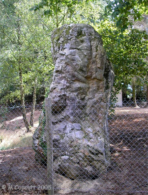
Pierre de Richebourg submitted by TheCaptain on 14th Aug 2013. This menhir is fenced off in the grounds of a big house, beside a pond. It is about 3 metres tall, and looks fairly much just like a big lump of rock.
(View photo, vote or add a comment)
Log Text: I could initially find no evidence of this stone, looking for it from the east, and thought that it is probably somewhere in the fenced off woodland grounds of the big house on the top of the hill. Further investigation from the north, the D.41 road to Retiers, and I found a trackway which takes you to right besides it, and it is signposted.
The menhir is behind the fence, beside a pond. The stone is about 3 metres tall by 3 metres wide, and looks fairly much just like a big lump of rock. Very difficult to photograph, with not only the fence in the way, but also the dark from being within the woodland.
Roche-aux-Fées (Essé)
Trip No.204 Entry No.324 Date Added: 16th Sep 2020
Site Type: Passage Grave
Country: France (Bretagne:Ille-et-Vilaine (35))
Visited: Yes on 13th Aug 2005. My rating: Condition 5 Ambience 4 Access 5

Roche-aux-Fées (Essé) submitted by theCaptain on 10th Jun 2010. Plan of this fantastic monument from the latest tourist leaflet.
(View photo, vote or add a comment)
Log Text: Small notes only for this very well known and popular site, which I was originally thinking of saving to be my last megalithic visit of my whole 6 month tour. First thoughts, Aaaaarrrrrgghhhh, it's busy. And you pay to get in. Aaaarrrgghhhhh. Never mind, I have to see it. I decided not to take my book with me and write much, I'll just go and have a look and take some photographs.
OK, it wasn't so bad as I first thought. After I had been here a while, most of the people had gone, and it was in fact free entry, but with a little shop and information shed you have to go through first. In fact, it's not a bad place at all. In actual fact, it's a truly fantastic place. It is really beautiful when not overrun by people.
It is a massive Angevin dolmen, 20 metres long by almost 5 metres wide and 2 metres high. The main chamber is divided into four sections by three internal upright slabs. The entrance porchway is about 3 metres long, and fronted by the most lovely portico, consisting of two uprights and a lintel of carefully worked and positioned stone. It is truly awesome. This is definitely one to visit - but try not to come when everyone else has !
Roche-aux-Fées (Essé)
Trip No.210 Entry No.2 Date Added: 16th Sep 2020
Site Type: Passage Grave
Country: France (Bretagne:Ille-et-Vilaine (35))
Visited: Yes on 3rd Jun 2010. My rating: Condition 5 Ambience 5 Access 5
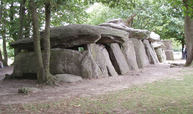
Roche-aux-Fées (Essé) submitted by AlexHunger on 21st Sep 2004. Roches Aux Fees viewed from North West
(View photo, vote or add a comment)
Log Text: June 2010 visit to France to see my sister, and as usual I had my Dad with me. I had decided on a long detour to visit La Roche-aux-Fées, but before we came here, I had told him nothing about it, except to say we were going to visit somewhere special. He is well used to me taking him to old stones all over the place, often on wild goose chases in woods and across fields finding nothing. But not this time.
This monument is now presented quite differently to when I previously visited in 2005, with a large new car park and visitor centre in what would have been fields to the south. Unfortunately, the visitor centre was closed, being open at weekends and holidays only this time of year until July and August when it becomes daily. I have read that this centre is very good, and with a decent book and gift shop.
From the visitor centre, a pathway leads through a nicely landscaped area towards the monument itself, which is hidden behind trees and hedges, until you round the end of a hedge (with a large fallen stone at the corner), and then there it is, in all its splendor, viewed towards the wonderful portal entrance. Even on my second visit here, it is awe inspiring, especially the work on the portico, which is over 4500 years old and still completely level.
My Dad was well impressed too, and couldn’t quite believe what he was seeing. “Oh My!, How can this be so big? What’s this for?” he asked. “It can’t be just to bury somebody in. All these separate room bits? Why? It’s a bit like the side chapels in a Cathedral”. Pretty much my thoughts exactly, and it is good to hear these things coming from somebody else with no prompting.
Somebody had made little piles of pebbles and other decorative bits and pieces placed at various places, which looked good. I am impressed by one of the massive capstones which seems to have been fitted exactly into a gap in the supporting side stones. This place is truly absolutely fantastic. I don’t have the words for it.
The new field around the monument has been splendidly done, and gives it the space it needs. Only two other people came to visit in the time we were here, a large improvement over my previous August Saturday visit. One downside are the various noticeboards now erected here, stating that cracks have been found in some of the stones, and people should be careful and not climb on the stones. I hope that there is no bad damage to the place. What would the Fairies think?
La Roche Piquée (Baudouinais)
Trip No.204 Entry No.325 Date Added: 16th Sep 2020
Site Type: Standing Stone (Menhir)
Country: France (Bretagne:Ille-et-Vilaine (35))
Visited: Yes on 13th Aug 2005. My rating: Condition 3 Ambience 3 Access 3
La Roche Piquée (Baudouinais) submitted by thecaptain on 24th Feb 2007. When I visited, the field was well fenced off, and full of cows, so I didn't get to visit the stone properly, but I would estimate it to be about 4 metres tall.
(View photo, vote or add a comment)
Log Text: A few kilometres to the west of the village of Livré-sur-Changeon, and a few kilometres to the south of the little town of St-Aubin-du-Cormier, near to the hamlet of Baudouinais can be seen this menhir marked on some of my maps as Pierre Piquée. It is signposted, and after a little walk along a farm track it can be seen across the fields. When I visited, the field was well fenced off, and full of cows, so I didn't get to visit the stone properly, but I would estimate it to be about 4 metres tall.
Allée Couverte le Rocher Jacquot
Trip No.204 Entry No.326 Date Added: 16th Sep 2020
Site Type: Passage Grave
Country: France (Bretagne:Ille-et-Vilaine (35))
Visited: Yes on 13th Aug 2005. My rating: Condition 3 Ambience 3 Access 4
Allée Couverte le Rocher Jacquot submitted by thecaptain on 24th Feb 2007. At first I thought it was the remains of a dolmen with entry corridor, but further investigation in the undergrowth suggested to me that it is perhaps the remains of a well damaged allée couverte.
Cupules du Rocher Jacquot
One capstone remains in place on top of some largish stones, with the sideslabs of a passageway leading off towards the east.
(View photo, vote or add a comment)
Log Text: The remains of this monument can be found a few kilometres northwest of Fougères, along the D.17 road towards St-Germain-en-Cogles. It is signposted, but not very clearly, and there is a little trackway and fenced off area around it.
At first I thought it was the remains of a dolmen with entry corridor, but further investigation in the undergrowth suggested to me that it is the remains of a well damaged allée couverte. One capstone remains in place on top of some largish stones, with the sideslabs of a passageway leading off towards the east. It looks like there was perhaps another chamber nearby, indeed perhaps the whole thing was once several passageways and chambers within a single mound, of which traces around it survive.
Pierre Courcoulée (Landean)
Trip No.204 Entry No.327 Date Added: 16th Sep 2020
Site Type: Passage Grave
Country: France (Bretagne:Ille-et-Vilaine (35))
Visited: Yes on 13th Aug 2005. My rating: Condition 3 Ambience 4 Access 4
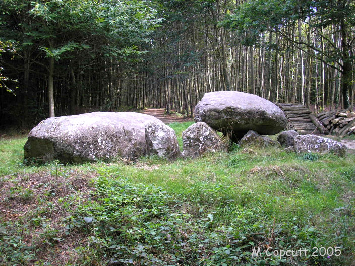
Pierre Courcoulée (Landean) submitted by TheCaptain on 28th Jun 2007. North of Fougères, in the forest, are several megalithic remains. The Pierre Courcoulée is towards the northwest of the forest and well signposted.
(View photo, vote or add a comment)
Log Text: North of Fougères, in the forest, are several megalithic remains. The Pierre Courcoulée is towards the northwest of the forest and well signposted, it is just 200m from a big forest carpark and has its own circular walk which can be followed.
The dolmen is in a little clearing with signpost, and is the remains of a little allée couverte. The western end is fairly ruinous, but the east end is quite complete and has a closing stone. There are 7 metres of chamber remaining, with two large capstones covering most of it. As the eastern end is not the entry, I would think that this is a lateral entry chamber, with the entrance somewhere on the south side, like several of the other nearby Mayenne monuments. It is in the remains of a mound, and there is evidence for some of the stones of its peristalith still being in place.
Pierre du Trésor
Trip No.204 Entry No.328 Date Added: 16th Sep 2020
Site Type: Burial Chamber or Dolmen
Country: France (Bretagne:Ille-et-Vilaine (35))
Visited: Yes on 13th Aug 2005. My rating: Condition 3 Ambience 3 Access 4
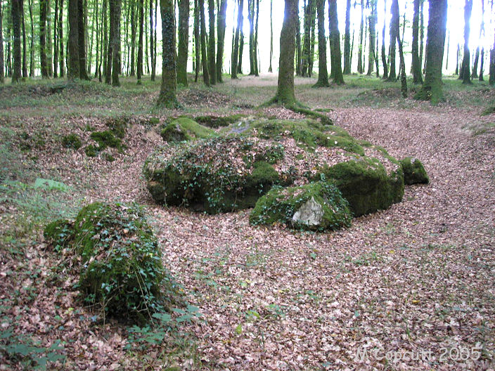
Pierre du Trésor submitted by TheCaptain on 28th Jun 2007. It is hard to tell exactly what these stones are the remains of. It is probably a fairly large simple dolmen which has now collapsed.
(View photo, vote or add a comment)
Log Text: Deep in the darkest depths of Fougères forest can be found the Pierre du Trésor. Its actually only about a 400 metre signposted walk from the big car park at the Chennedet crossing of the main D177 road north from Fougères, and the traffic on this busy road is only 100 metres away. My gps didnt stand a chance of picking up a signal, and my camera insisted on using its flash, even on this bright and sunny afternoon.
Its hard to tell exactly what these stones are the remains of. It could be a fairly large simple dolmen which has now collapsed. Normal ground level would be above the stones, and they are now seen within a pit which has been dug around them at some point, no doubt people looking for the treasure. What is probably a capstone is about 4.5 by 2.5 metres, and very irregularly shaped. It is possible to wriggle underneath it, if that should be your want.
Cordon des Druides
Trip No.204 Entry No.329 Date Added: 16th Sep 2020
Site Type: Stone Row / Alignment
Country: France (Bretagne:Ille-et-Vilaine (35))
Visited: Yes on 13th Aug 2005. My rating: Condition 4 Ambience 4 Access 5

Cordon des Druides submitted by TheCaptain on 29th Jun 2007. The largest stones are at the centre of the row, up to two metres in height, but most are much smaller.
(View photo, vote or add a comment)
Log Text: This long line of white quartz stones is easy to find in the Fougères Forest, north of the town. It is about 500 metres east of the big parking area at Chennedet crossroads along the D177 road, and has a sign and a few parking places nearby.
The row is about 250 metres long, and the white quartz blocks are spaced at about 3 metres apart. The row runs at an alignment of 233° / 053° or Southwest to Northeast. The largest stones are at the centre of the row, up to two metres in height, but most are much smaller. Apart from this long row, there are several other quartz blocks which seem to have once been a parallel row nearby.
Bellever Tor 9
Date Added: 27th Sep 2020
Site Type: Cist
Country: England (Devon)
Visited: Yes on 18th Sep 2020. My rating: Condition 2 Ambience 3 Access 3
Bellever Tor 9 submitted by davep on 5th Apr 2020. Photo taken July 23 2019 at SX 63585 75470 (N50.56295 W3.92748). Interesting to contrast with the pics taken by Bladup two years earlier. This pic is shortly after vegetation had burnt back.
(View photo, vote or add a comment)
Log Text: Day to Dartmoor for a lovely and sunny but tiring walk from Dunnabridge. Decided to start my walk by searching out the various cairns and cists on the way up to Bellever Tor, for which the ViewRanger with OSMap app helped enormously for those marked on the map. First I found, marked as "Cairn & Cist" was a small cist with a couple of surrounding kerbstones in some open rough ground which had probably been burned fairly recently.
Bellever Tor 10
Date Added: 27th Sep 2020
Site Type: Cist
Country: England (Devon)
Visited: Yes on 18th Sep 2020. My rating: Condition 2 Ambience 3 Access 3
Bellever Tor 10 submitted by davep on 5th Apr 2020. Photo taken 23/07/2019 at grid reference SX 64086 75691 (N50.56506 W3.92048)
(View photo, vote or add a comment)
Log Text: Second cain I looked for first had the challenge of getting across the wall into the eastern area. I found the cairn in what I thought was a most unlikely place on a slope, the remains being largely a single cist sideslab, with a few other stones laying nearby.
Bellever Tor 6
Date Added: 27th Sep 2020
Site Type: Cist
Country: England (Devon)
Visited: Yes on 18th Sep 2020. My rating: Condition 3 Ambience 3 Access 3
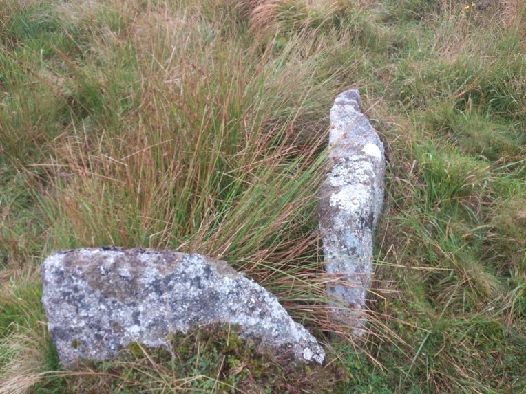
Bellever Tor 6 submitted by caradoc68 on 8th Oct 2013. Great little Kist hidden away in the long grass.
(View photo, vote or add a comment)
Log Text: Back into the western area to search for this marked as "Cairn Circle & Cist", hiding in amongst the long grass, which was at times almost waist deep. Nice remains of a cist with several cairn kerbstones encirling it.
Bellever Tor 2
Date Added: 27th Sep 2020
Site Type: Cairn
Country: England (Devon)
Visited: Yes on 18th Sep 2020. My rating: Condition 2 Ambience 3 Access 3
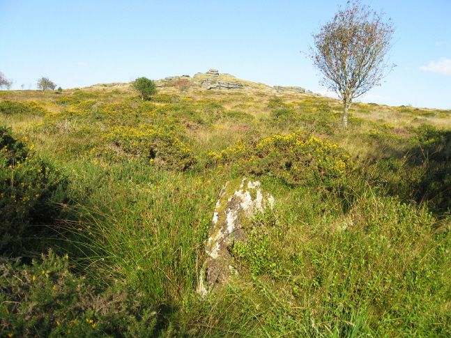
Bellever Tor 2 submitted by AngieLake on 25th Nov 2009. This is a possible candidate for the 'circle' at SW of Bellever Tor. It's hard to tell, but this looked as if it was placed upright deliberately, and probably part of a cairn circle or hut circle.
10 Sept 09.
(View photo, vote or add a comment)
Log Text: Making it over the northern wall into the area where the forest has recently been cleared, and look for the next "Cairn" marked on my map. Even with gps I struggle to find what could be considered to be a cairn, although there were several contenders. I suspect that what I found as a single standing stone was its last remains.
Bellever Tor Cairn one
Date Added: 27th Sep 2020
Site Type: Cist
Country: England (Devon)
Visited: Yes on 18th Sep 2020. My rating: Condition 4 Ambience 4 Access 3

Bellever Tor Cairn one submitted by caradoc68 on 6th Oct 2013. This incredible Circle Kist is just on the edge of Bellever plantation facing Bellever Tor, mentioned by both Worth and Butler has being a Kist with three sides and a capstone.
(View photo, vote or add a comment)
Log Text: Now on a worn pathway along what was previously the edge of the forested area, and I get to what is marked "Cairn & Cist". A nicely formed cairn is found with a few surrounding kerbstones and a large capstone covering the remnants of a cist underneath.
Bellever Tor N Settlement
Date Added: 27th Sep 2020
Site Type: Ancient Village or Settlement
Country: England (Devon)
Visited: Yes on 18th Sep 2020. My rating: Condition 3 Ambience 3 Access 3
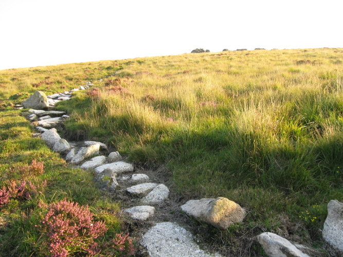
Bellever Tor N Settlement submitted by AngieLake on 5th Nov 2009. Looking up the slope of the eastern border of this settlement towards the south and the summit of Bellever Tor.
(View photo, vote or add a comment)
Log Text: Following lunch atop the splendid viewpoint that is Bellever Tor, I walked northwards towards Lakehead Hill along the nice and clear pathway which passes through several ancient settlements, of which various walls and other remains can be seen.
Lakehead Hill
Date Added: 27th Sep 2020
Site Type: Stone Row / Alignment
Country: England (Devon)
Visited: Yes on 18th Sep 2020. My rating: Condition 3 Ambience 3 Access 3
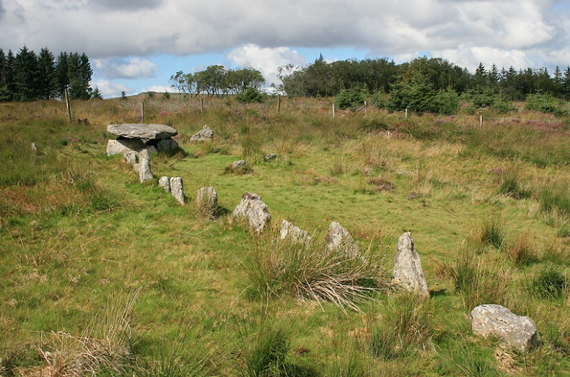
Lakehead Hill E submitted by postman on 31st May 2013. Stone row, stone circle and big cist, I never told my wife our weekend away was just so I could come here, don't think she would've been dead impressed.
(View photo, vote or add a comment)
Log Text: Day to Dartmoor for a lovely and sunny but tiring walk from Dunnabridge finding several cairns and cists on the way up and over Bellever Tor and on to Lakehead Hill with all its prehistoric remains. Down through Kraps Ring and the forest to Bellever, then up past Laughter Hole to the stone rows on the slopes of Laughter Tor then back to Dunnabridge. Pint at the Warren House Inn after. Lovely.
Lakehead Hill Cairn 8
Date Added: 27th Sep 2020
Site Type: Cairn
Country: England (Devon)
Visited: Yes on 18th Sep 2020. My rating: Condition 3 Ambience 3 Access 3
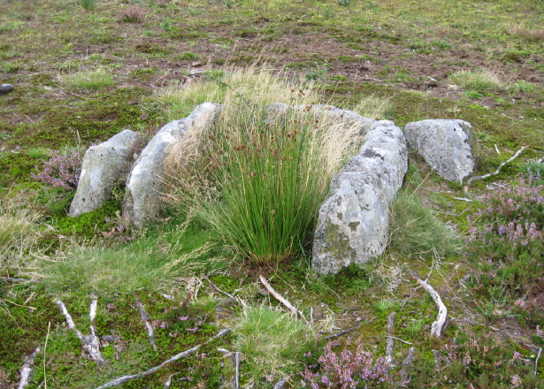
Lakehead Hill Cairn 8 submitted by AngieLake on 8th Dec 2009. The remaining cist from Cairn 8 on Lakehead Hill.
(See site notes for further info.)
(View photo, vote or add a comment)
Log Text: North to Lakehead Hill, and my first target is on the right of the forest track and marked as "Cist" on the map. It does what it says on the tin, and a decent cist is found within a large circular cairn.
Lakehead Hill Cairn 7
Date Added: 27th Sep 2020
Site Type: Cairn
Country: England (Devon)
Visited: Yes on 18th Sep 2020. My rating: Condition 3 Ambience 3 Access 3
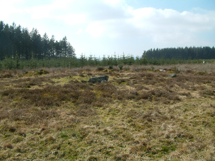
Lakehead Hill Cairn 7 submitted by simonsworn on 7th Apr 2005. Facing south
(View photo, vote or add a comment)
Log Text: Further north along the forest track and across the Lich Way, this next target is marked as "Cairn Circle & Cist" on the map. Down a little open trackway into a clearing in the forest, I find the remnants of a large cist in a large round cairn, but the remnants of a cairn circle elude me. Possibly once had a stone row associated, although that perhaps is for another cairn yet to be found within the forest.
Lakehead Hill E
Date Added: 27th Sep 2020
Site Type: Stone Row / Alignment
Country: England (Devon)
Visited: Yes on 18th Sep 2020. My rating: Condition 4 Ambience 4 Access 3
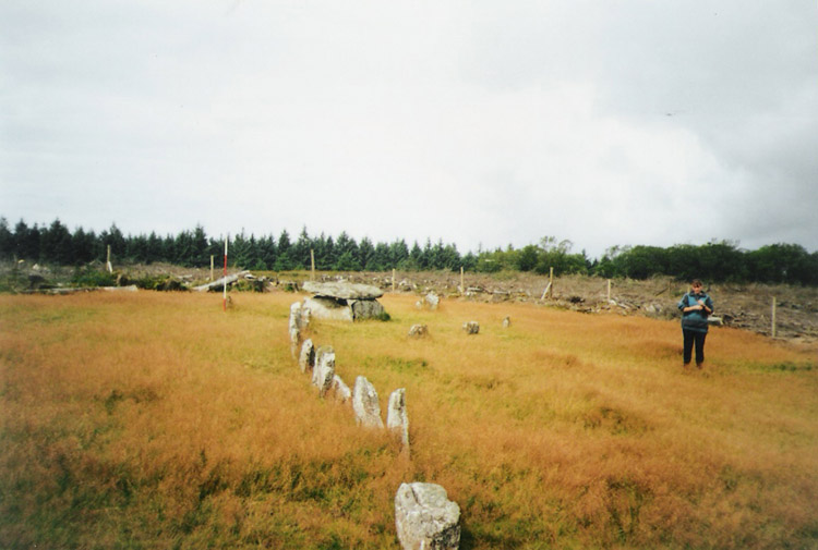
Lakehead Hill E submitted by simonsworn on 15th Mar 2005. After the surrounding plantation was cleared, facing NW, scale at 2m.
(View photo, vote or add a comment)
Log Text: Carry on northwards and then left in the scrubby gap between the forest trees to what the OS mark as "Cairn Circle & Cist". A path leads on westwards and then there it is, the coverstar of the Lakehead Hill sites. A short stone row leads westwards to a large rectangular box structure, all in a very nicely tended open area. I suspect this has all been "restored", but it does look very pretty in the afternoon sunshine. These days eleven stones make the row leading westwards to the cist, with a kink in the middle. The cist is a large box structure, much bigger than most of the cists on Dartmoor, and I think could be considered more of a burial chamber. This is partially surrounded by a circle of half a dozen small stones, although this has probably not been reconstructed very accurately. I like it.
